Day 75 – Portreath to Perranporth 12th July 2016

Day 75 – Portreath to Perranporth 12th July 2016

IMG_0931Sitting in a grim hotel in Perranporth which I shan’t name, further than to say it ain’t the accommodation highlight of the trip! Distinct pong of damp dog, and the door won’t lock from the inside.

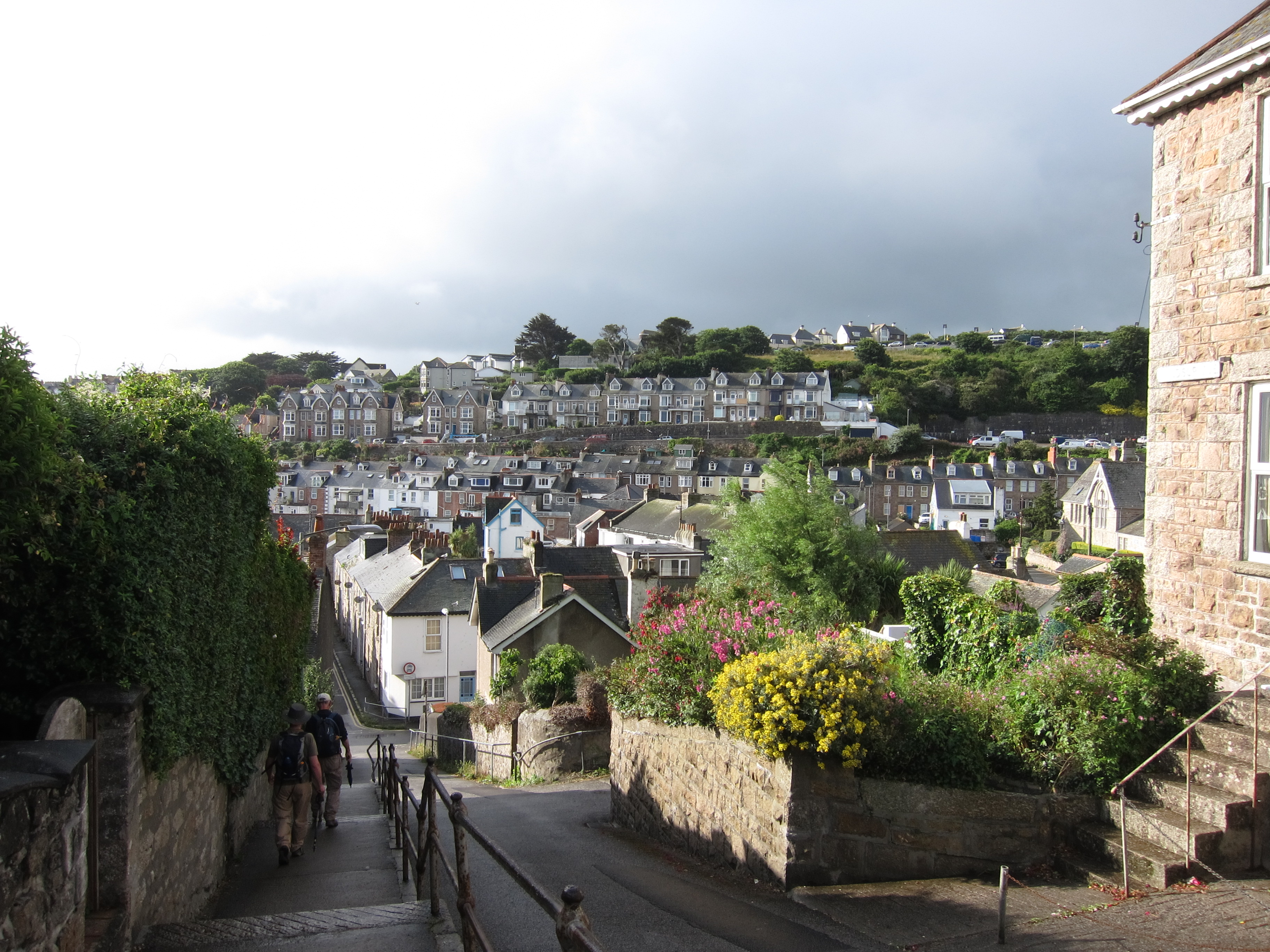
We left our very pleasant little B&B in Portreath at 8.45, rather a record this trip. Unfortunately, owing to oven issues there was no cooked breakfast, but a good selection of fruit and pastries staved off the worst pangs of hunger. As it was necessary to go up and down two very stiff slopes to get into the village yesterday, so the same pertained on the other side, but we were rewarded with excellent views back toward St Ives and forward to St Agnes’ Head. An hour and a half brought us into Porth Towans where we had truly excellent bacon sandwiches in the beach café.

The weather was bright, although not very warm, hut the sea was again a superb turquoise with darker patches.IMG_0944 The vivid purple heather makes a wonderful contrast, especially with the myriad rock colours red, orange, white and even occasionally verdigris where the copper is close to the surface. IMG_0956
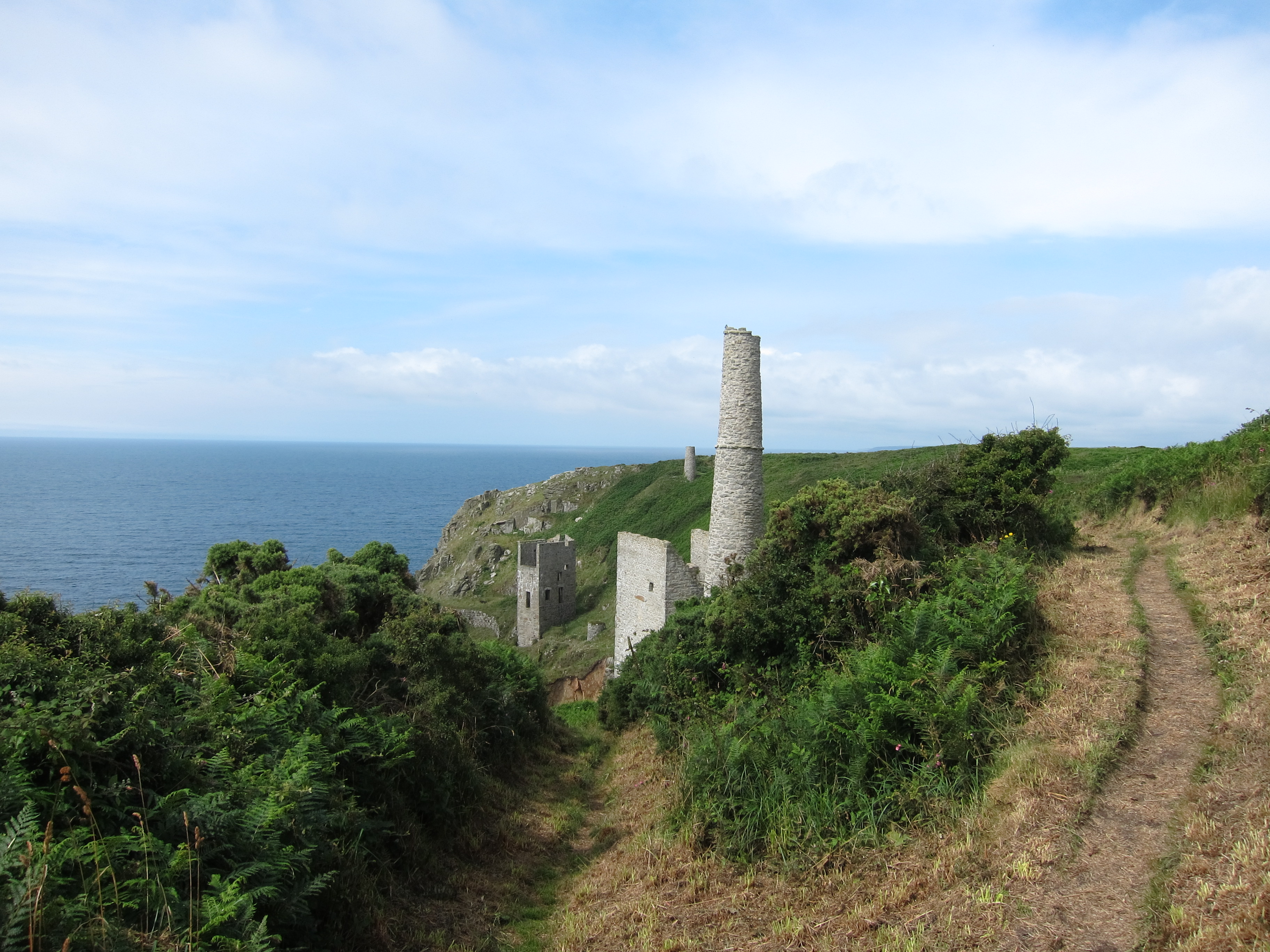
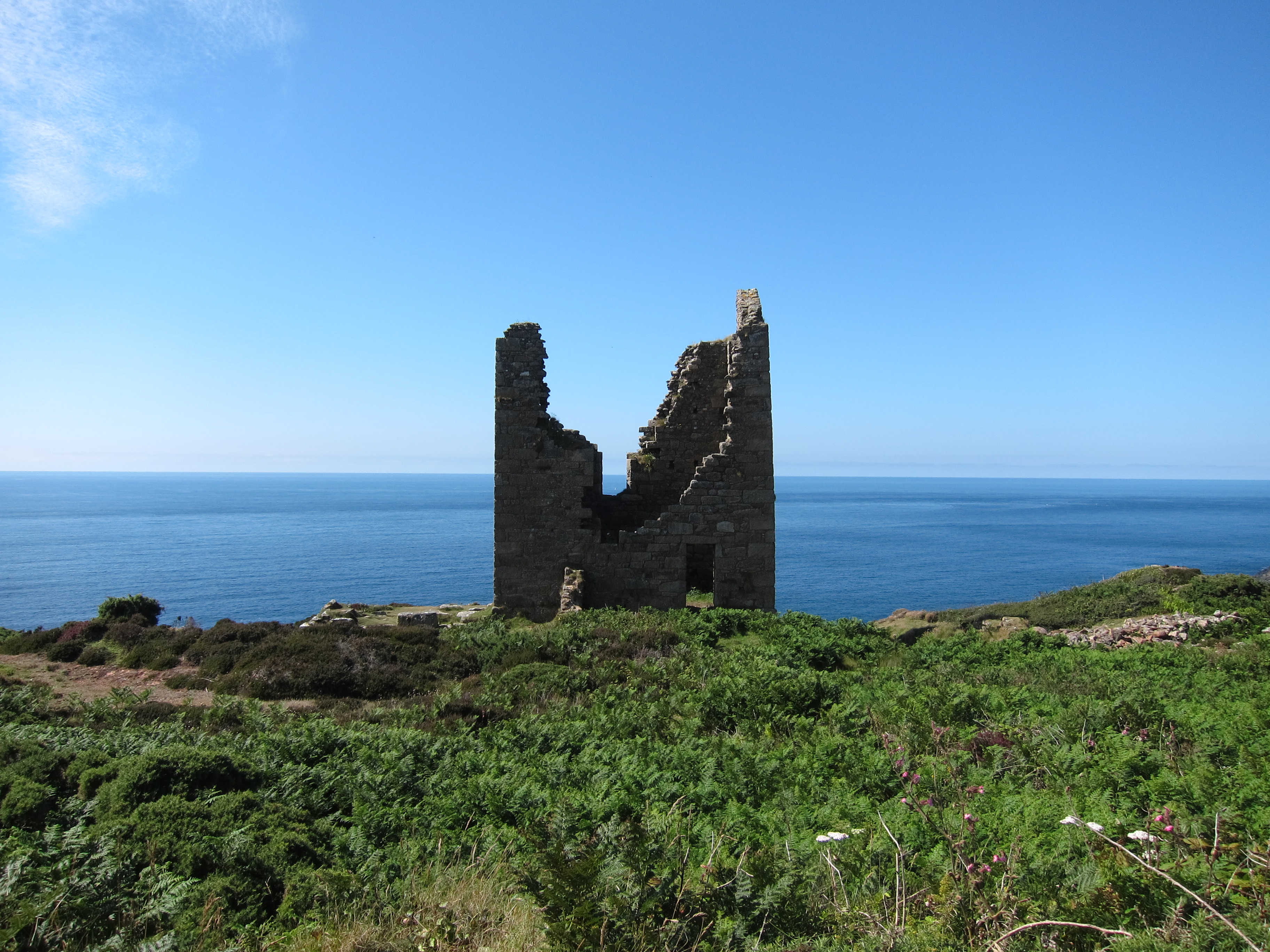
There is plenty more evidence of copper mining here. Portreath used to ship the ore direct to the smelting works in South Wales. It may have been on one of those very ships that my ancestors left Cornwall to head for Newport.

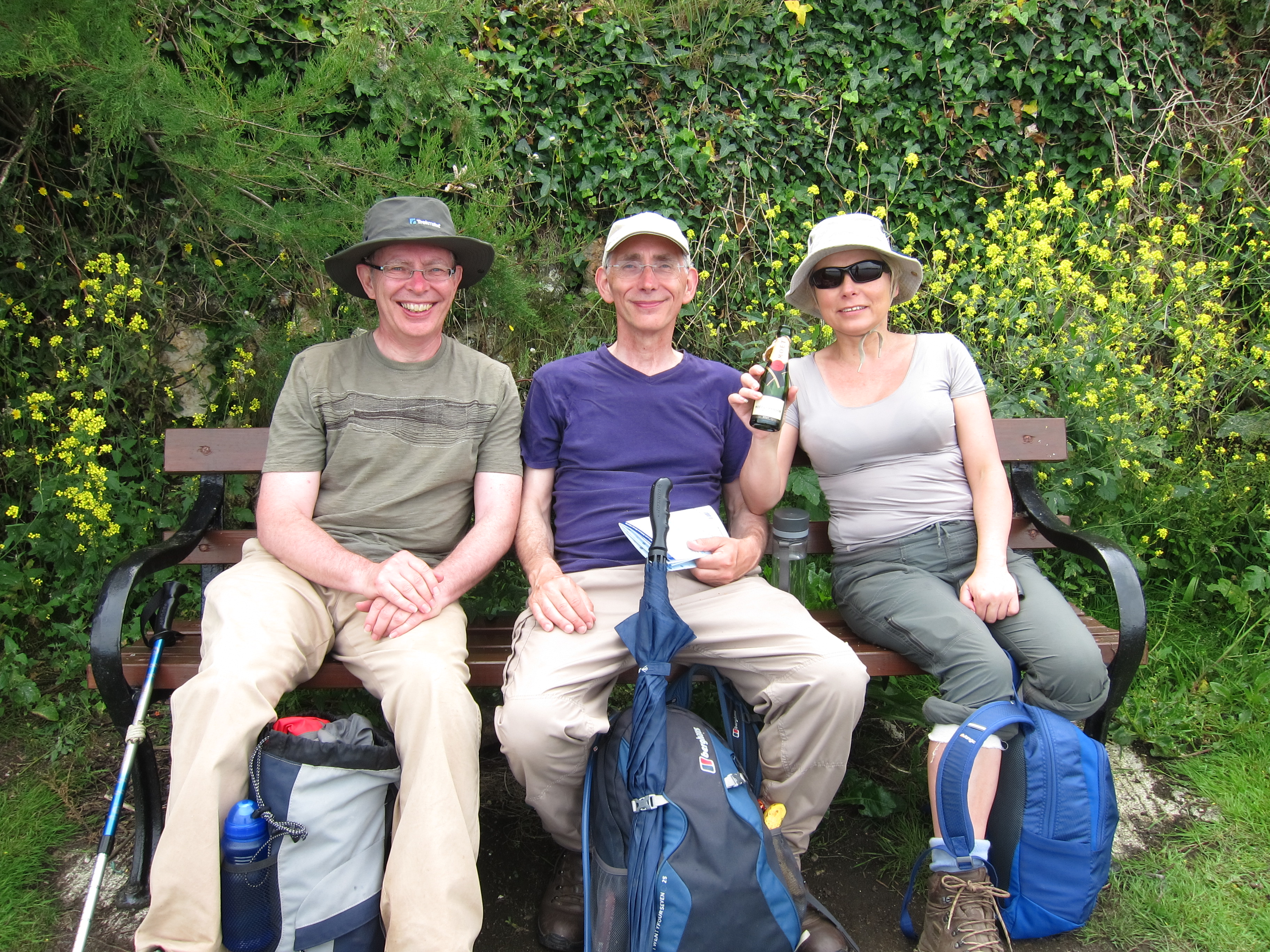
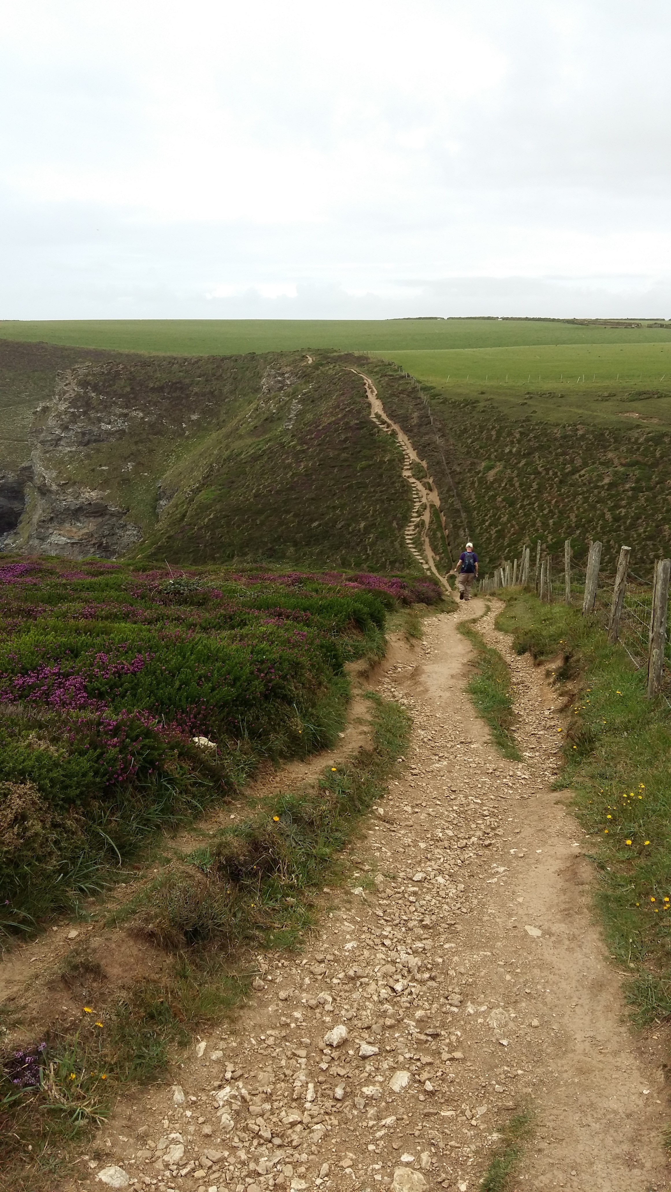
A long pull up from Porth Towans, then a good bit of flat cliff top before an evil slope down into St Agnes that played the devil with my knees, which so far this trip have been fairly quiescent. IMG_0935We stopped for a welcome drink in the Driftwood pub before hauling ourselves up the other side of the valley. Another double dip, and then we were on to a long flattish stretch.

Towards Perranporth, the path, which is very poorly signposted as usual, gets rather lost amongst what may be old airfield buildings or mining works.  It then clings rather precipitously to the edge of the cliff.  I had my eyes firmly inland at that point.

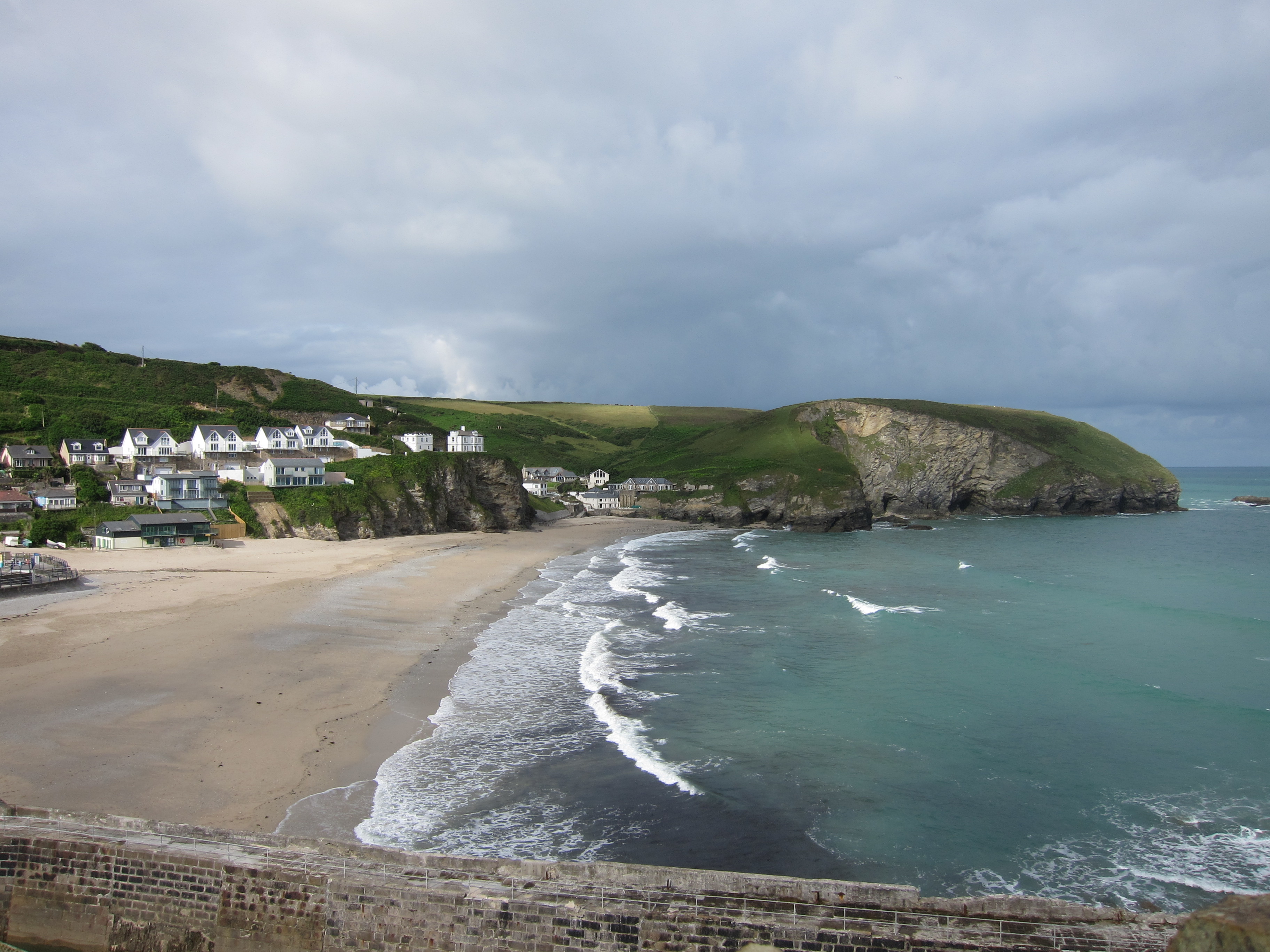
We arrived around 5pm having done about 11.5 miles.  I have used all of my camera card and am struggling to find a new one. The good news, is that there is a camera shop here, the bad news is that it is closed and won’t open before 10.30 tomorrow.

Advertisement
Day 74 – St Ives to Portreath, 11th July 2016

Day 74 – St Ives to Portreath, 11th July 2016

Today (11th) is my birthday, and I have spent it very pleasantly. We left our bags to be picked up from our strangely impersonal accommodation – there was never any interaction with a human, only a key safe and instructions. No breakfast, just a common room with tea and coffee for the morning, which was occupied this morning with a young man who exuded an astonishing level of grumpiness without saying a single word.IMG_0863

We walked down towards the sea front and found a lovely spot for breakfast. We were still feeling food deprived from yesterday so had an enormous bowl of granola with Cornish yoghurt and honey, with fresh fruit, followed by eggs benedict. The waitress looked a bit shocked. ‘Do you really want two breakfasts?’ she asked. Jon and I nodded, but Stephen sheepishly opted just for the eggs benedict.

Whilst we were eating a squall came over and we began to think it might be plastic trouser weather, but it soon cleared. IMG_0866The rest of the day there were odd showers but nothing serious. The walk to Hayle was straightforward, gliding along the cliff edge, but not too steep or narrow. I had definite house envy as we passed some of the cliff top villas. We passed Carbis bay and rounded into the Hayle estuary.

We had a peep into Uny Lelant church – more ancestors, although I couldn’t find any names in the graveyard that I recognised, although there were some fabulous pyramid orchids in the long grass. During the Civil War Lelant held for the King whilst St Ives was for Parliament so inside there was a much treasured transcription, in giant letters, of a missive from a grateful Charles I.

Rounding the estuary we stopped for elevenses and Stephen whipped out three little cup-cakes, one with a candle and an ‘M’ iced on it, together with a small bottle of Moët Chandon. A great way to celebrate my nnth birthday, although the picture makes us look like the three wise monkeys, and I appear to have eaten quite enough cake already!IMG_0904

We went on to Hayle Towans (I assume towans is the equivalent of Welsh tywyn – sands) and the path went up and down the dunes. Stephen left us to meet his daughter and Jon and I ploughed on, passing Gwithian, but on the dunes side, rather than through the town. I wonder how many of my ancestors were conceived on the beautiful beach of Gwithian Towans?!20160711_171343

The path then went onto the cliff tops. Easy walking, with lots of wild flowers – heather, oxe-eye daisies, vetch – yellow and purple, clover of all sorts, thrift and everywhere yarrow in such profusion that you can smell it.

The route was straightforward until a mile out of Portreath, when there was a huge drop into a valley and a steep staircase up the other side. At the top there were a few moorland ponies, then we rounded a bend to see Portreath at the bottom of the slope. It’s a lovely evening, fingers crossed for tomorrow to be sunny.

Day 73 – Pendeen to St Ives 10th July 2016

Day 73 – Pendeen to St Ives 10th July 2016

Lolling on my bed in a very pleasant B&B, completely exhausted. I had heard that the Pendeen to St Ives stretch is the hardest on the whole South West coast path, and whilst I would not say it was harder than the murderous Mousehole to Lands End leg, it is certainly up there.

I took an early bus from Penzance to meet Jon and Stephen at their pub in Pendeen – the vey spot where Chris and I finished last year. We had arranged for the baggage people to collect our gear from there, and I am very thankful we did. Not sure I could have made it today with a big pack.

The weather was excellent all day. Plenty of sun to make the sea a wonderful turquoise, but also breezy enough to be the right temperature in a t-shirt.

The first point of interest was the Pendeen Watch lighthouse, a landmark which we could see behind for miles as we progressed north-east. IMG_0765For the first time, I now have the sun generally on my right arm with the sea on my left. So far, as I have walked clockwise I have had a burnt left arm, and a burnt right arm as I have walked anti-clockwise. There won’t be any much sun on the left side until I start west again along the coast of South Wales.

The path dipped and swooped, climbing up and dropping down. It was nowhere as steep as some of the parts of Devon, but it was always narrower and closer to the cliffs. At some angles, the wind was blowing off the land, which is quite disconcerting when there is a steep drop to the side.IMG_0798

As always in Cornwall, the path is very poorly sign posted, and although you might think it can’t be that difficult, there are often tracks and sheep-trods to confuse the unwary.

There are numerous old mine shafts and wheal houses still dotting the countryside. After last year’s trip to Geevor mine I could imagine the shafts going out a mile or so under the waves. A lot of the stone had the greens tinge of copper ore.IMG_0820

The various interpretations boards (none today) promise choughs and kittiwakes, but so far only herring gulls and ordinary crows have materialised.

We did, however see a kestrel from above, hovering golden in the sun-light, before it swooped down and grabbed a small creature.

We had toyed with the idea of turning inland at Zennor to go to the well-known Tinners’ Arms for lunch, but we were making such slow progress that we decided not to add the additional mile or so each way. I can normally take or leave lunch when walking, being quite happy with an apple and some chocolate, but today to was so strenuous (although only 14.6 miles) that I was really struggling by the end and chomping on my dark chocolate with no thought of anything but shovelling in energy. We eventually crawled into St Ives at about 6pm, found the nearest restaurant and stuffed our faces. We were on a terrace, and so cold from hunger and exhaustion that we sat huddled in our fleeces and extra blankets whilst people on the next able were in shorts and t-shirts.

Day 72 Penzance to Mousehole 9th July 2016

Today is probably going to be the shortest day of the whole walk – a mere 3.3m from Penzance to Mousehole, where I started Day 69 last year.

The walk was simple – along the cob from Penzance to Newlyn. Newlyn was interesting: I enjoyed seeing a real working fishing port rather than the little ports that just seem to run pleasure craft. IMG_0704The warehouses were shabby, and the place does not seem to be very wealthy but there were dozens of ships crowded into the harbour and numerous fish wholesalers lining the streets.  I also came across another of the cycle way signposts – haven’t seen one of those for ages.IMG_0703

Just outside Mousehole there is a memorial garden to the volunteers of the Penlee Life Boat station. Closed now, it performed its last service in 1981, when the Solomon Browne set out in hurricane force winds and 50ft seas to help the Union Star. After initial reports that four men had been saved, contact with the station was dropped and both ships were lost with all hands. Eight men from Mousehole had been in the lifeboat, a very high number for such a tiny village, but within forty-eight hours sufficient volunteers had come forward to form a full crew. The replacement boat, the Mabel Alice, was stationed in Newlyn.IMG_0717

The weather was not much to write home about. The cloud stubbornly refused to lift and the west wind was quite strong.  I reached my destination by 10.45, and caught the bus back to Penzance. My original plan had been to return to Marazion to go into the castle at St Michael’s Mount, but my landlady informed me at breafast that it is closed on Saturdays.

I wish I had taken the chance to go around quickly yesterday. My second thought was the open air theatre at Mynack, which I missed last year through going inland, but the weather was so dull it hardly seemed worth the bother. In the end, I took a bus to Gwithian, a small town in North Cornwall where a branch of my family came from, before emigrating to South Wales in the 1840s. The churchyard was full of Hockins, Cocks, Andrewarthas and Pascoes, all cousins in the 99th degree. A swift bus ride back (First Kernow operate an excellent and comprehensive service) gave me time to go to the Penlee Gallery to look at an exhibition of sea painting.

Day 71 – Porth Leven to Penzance 8 July 2016

IMG_0582Today was a perfect day to get me back in the swing of walking – not too hard, not too easy, ideal walking weather and the right sort of distance – just under 15 miles, plus nearly two to get to the start point.

I took the train to Penzance yesterday lunchtime, and it was no more than averagely late, getting in just before six. The weather was poor. It began to spit just as I was popping into a pub for supper, and by the time I came out it was of plastic trouser proportions. Last year the walk up to the youth hostel from the town centre seemed endless, even though Chris carried my bag, but this year the nearly two miles were no problem, especially as the rain eased off, although it was dreadfully muggy. It’s a good youth hostel (Castle Horneck) and despite being in a dorm with four others I got a good night’s sleep – no snorers, and although it was fiendishly hot, as they always are, I managed to grab the bunk by the window.

I was able to drop my bag off early at tonight’s B&B so was just walking with a day pack – so much better! The bus dropped me at Porth Leven where I finished day 68. The path climbs up the headland, but none of it was too steep, and the weather, which started poor with a low sea fret, cleared around eleven, to give a mix of sun and cloud. Absolutely ideal.IMG_0603

This is the start of the tin mining area and there are a number of old wheals dotting the landscapes. In our trip to Geevor mine last year, Chris and I found out all about the mines – absolutely fascinating. They were copper and tin, and many of the shafts can go more than a mile out under the sea. I cannot imagine how terrifying that must have been. If a mine collapsed inland you might have some hope of rescue, but not in these.

I reached the gorgeous Praa sands around 11.30 and had my first paddle. Icey! I stopped on beach cafe for coffee and a square of lemon drizzle cake that would have fed a family.

IMG_0631Another couple of hours of gentle up and down on a good path brought me in sight of St Michael’s Mount.  It can be seen for several miles before you actually reach the town of Marazion. It is a quite remarkable construction, inaccessible on its headland other than when the tide is low enough to reveal the causeway.

I didn’t have time to look at the castle before I needed either to turn back or miss the tide, so I shall go tomorrow afternoon – it should only take a couple of hours for me to go from Penzance to the point in Mousehole where I started day 69. Originally a monastery, a priory of the IMG_0688Norman abbey of Mont St Michel, it was captured by the Earl of Oxford in 1473 and held for Lancaster against the prevailing Yorkist dynasty for nearly six months. After the dissolution, it was held by the Crown until it was granted to Sir Robert Cecil, later Marquess of Salisbury. It was sold to the Bassets, a prominent Cornish family, who supported the King during the Civil War. It eventually came into the hands of another old Cornish family, the St Aubyns, who are still in residence, although the place is managed by the National Trust.

I walked a long way across the beach toward Penzance. I am not generally a fan of sand walking it is very hard on the legs, but this sand was firm. The last couple of miles into Penzance are on a cycle track parallel to the railway, so easy going. A very fine day indeed.

I haven’t gone away!

For anyone who thought I might have given up – I am still here. It is hard to believe that a year has passed since my last walk, but in the meantime I have been busy with my new business www.tudortimes.co.uk and I am also writing a book. So weekends have been a bit hectic. Nevertheless I have managed to squeeze in 10 days back in Cornwall, this time in the company of friends Jon and Stephen. Jon is working on an end to end project and wanted to start from Land’s End. That works perfectly for me, because I can pick up the bits I missed last summer – Porth Leven to Mousehole on Friday and Saturday, and meet the others at the pub in Pendeen where Chris and I finished last year.

On the final day last year, instead of walking on from Pendeen, we spent the day at the Geevor tin-mine. The weather was absolutely appalling – quite different from the previous day, and my boots were slipperier than ever, so we thought the tin-mine would be a good option. And it was – absolutely fascinating. I highly recommend to anyone with the slightest interest in history, mining, industrial archaeology, industrial relations, systems, engineering, or just about anything.

Since then, no plans have actually come to anything, so I am absolutely delighted to be off again. I hope the weather is as good as last year!

The advantage to going with friends, is that we are clubbing together for a bag transport service. After the miseries of last year, I’ll welcome it, as it is fair to say fitness levels are slipping with the current very sedentary projects.

I’ve bought new boots too. I went for Zamerlan again because they are so comfortable. Just hoping that the first pair had faulty soles, rather then the whole design being poor. Fingers (and toes) crossed!

Train at 12.05 from Paddington tomorrow and a whole 10 days of Cornish Pasties and cream teas ahead.

Day 70 18th July 2015

Day 70 18th July 2015

IMG_0075I am glad to say that I have discovered the cause of my low satisfaction level. My pack is too heavy. I am not sure what it weighs, probably about 9-10 kg, including its own weight and water. It is difficult to slim down more – I could perhaps lose one sweater and two very light weight tops, but not sure that would make a noticeable difference. It is less than 10% of my body weight.

Depressed by the screaming of my knees yesterday, and having heard that today would be rainy and the path steep, I decided to send the majority of my kit on to my next hotel.  Elegantly decanted into a black plastic bin liner, my dirty laundry and spare shoes travelled in state in their own taxi, rolling up at the front door of the Treloyan Manor Hotel as Chris and I toiled up the coast path. My only physical complaint today is the horse-fly bite I got above Portloe. It has swollen up into a hard yellow lump, the size of a 2 pound coin.IMG_0095

In fact, divested of my pack, I was practically dancing along the path. The weather turned out to be absolutely fabulous – hot, sunny, with the odd breeze.

Today’s route was fascinating. Through the old tin mining territory north of Land’s End. I was particularly interested because my grandfather’s grandparents and all their ancestors back into the mists of time came from the villages around here – Gwithean, Morvah, St Just and Camborne. I haven’t had time today to look, but next time I come, I will spend a few hours investigating the local church yards.

The mines looked very romantic, set in the green bracken, with the bright blue sky and the purple CornisIMG_0100h heather setting them off. Almost all of them closed around the turn of the 20th century, apart from Greevor, which only closed in the 1980s. We are planning to do the guided tour of it tomorrow morning. We met a very informative couple who told us all about the mines – apparently most of the mining took place in long latitudinal shafts that went as far as a mile or so under the sea. Apparently, when sinking parallel shafts, they did not allow for the fact that magnetic north changes over time, and major disasters were caused by new shafts running into old ones that were not being pumped.

I am sure that when they were being worked they looked dirty, ugly and dangerous, but now they are beautiful. This is also the area where the recent Poldark series was filmed. My ears pricked up at that, and I scanned the horizon for the gorgeous Ross Poldark, sadly, I have been informed he is off on another job.

We stopped at Cape Cornwall, which is about 5 miles north by east of Lands End. There was a natural swimming pool in the rocks that Chris took advantage of, plunging in entirely. I confined myself to dangling my feet in. It was cold, but fabulous. We then sat in the sun and had Cornish pasties and ice cream.

We walked as far as Pendeen. Chris set up his tent in a campsite there, and I hopped on a bus up to St Ives to join my black bin liner.