Day 91 – Porlock to Minehead 11th July 2017

Day 91 – Porlock to Minehead 11th July 2017

It was just as well we did the little bit extra yesterday rather than finishing at Porlock Weir in line with standard route, as we had to be in Minehead to meet our luggage and catch the bus to Taunton. All the other days we have dawdled, but we managed a respectable speed of 2.2 miles per hour today.

There was a gentle start from picture perfect Porlock across the flood plain, via Bossington, which also looks like it fell off a chocolate box – all thatched cottages and roses rambling. IMG_2410

We then turned into woodland at the foot of the hill, followed by a long, steady pull upwards for at least a mile. Once on the top, we had a choice between the ‘rugged’ path, which went up and down the combes, closer to the water’s edge, or the cliff-top path, with the view. We elected the top path – partly because it would be quicker, and partly because we had plenty of woodland yesterday, and wanted the views.

In fact, there was not a lot to see, as rain set in around 9.45. It was not heavy, but it was persistent and the sea and sky blended into grey. Wales, which we have been able to see for several days, disappeared from view. There were a few Exmoor ponies chomping quietly and quite a few cows. Only heifers though, so no bother with them.IMG_2429

The final 2 miles wound down through woodland again and we arrived promptly at 12.15. We had a quick bite in The Old Ship Aground, which had very kindly agreed to take our luggage in, then a whistle stop photo opportunity at the end of the South West Coast Path before a 10 min wait in pouring rain for the bus. Now on the fast train to Paddington.

Today is my birthday, and I am able to celebrate it with a truly great present – finally completing the South West Coast Walk – 630 miles from Poole. But still only a fraction of my whole scheme!  We covered 7.4 miles.

Day 90 – Lynmouth to Porlock 10 July 2017

Day 90 – Lynmouth to Porlock 10 July 2017

We had an absolutely superb meal last night, and managed to be in bed by 10.30. It rained heavily during the night, but by breakfast time it was beginning to clear. We walked along the sea front at Lynmouth then climbed up through woodland to the cliff top.

IMG_2337

We passed a small church at Countisbury and, since both of us like old churches, decided to go in. Saxon in origin, the church is very plain, and now at quite a distance from any village.

The hymn numbers from yesterday were still on the board. We checked the first, and, astonishingly, it was the hymn I think of as my own – ‘Eternal Father, Strong to save’ sung to the tune named Melita. Of all the possible hymns that it might have been, it was that. I am sure it was a sign – although for the life of me, I am not sure exactly what of.IMG_2356

Rachel, who is a talented singer in one of the big London amateur choirs, began to sing, much to the delight of some German walkers who wandered in. Rather less dignified for Rachel was the failure of her trouser zip. I have been forbidden from adding any photographs illustrating the mishap.

Shortly after, we took a short cut – the kind of short cut that ends in long delays. The Germans were following us, and we compared notes, agreeing that the map suggested a path outside a field edge would bring us back to the main route. We ended up in a thicket of bracken, so dense that we had to give up and retrace our steps to the point where we had left the main path. It must have added at least a mile to the whole day.

The route then dropped down onto a valley, before joining a road a road, then into a long stretch of woodland, the flies were dreadful, crawling all over us, in our faces and hair, and driving us completely potty. We had to tolerate this through several miles of woodland, not compensated for by its general prettiness, lined with foxgloves. We were amused to see a mower of some sort that looked as though it had just been abandoned in the middle of the bracken – the driver was probably driven mad by the flies.IMG_2381

There is a choice of routes here, and we elected to take the upper one along the cliff top. Longer, but easier and slightly more direct, with the aim of avoiding the flies. After several uneventful miles we dropped down again into woodland, and then we entered Alice in Wonderland territory – there were numerous signs for Porlock, but they pointed in different directions – we would follow one, then come to another pointing back in the direction we had come. No matter how far we walked, the signs continued to say 1.5 miles.

At last, we caught sight of the edge of the village through the trees and, ignoring signs, headed for it. Porlock is a lovely little town, and our B & B is gorgeous. I have a vile horse fly bite from our encounter with the cows yesterday. They disagree with me, and it has swollen up into an angry red lump. 14.5 miles

Day 89 – Coombe Martin to Lynmouth

Day 89 – Coombe Martin to Lynmouth

Coombe Martin is an interesting little town – apparently, it has the longest high street in Britain, extending two miles up the valley. Originally a Saxon port, the Norman church of St Peter ad Vincula has a tower ninety-nine feet high. Sadly, the public conveniences were equally mediaeval.

Just on the outskirts of the town was a waymarker showing the full coast path distance – they are not that common – 35 miles to go to Minehead, and 595 completed since Poole; (although I have walked considerably further, with all the detours and the frequency of getting lost – I know, how hard can it be to find my way with the sea on one side?)

It was a cracking day. Superb weather again – warm, and absolutely still, although more humid than is ideal. The morning began with a long steady pull up to little Hangman’s head, followed by an even longer, but steady, climb to Great Hangman’s head. Apparently, this is the highest point on the whole coast path, although I must say it did not seem as high as some of the Cornish cliffs, or even as Golden Crest on the Dorset coast. Still, I suppose the people who carefully  (do I mean obsessively?) measure these things, must know. IMG_2232

The views were superb, the rocky cliffs behind and in front of us with Lundy falling behind, and the coast of South Wales looking clearer than yesterday.  I guessed what we could see was the Gower Peninsula and the Mumbles. There was also a massive factory with a plume of steam emerging –  presumably the steelworks at Porth Talbot.

The day was uneventful – perhaps one to be remembered as a typical day on the coast.  Even the cows were on the other side of the fence – atlthough they could not resist coming over to stare at me.

IMG_2283

We are now on the north edge of Exmoor – Lorna Doone country. I must re-read the book.  The steepest drop of the day was down to the river Heddon, on a narrow track which winds through low woodland, and is invisible from the other side of the valley. Located on the riverbank is the only refreshment point on today’s route, but as it was a half-mile extra in each direction, we decided not to make the detour.  Instead, we took off our boots and soothed our hot feet in the bone-achingly cold river.

IMG_2293

There was then a long steady climb up the other side of the valley. The rest of the day, the path meandered on the tops of the cliffs, or along the sides, through a mixture of moorland, woodland and heath.

We passed Lee Abbey, then, not far from Lynmouth, walked through some strange formations called Castle Rock, which were rather atmospheric, surrounded by the cloud that rolled in during the late afternoon. We dropped down a steep wooded valley to Lynmouth, which seemed to take hours as it zig-zagged down the cliff. Handily, there was a waymarker showing the routes to America, New Zealand and Iceland.IMG_2323

We arrived at the bottom only to see a funicular arrive at  the same time. Had we known, we would have given it a try. Distance of 14.2 miles.

We have just had a truly excellent meal in the Ancient Mariner Inn.


Day 88 – Woolacombe to Combe Martin 8 July 2017

Day 88 – Woolacombe to Combe Martin 8 July 2017

We left the Gulag at 9 this morning, after I had wasted a load of time trying to contact British Airways about a booking for Australia, and ate in a café on the sea front – The Captain’s Table. The path leads up out of Woolacombe, towards a place called Baggy Point. The view of Lundy was very clear, and we could also see all the way back to Hartland Point.  Most exciting of all was the nearness of the South Wales coast – not far now before I shall be in home territory! The Gower peninsula with the Worm’s Head was quite clear.

The stretch of coast here is well-known for seal-sightings, and we were thrilled to see a pod of them. Rachel and I have argued about the collective noun for them. I think pod sounds right, she is certain it’s a herd. There were six creatures in this group, three basking on the rocks, looking like slugs with tails and fins, and three bobbing on the waves. In the same area I saw a black headed bird with a white collar and red chest. No idea what it was, but subsequent googling suggests a stonechat. I’ve never seen one before, but was rather taken with it.IMG_2145

There were a couple of steep ups and downs, but nothing too serious. We stopped at Lee for lunch at a what should have been a delightful café, but the service was so slow we didn’t have as much as we planned. The pasties were good, though.IMG_2148

We came to Ilfracombe in the late afternoon. The main town was dead – we searched long and hard for a decent café, but all were either chains or shut. We went into an old-fashioned Gentlemen’s Outfitters in search of new socks – it was a relic from the 1950s – hats, checked shirts, walking sticks and scarves, all in beautiful wooden drawers and cabinets. The visit was successful and a vivid red pair of socks purchased.

A curious insight into the causes of the First World War was offered to us – a poster outlining the story of Alf Price, who, annoyed at the visiting Kaiser’s behaviour in throwing stones at the beach huts, had punched him on the nose. Apparently, Kaiser Bill bore a grudge ever after against the whole British nation. They didn’t tell me that in school!IMG_2189

Down at the waterfront, business was more brisk. We found Dolly’s Café and had two scoops each of creamy ice cream, with extra clotted cream. Mmmmm. Whilst we were there, several very odd characters came in – three white people and one black person.  All were dressed in long coloured streamers or rags, with feathered hats and all were ‘blacked-up’. No-one else in the café seemed to think their appearance at all odd, and we assumed they were just a bunch of local eccentrics.

All was revealed when we emerged to discover that they were part of a vIMG_2187ery large group of Morris dancers, prancing on the green. I have never seen colourful Morris costumes befores before – only the traditional white outfits. The bells on their legs were surprisingly loud.

We finished with a long, pleasant, but uneventful walk past the Iron Age Hillsborough Fort, arriving into Combe Martin at around 7pm, having covered 15..9 miles.

Day 86 – Westward Ho! to Braunton 20 Oct 2016

Day 86 – Westward Ho! to Braunton 20 Oct 2016

Today was a good day to end the trip.  We left our very nice B & B (excellent breakfast of smoked salmon) and walked back into the town to rejoin the path. We wound through the edge of Westward Ho, into the little village of Appledore, with its lifeboat station and prettily coloured houses.

Appledore is an old harbour, used for years for salmon fishing. It is the location for the ferry across to Instow. There was a slight hitch when Chris realised he had forgotten his phone.  A frantic call to the B & B arranged for Mrs B & B to drive round to meet us on the other side of the ferry with the offending article.

We had an excellent coffee in the wholefood café and shop at Instow whilst Chris’s phone was en route. Although it was early for elevenses, the cake looked extremely yummy, so we took the opportunity to load up on calories early. Not that today’s walk was difficult – it took us along the south bank of the River Taw, which meanders gently into Barnstaple, with mudflats, marsh and various bits of old engineering to interest us, particularly the old Instow railway station, on the route between Barnstaple and Fremington.

We watched some workers fixing the old railway bridge crossing an inlet. They had their work cut out – every time they tried to push the full barrow up the bank, they slipped and slid in the mud. We marked them for barrow-running technique as we munched our lunch. The older chap had more technique, the younger ones, brute force.

I was delighted to find two of the Sustrans cycle way markers, that I haven’t seen for ages. There were loads in Kent, but they have been few and far between since.  Like most flat journeys, the walk seemed to take a longer time than expected.

We arrived in Barnstaple at around 4pm. Jon and Chris elected to call it a day, as Jon is now going inland to pursue his end-to-end journey by going across Exmoor and has refused to accept my pleas to divert to the coast as it would mean going west again. I decided to continue along the north side of the River Taw as far as Braunton.  Other than crossing the modern road bridge, which saves a good mile on going into the town to cross the old bridge, It was a very dull walk, mostly paved, and there was a rather creepy bloke on the path who kept stopping, then when I passed him, started again, passed me and stopped. But he didn’t actually say or do anything.

I popped up onto the main road just outside  Braunton and got a bus back to Barnstaple. We are staying in an enormous old rectory, high up in the attic.  Doing the extra to Braunton also gave me five more miles, bringing the day to 22, the longest I have done since the crazy Seaton to Exmouth stretch on Day 28.


Day 85 Clovelly to Westward Ho! 19th October 2016

Day 85 Clovelly to Westward Ho! 19th October 2016

Today started out very straightforwardly.  Back up the cobbled street of Upalong-Downalong to the path, greeting more Clovelly cats as we went. The first three miles were along a level path called the Hobby Track through the woods. Once again there were lots of pheasant, but today there were also lots of guns. We could hear the beating and them the calling of the pheasants as they took flight. I shouldn’t complain as I am happy to eat pheasant and it is far better than factory farming, but I struggle to understand how anyone can actually get pleasure out of killing a live creature.

The guns gradually faded as we travelled briskly along. Our first descent was to Bucks Mill. – a tiny hamlet which once again hailed to produce a café. Then up and flat again until a sharp descent into Peppercombe where there was a crew of National Trust volunteers burning brush. There was not much wind so the smoke caught my throat and got into our eyes and hair.

As we looked back, we could see Clovelly – it had a bit of morning sun, but was soon in shadow. Coming out of Peppercombe, the path climbs up to the cliff top and veers north again. There were several long, painful ups and downs, before one drop right down to the cobbly shore. There was lots of litter and driftwood, some of the bakers’ tray sleds that the people of Clovelly use to drag things up and down. Not sure if they find trays that have come ashore or whether the trays get washed away. We reached Westward Ho! along the old Bideford to Westward railway track, which was apparently torn up for the First World War effort and shipped to France. Unfortunately, it never got there, being sunk in the Channel.

After an excellent cream tea at the Tea on the Green Café, we arrived at our B & B, the Mayfield. We had noticed down on the sea-front, some of the lines from Rudyard Kipling’s famous poem ‘If’, laid out in shells. It seems he went to school here, in the buildings opposite our B & B and this is where his book ‘Stalky & Co.’ is set. Excellent school stories – not nearly as ‘play up and play the game’ as you might imagine. In fact, Stalky is a rebel who hates games – my kind of schoolboy.

Today’s distance was 19.7 km – just under 12.5 miles.

Day 84 – Philham to Clovelly 18th October 2016

Day 84 – Philham to Clovelly 18th October 2016

It rained hard during the night and looked distinctly miserable at breakfast this morning. Jon, who had had a bad night, decided to do a shorter route but I was not to be dissuaded from the full monty and Chris decided to lend me moral support.

It soon cleared up and we have had a bright, windy, blustery day.  It took surprisingly little time to get back to the coast, compared with the hopeless trekking about of yesterday evening.  We rejoined the path about 1.5 miles south of Hartland Quay. Hartland Quay itself is a little strip of cottages, a pub and a hotel, all owned by the local manor.

Lighthouse at Hartland Point

Lighthouse at Hartland Point

There were several steep drops and climbs, but the path soon levelled out towards Hartland Point.

The views were great. Lundy was so clear today that we could almost see the puffins for which the island is famous.  12 miles off the coast, it marks the point where the Atlantic Ocean meets the Bristol Channel and was once owned by the Knights Templar (my completely random fact of the day!)

Around 12.15pm, we rounded Hartland Point, and began walking directly east, after days of north-north-west. We had a leisurely walk along the cliff tops for about 5 miles before dropping into several wooded groves.

Towards Clovelly

Towards Clovelly

I have never seen so many pheasants in my life. They were everywhere: in the woods, in the fields, skittering along the paths. Just outside Clovelly, the scenery becomes very woody, and the walking was lovely, through the fallen beech trees.

Clovelly itself is very odd. It seems to be entirely owned by the local estate and there is a distinctly feudal air about the whole place, which I guess might be friendly if you live there, but I found a bit overpowering.  The village is one long, and very steep, cobbled street from the top to the dock at the bottom.

Clovelly

Clovelly

It is famous apparently for donkeys, although we have not seen any – we were told that either ‘health and safety’ or ‘Europe’ has got rid of them, but I can’t remember which. The street down to the sea front is very steep and slippery – I didn’t much fancy going up and down it twice, so we went down to the pub and stayed there all evening.

On the up side, there are lots of cats, all very friendly and we were impressed by the clever use of baker’s palettes for carrying everything up and down the narrow street.

I was rewarded for resisting Jon’s attempts to lead me astray with a short walk as he had a scary cow incident that I am glad to have avoided.  On tomorrow to the wonderfully named Westward Ho! 13.2 miles.

Save

Day 83 – Bude to Philham 17 October 2016

Day 83 – Bude to Philham 17 October 2016

Today has been pretty hardcore. Not the very hardest day I have ever done, but definitely in the top five, perhaps even the top three!

We managed to start a bit earlier today. Rachel had a bus to catch to get back to London for work tomorrow, so we had an earlyish breakfast and set off a few minutes before nine, fortified with an excellent meal including including Cornish pudding –  a sort of sausage but very peppery.

I slipped a Cornish pasty and some lemon cake into my rucksack. I was so full from last night and breakfast that I contemplated not taking lunch but everyone warned it would be a long tough day. The weather was blustery as we set out, blowing foam like confetti onto the land. img_1605The wind has been strong all day but although a few squalls crossed onto land, they were behind us, just giving us the odd shower. Not enough to get really wet.

What has been so tough are the relentless ups and dens. At least twelve times we climbed down steep slopes or staircases from the top of the cliffs to sea level, and up the other side. Absolutely exhausting, especially as the wind was fierce at times, although blowing us onto the coast rather than off.

We could see Lundy getting and at the end of the day it was plain visible whenever the clouds rolled back, although it frequently was obscured by clouds.

Around 2pm, we finally left Cornwall and crossed back into Devon. The Cornish coast has taken me twenty-three days to complete – definitely the longest county coast so far.img_1684

Above the long valley leading into Welcombe Mouth beach, we came to the writing hut of Ronald Duncan. I had never heard of him before, but Duncan was an important playwright and poet from the mid-twentieth century. Duncan was a pacifist and a conscientious objector, who, before the Second World War worked with Benjamin Britten, and is best known for writing the libretto to Britten’s ‘Rape of Lucretia’.  During the war, he began a co-operative farm near Welcombe Mouth, although not with conspicuous success. His little hut, which must have taken huge grit to complete, as all of the stone would have had to be dragged up or down a precipitous slope, made a welcome retreat from the wind.img_1694

Unfortunately we could not book anywhere to stay in Hartland Quay (the nearest settlement to the path), so had to go several miles inland to find one. It was getting dark and we were exhausted, so my navigational error that took us nearly a mile out of our way was not my finest hour. I must say,  Jon and Chris were very forgiving!

Pleasingly, we have a little suite to ourselves, and my bathroom has an enormous bath and numerous fluffy towels. Our hosts gave us a lift to and from the pub, for a rather indifferent meal.  I am now about to plunge into the aforementioned tub.

Save

Save

Day 61 – Plymouth to Downerry – 10th July, 2015

Today has been a great day, although, at just over 20 miles, a bit too long. We were lucky to get here at all as yesterday there was both a tube and a rail strike and our planned train was cancelled. The only way to get here was to walk from King’s cross to Paddington, in my case, and Finsbury Park to Paddington, in Rachel’s, then make a run for the Plymouth train as soon as it was announced to try to get ahead of the two trainloads of people crammed into a single train with fewer carriages than usual. There were some very unhappy punters!

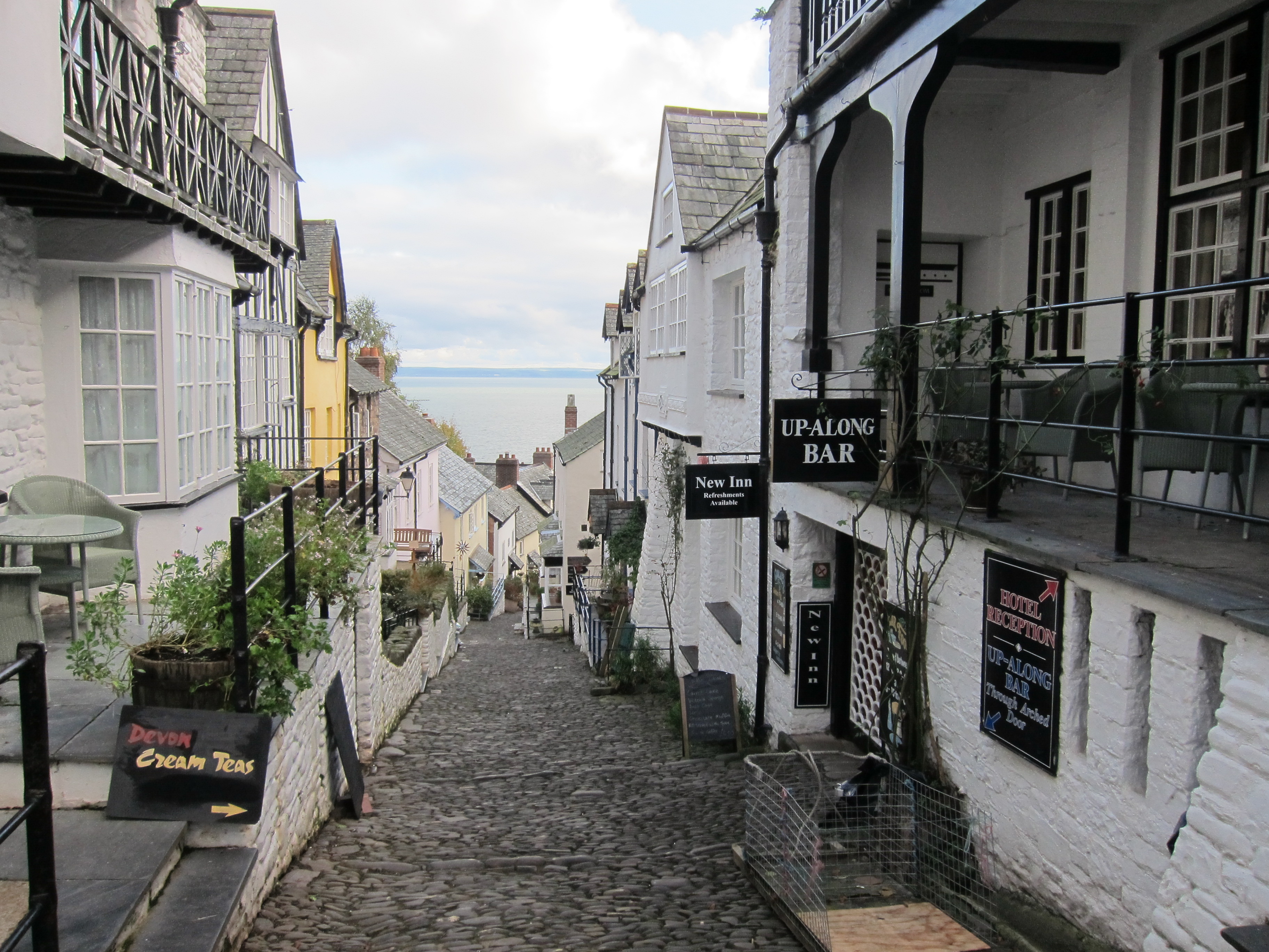
In the end, all worked out well and we got to our charming little guest house on the outskirts of Plymouth just before midnight. Following a very substantial breakfast, we took the bus into the city centre, and picked up the coast path not far from where I left it with Vicki nearly two years ago (can’t believe it is that long since I was on this side of the country!)

We walked along the Hoe, pausing to take in the enormous memorial to the fallen of the Royal Navy in both World Wars, and then past the lovely eighteenth century housing. IMG_9737There is still a very large and elegant stone barracks to admire. We caught the 11.15 Cremyll ferry across Plymouth Sound, which was full of pleasure craft as well as more serious looking boats, to Mount Edgcumbe. We stopped for a coffee in the very attractive Edgecumbe Arms pub, then followed the path though the really beautiful woodlands that fringe the estate on the seaward side, pausing to admire the view, and the multifarious follies.

Mount Edgecumbe is home to one of the biggest camellia collections in the country, but, sadly, they have all finished blooming now. The day was perfect – sunny, clear, with a light warm breeze, but not too hot. Unfortunately my pack is too heavy…I have not carried a pack for a 12 day trip, and although I have pared it down and can still fit it into 26 litres, it seemed weighty. It has been a while since either of us has done much walking – my last coast walk joint was back in February although I had a couple of days in the Lake District recently, and Rachel has dished her knee, so we took it pretty gently.IMG_9768

The sea glistened to our left as the path gently undulated through woods and on the edge of fields.

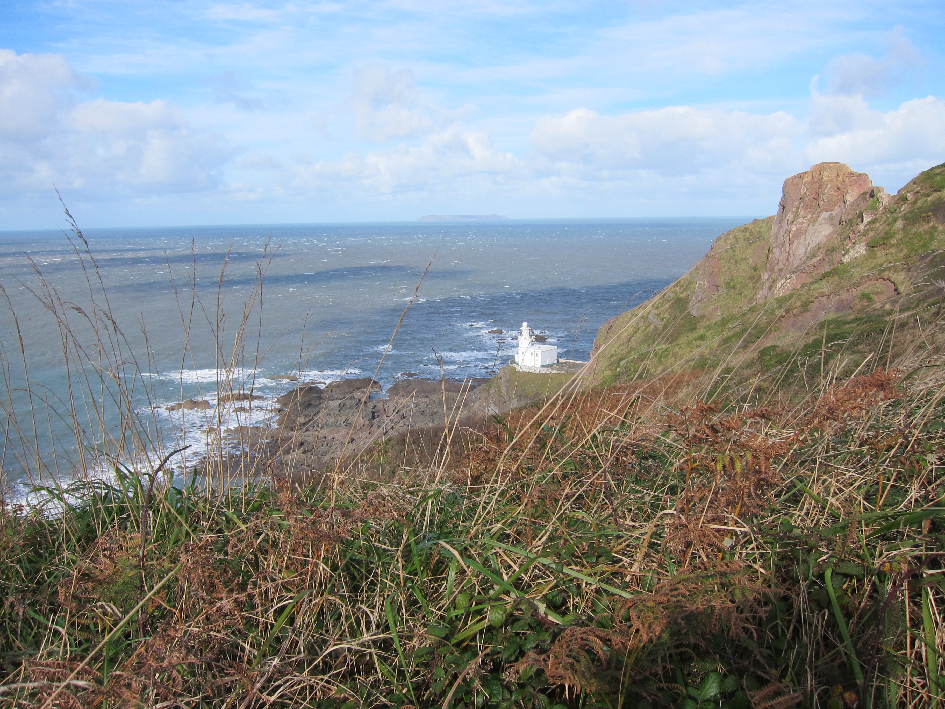
Our first landmark was the tiny chapel at Rame Head, visible for miles in both directions, and mentioned in the shanty, ‘Spanish Ladies’ as one of the places the sailors recognise on their return home. IMG_9807I had to double black to find my camera case which I had dropped, and caught Rachel up to find her listening to the Wimbledon men’s semi-final. After a short, not entirely intentional detour to the Rame Head life boat station, and a very confused scramble through a field full of brambles, the whole thing became fairly plain sailing. The path is broad, and easy at this point, and we ambled long, the silence punctuated by Rachel giving me updates from the tennis – apparently one of the best matches ever played by Federer. On one of the few narrow points, we ran into some Dartmoor ponies, who completely blocked the path, and refused to move, even when nudged by the end of Rachel’s walking pole. Eventually, we had to climb past them, hoping they wouldn’t take fright and kick.

The path led throughout the firing range at Tregantle, where we were thrilled to see a stoat actually mesmerising a small bird. We watched as the two creatures stared at each other, wondering why the bird didn’t just fly away. The stoat got closer, but I’m afraid we interfered with the course of nature by making a noise. The bird immediately came to its senses and flew off. There was nothing else to be seen at the barracks other than a rather good looking young man emptying the water out of an inflatable dinghy and pulling determinedly on the outboard. As the boat was at least half a mile from the sea, and not even on a trailer, I couldn’t really see the point of running the engine. Perhaps it was to confuse the enemy…

We thought a detour to a fish and chip shop in Port Wrinkle would be a good plan, as it was getting quite late and we were starving, but unfortunately the only café was closed. Downderry was a further 2.5 miles up the steepest slope of the day. A sudden squall meant a scramble for waterproofs – no sooner on than the sun was shining. Rachel’s knee was causing a bit of bother, so mindful of the fact that the pub might stop serving food at nine, I raced on ahead to get our orders in – not a moment too soon. We are staying at the Inn on the Shore and I am just heading to bed after an excellent supper.