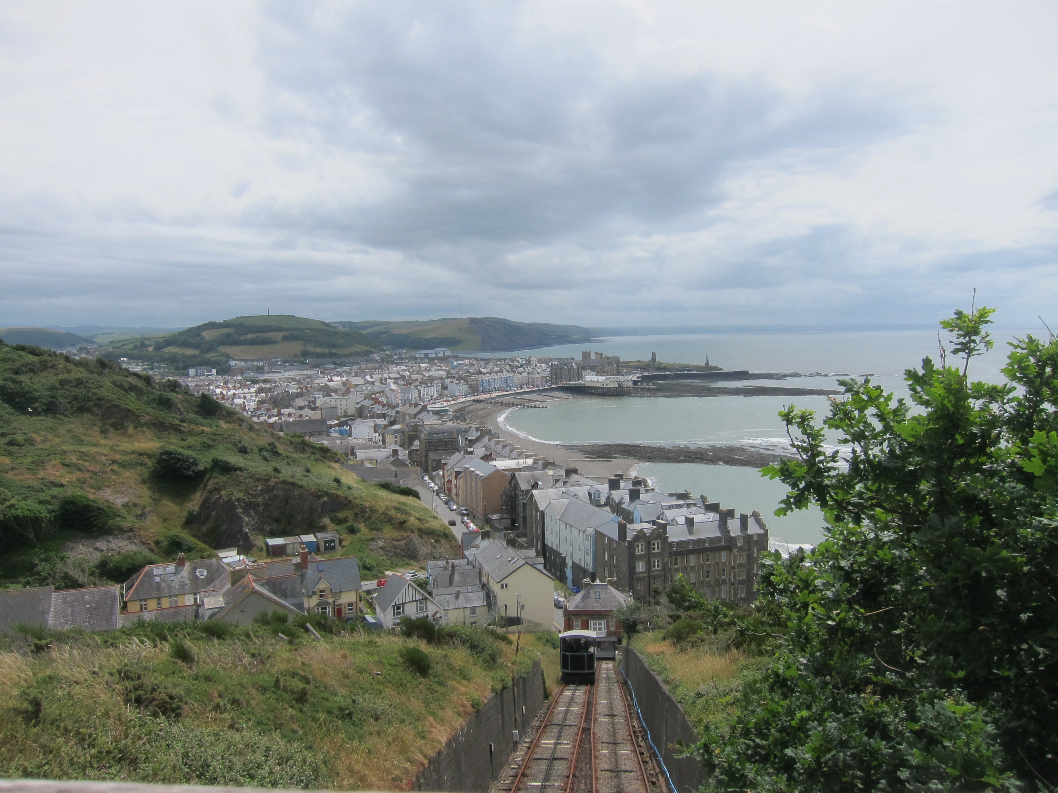

Today was definitely a game of three halves, as they say. I dropped the car at the tiny request stop at Llwyngwril – although since four other people got on, I am surprised it is not a fixed stop. The train puttered along the coast, with the most fabulous views of the sea. Even if you don’t fancy walking the coast, the Welsh coastal railway is a great journey.
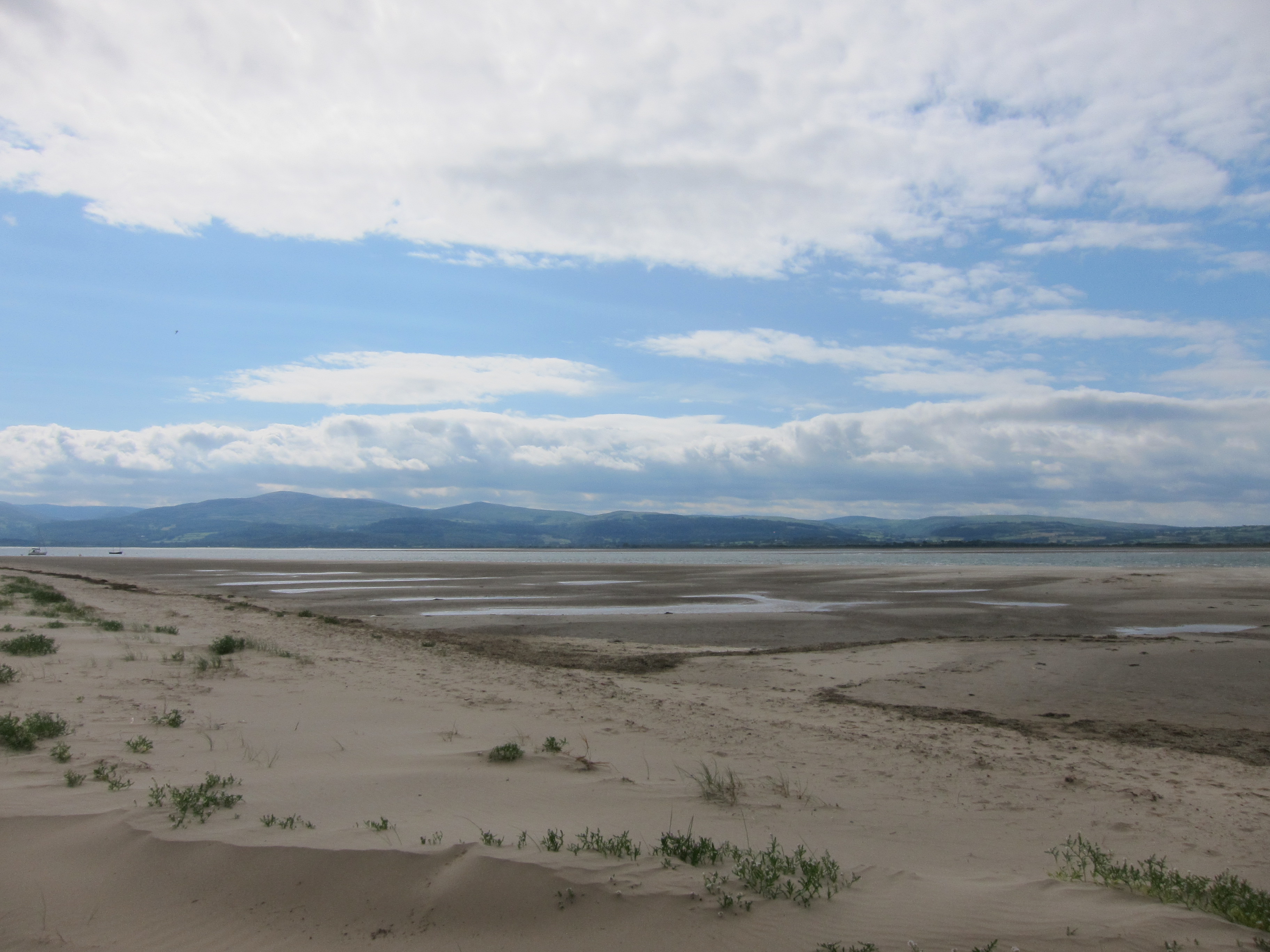
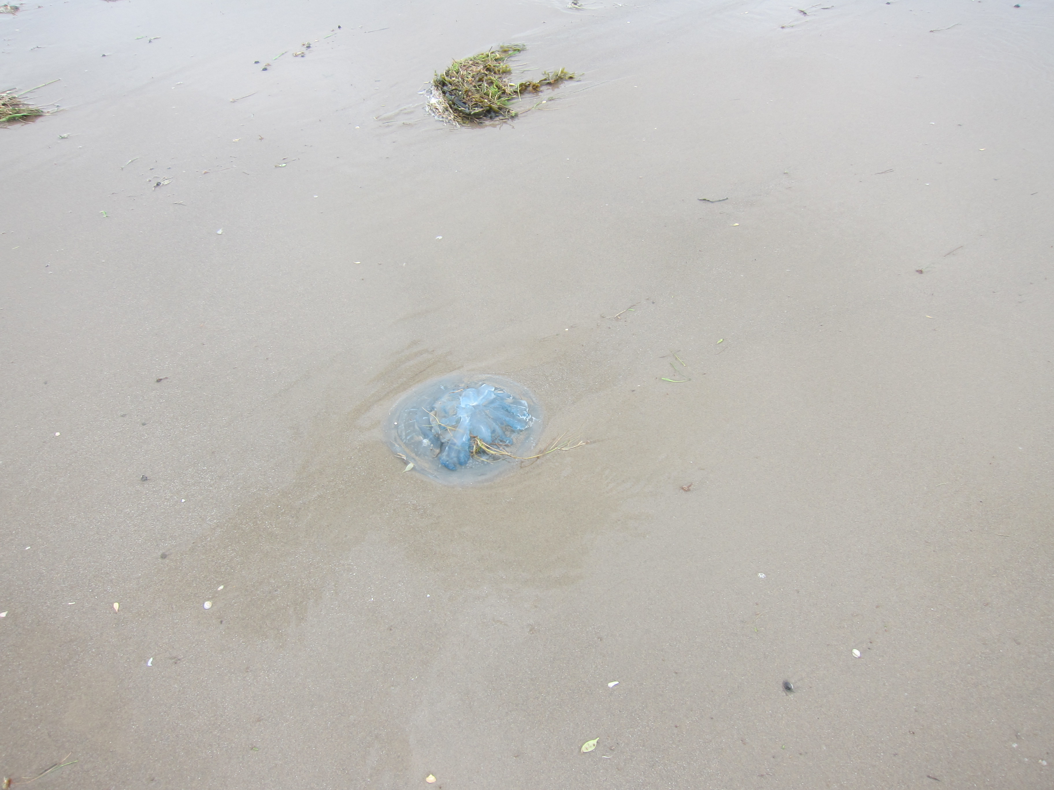
The station at Aberdyfi is right by the coast, and there is a level crossing for people to walk down to the shore. The tide was just coming in and the boats were beginning to bob. Yesterday’s wind, from which I was largely protected, being inland, made the sea quite choppy. At low tide, you can walk the whole three miles to Tywyn. I got about half way, relishing the feeling of the water and sand on my bare feet, (and avoiding the big blue jelly-fish) before I had to climb up onto the sand dunes above the high tide mark. I spent a while putting my boots back on – you have to make sure every grain of sand is off your feet or else it is very uncomfortable – think the Princess and the Pea!
Walking along the promenade at Tywyn, the sea was very impressive – splashing up onto the path and leaving foam everywhere. There was a little cafe near the beach – not prepossessing from the outside, but the coffee was okay, and the Victoria sponge quite good. The gannets were watching with a beady eye, but were more interested in another customer’s savoury snack.
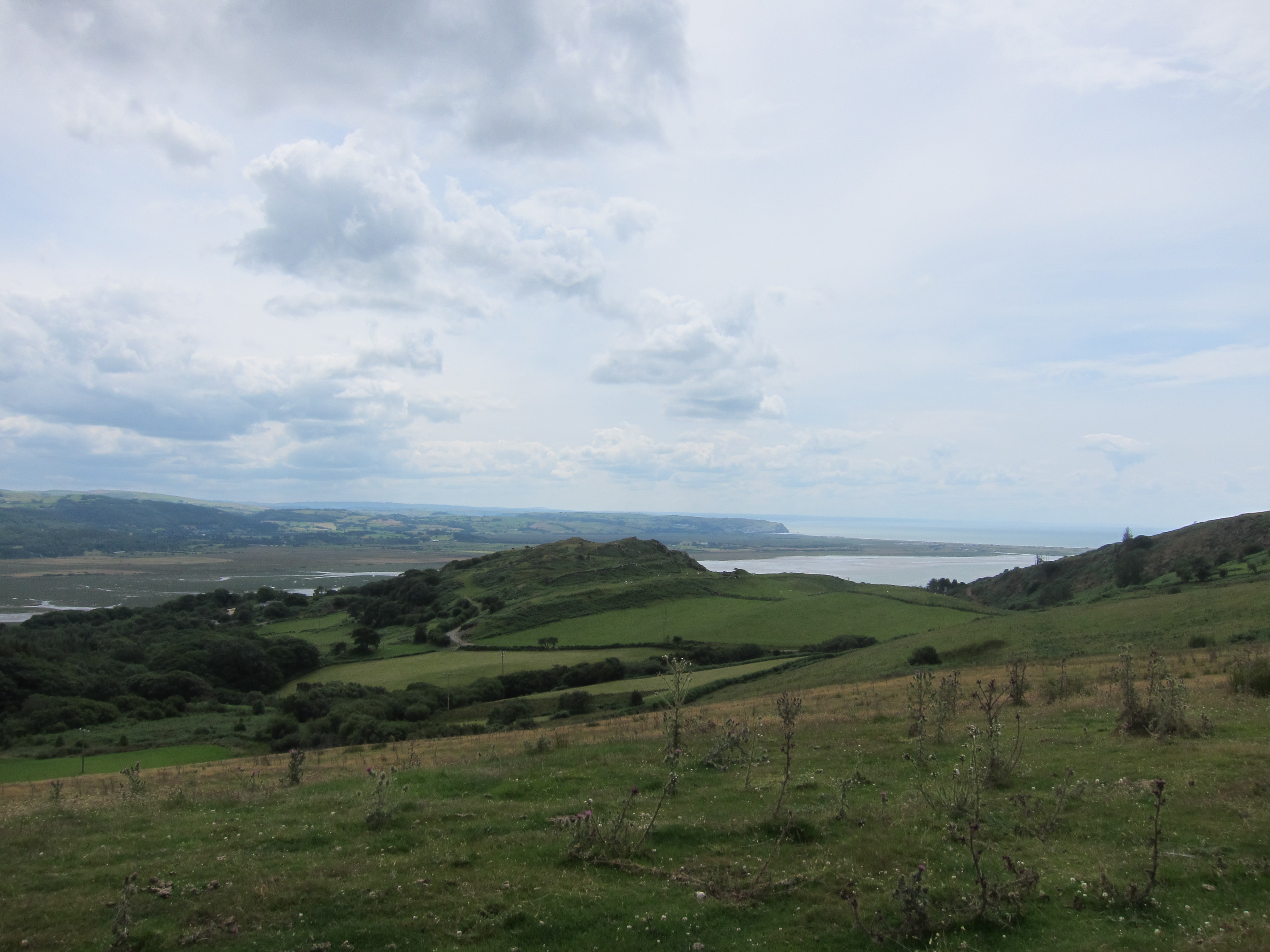
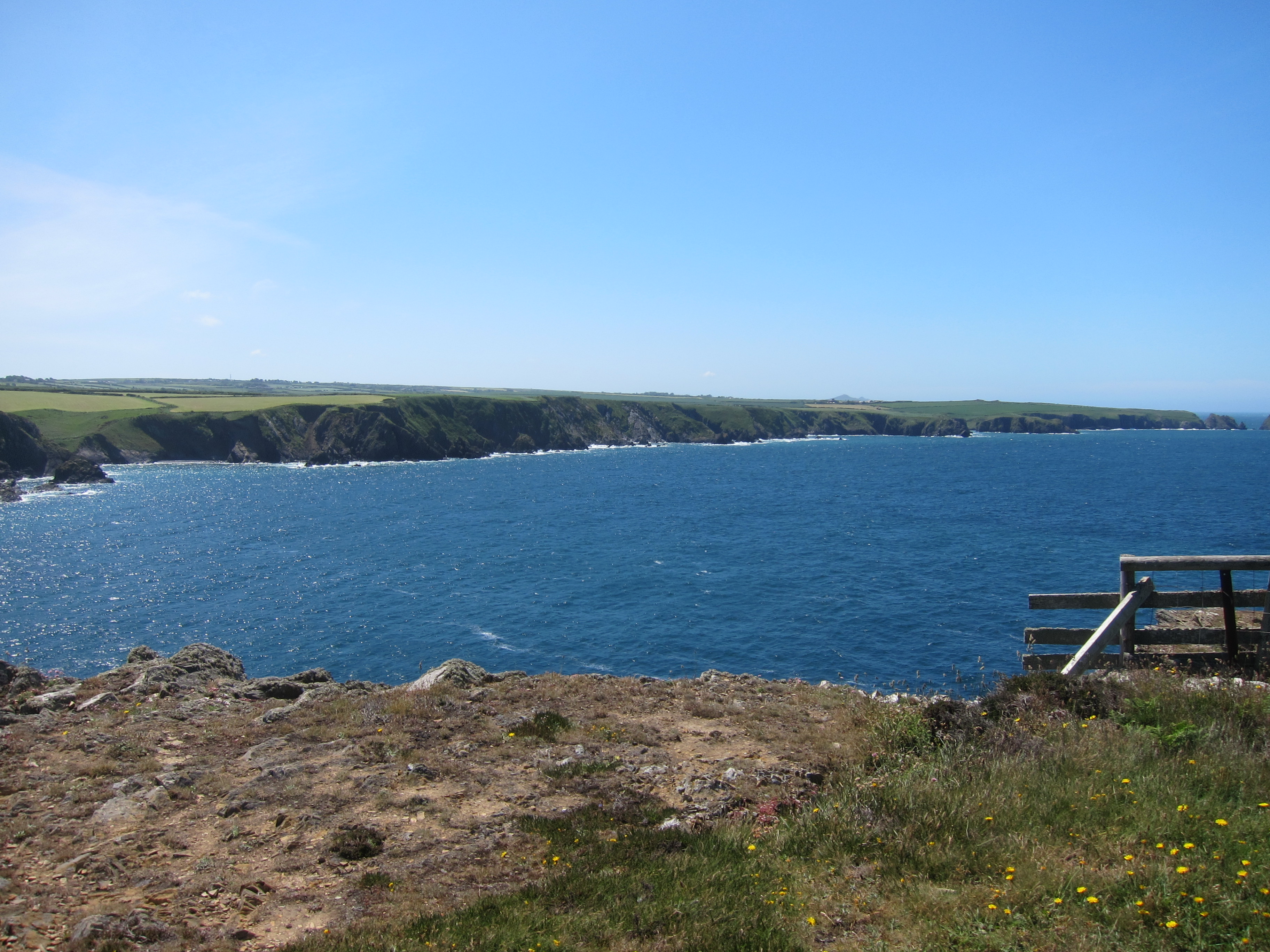
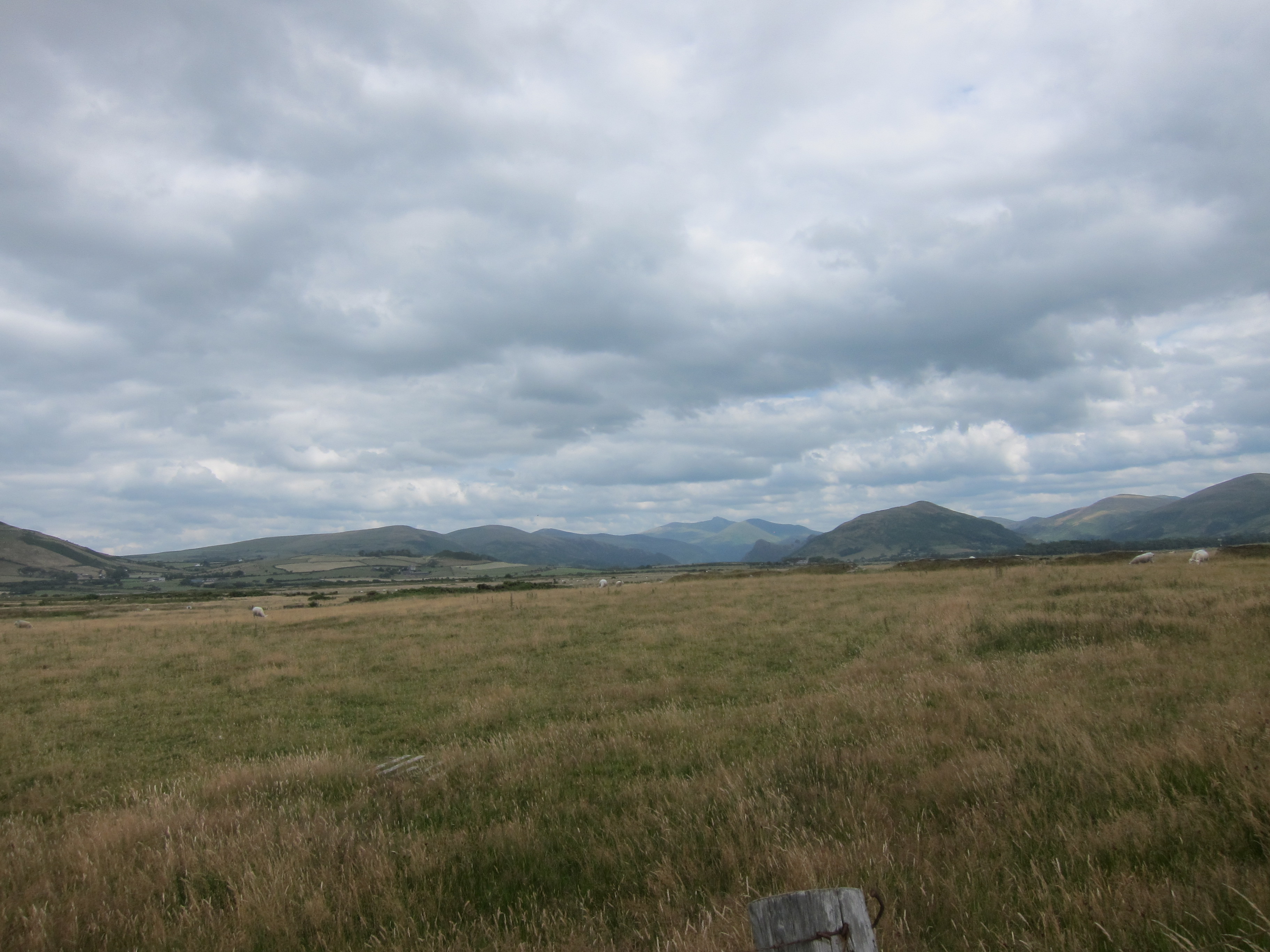
I continued along the prom – following a man who also had the air of a coast walker, however, at the point where the path turns inland, he carried on. I have a nasty feeling that the poorly angled sign led him astray, and he did not look at a map. You have to come off the prom to cross the railway line at the level crossing. The path then runs along the road straight beside the track for a long stretch. It was hard under foot, as I did a fair bit of road yesterday. I won’t say it was boring, because inland the views were opening up splendidly, up the valley of the Afon Dysynni, which rises in Llyn Mwyngil (Lake Tal-y-llyn) and empties just north of Tywyn. Far in the distance, Cader Idris, home of the Brenin Llwyd (the Grey King who snatches unwary travellers) was raising its sinister head.
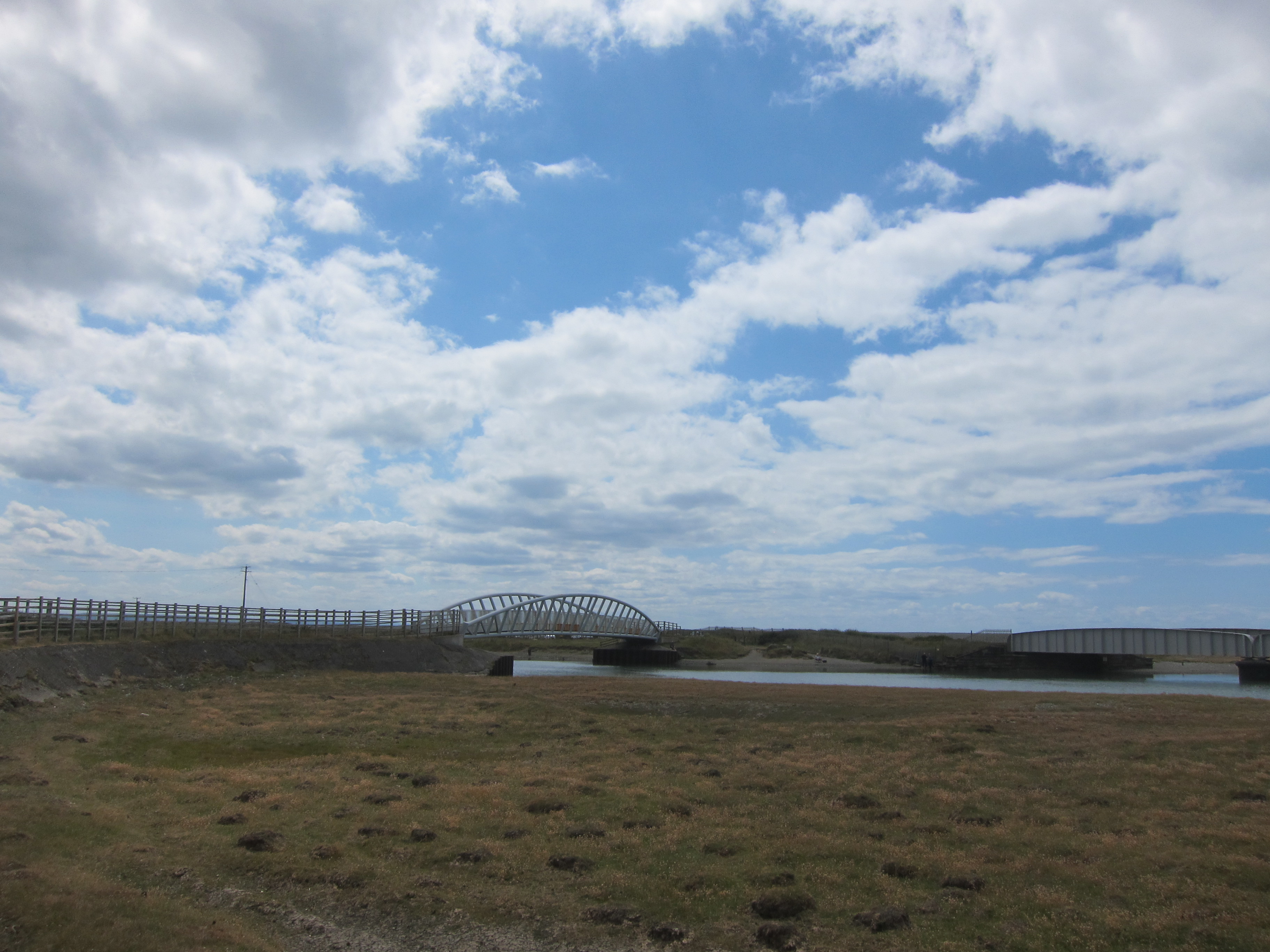
At the mouth of the river, a new footbridge was installed in 2016, which saves several miles of walking up the estuary. It seemed a popular place – a number of cars were parked there, with fishermen, dog-walkers, and even paddle-boarders taking advantage of the river. A flock of sheep were also on the bank, drinking and paddling. The path continued along the road – it used to go up around the quarry on the crag overlooking the river, but now stays on low ground, passing the station at Tonfanau, where I sat on a perfectly shaped stone by a monument to British-Ugandan relations, to eat my lunch.
By now, I was a bit tired of road walking, but it continued into the tiny hamlet of Llanfendigaid which is indeed, as the name tells us, a blessed place. The ground is rising, and the sea is visible. The whole place has an air of tranquillity. Soon after, the route leaves the road and crosses a couple of fields to a farm. Here, I nearly came to serious grief. Not from cows, but from a recalcitrant gate. I had followed the sign across the field which contained a solitary lamb – I could hear all its mates calling from the barn. I suppose it was sick, and being kept in isolation. There were two gates, neither of which seemed to have a waymarker, so I headed for the top corner of the field, as I thought I could see a stile beyond. The gate was fastened with a bit of string, but not in the vicious knots that suggest no entry. Nevertheless, it was not properly hung and I could barely open it. I managed to push my bag and poles over, and squeeze through. I then realised it was a dead end. I opened the gate again, but it slipped down. I wriggled past and tried to lift it back into position, but it slid all the way down, landing on my foot – fortunately, my boots are solid, and the weight was only partially down – it could have been a nasty injury. I was quite unable to lift the gate, but managed to edge my foot out. I felt very guilty, as the solitary lamb was now in a position to escape.
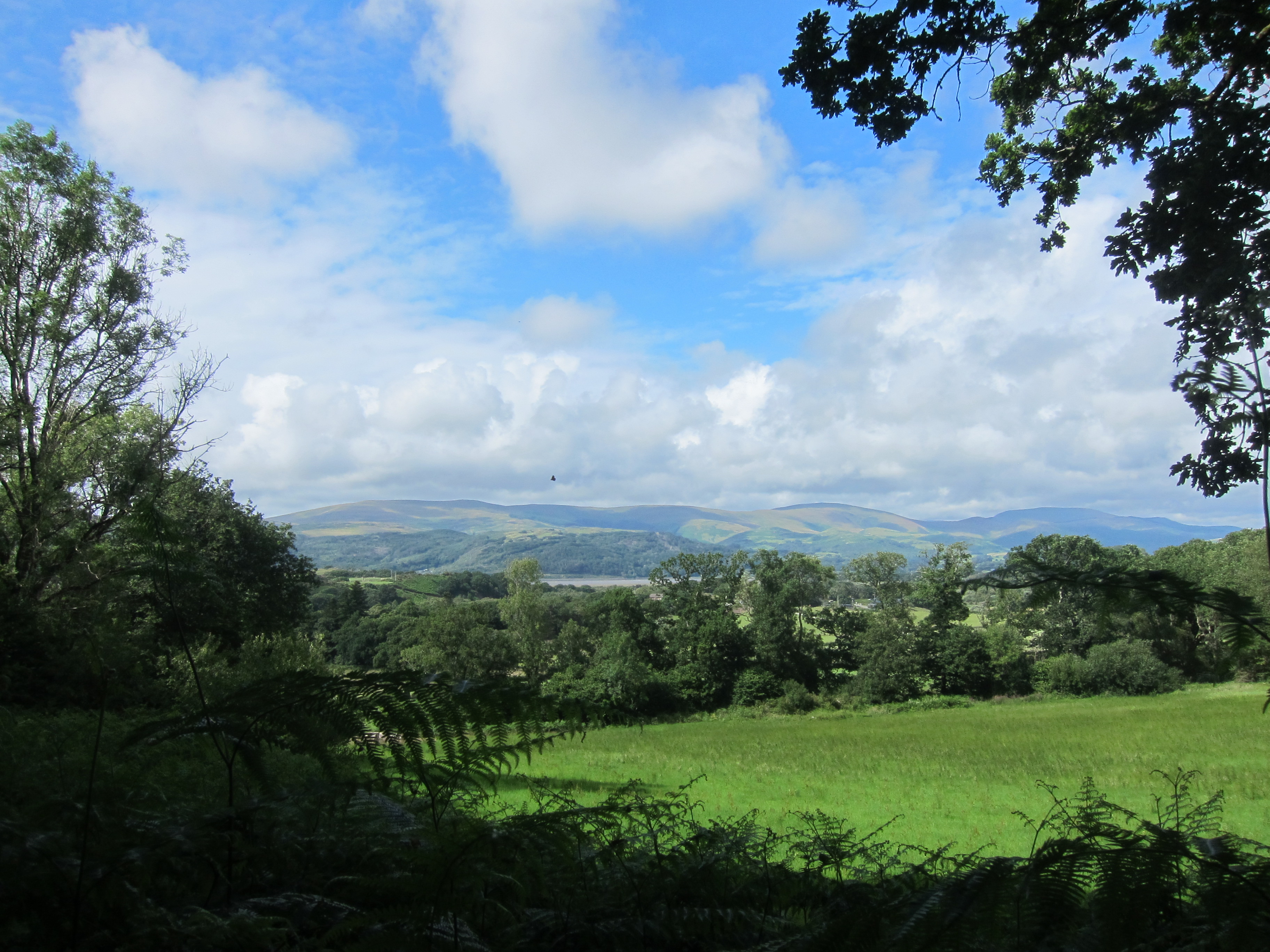
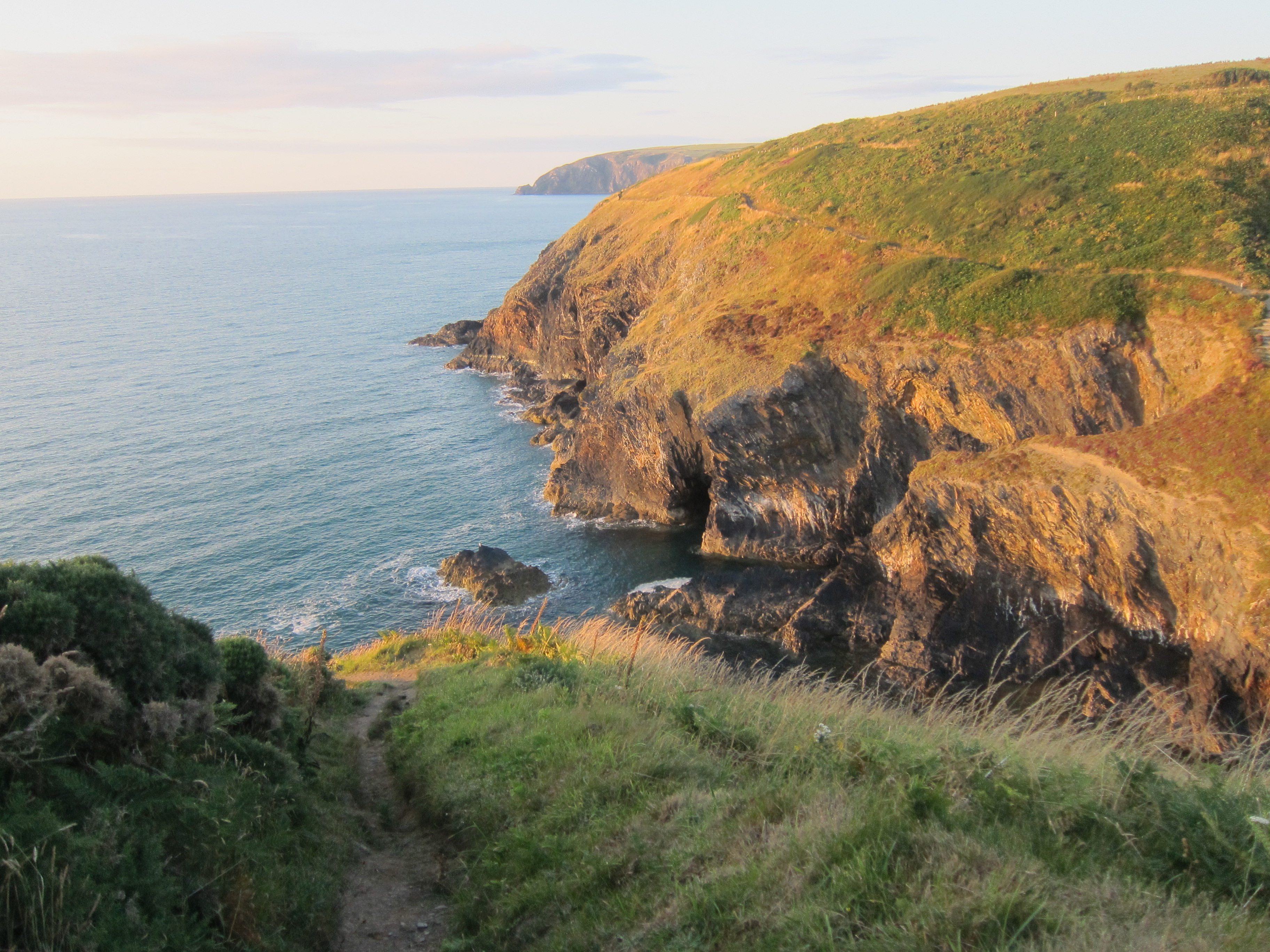
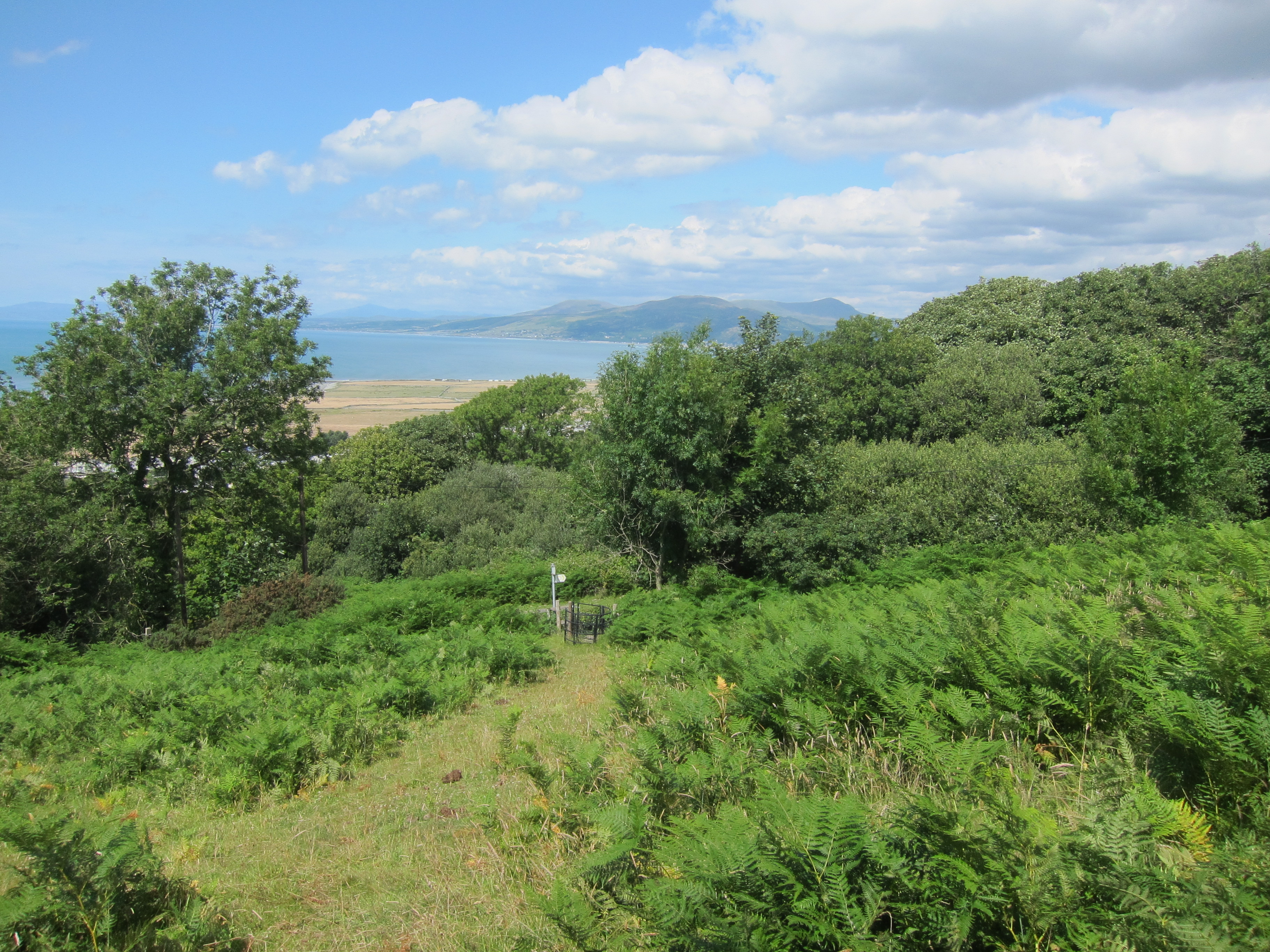
I thought I had better go to the farmhouse and tell them – even though in my experience there is seldom anyone about in the day. As it happened, there was a farm worker in the yard and I explained my mishap. Fortunately, it was not his farm, so he was very nice about it. He did give me minute instructions for the next stage of the walk. This was the third half – up a narrow grassy track, with lots of stinging insects – I am covered with bites. I already have a bad one from yesterday on the ball of my left thumb, which has swollen up. The horrible little flies or whatever they are that hang about in bracken went inside my shirt and I have bites all over. Fortunately, this track came out onto another lane, which then led up over various fields – the views were absolutely stunning – across to the Llyn peninsula, where I could name the hills, and slightly east to Snowdonia – even Yr Wyddfa (Snowdon) itself was visible. This was a fabulous few miles, rounded off with a delicious ice-cream from the village shop in Llwyngwril.
11.2 miles in all and a golden day, despite the midges!