Day 83 – Bude to Philham 17 October 2016

Day 83 – Bude to Philham 17 October 2016

Today has been pretty hardcore. Not the very hardest day I have ever done, but definitely in the top five, perhaps even the top three!

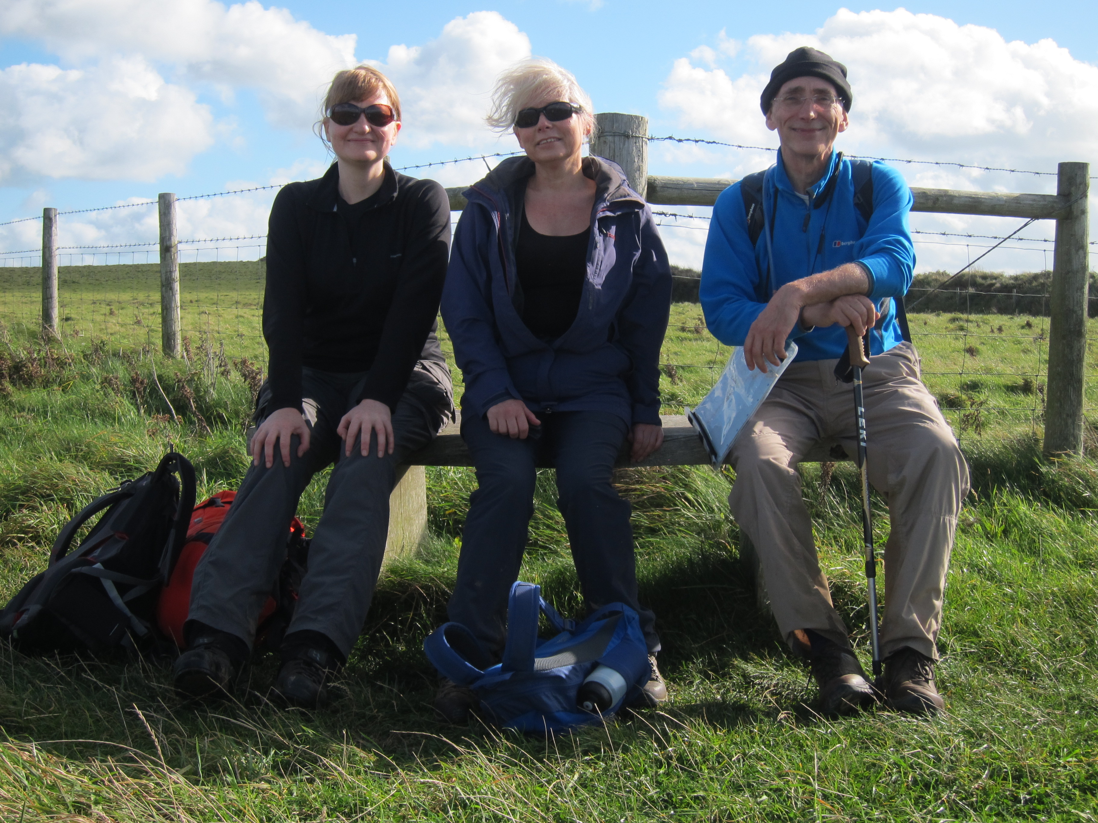
We managed to start a bit earlier today. Rachel had a bus to catch to get back to London for work tomorrow, so we had an earlyish breakfast and set off a few minutes before nine, fortified with an excellent meal including including Cornish pudding –  a sort of sausage but very peppery.

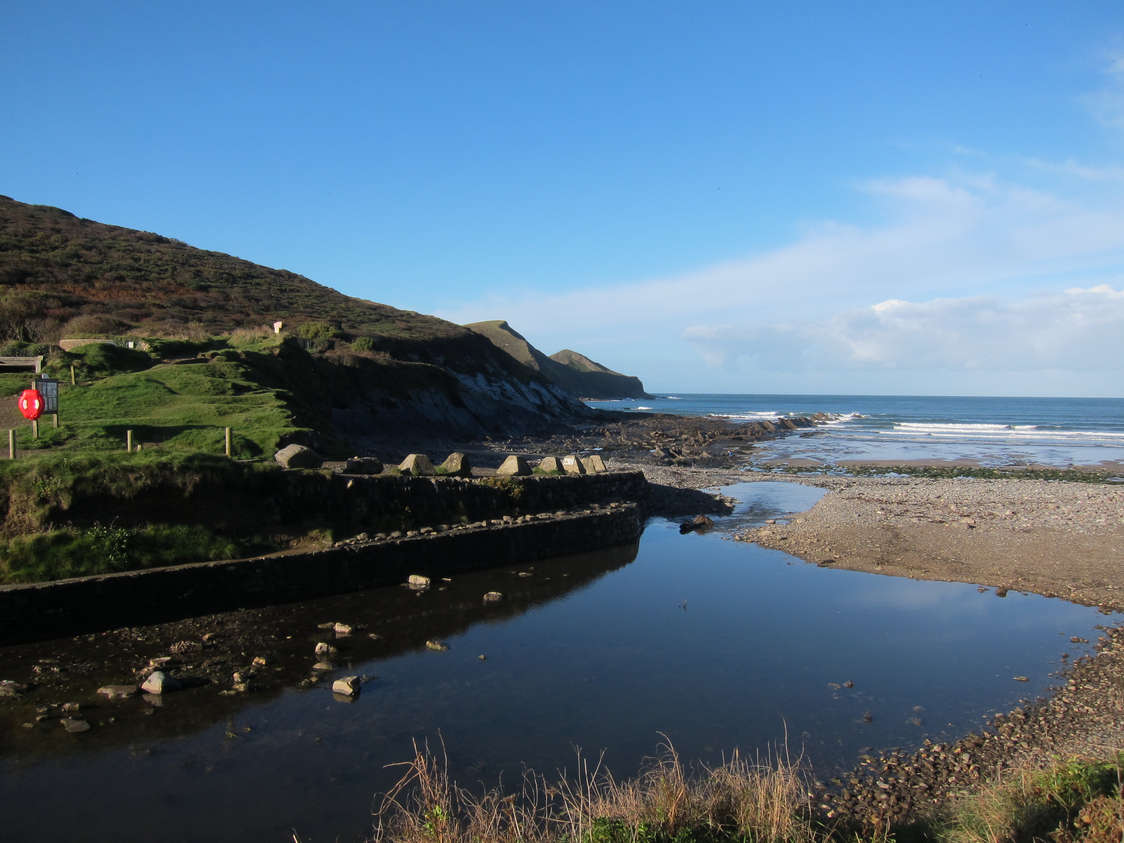
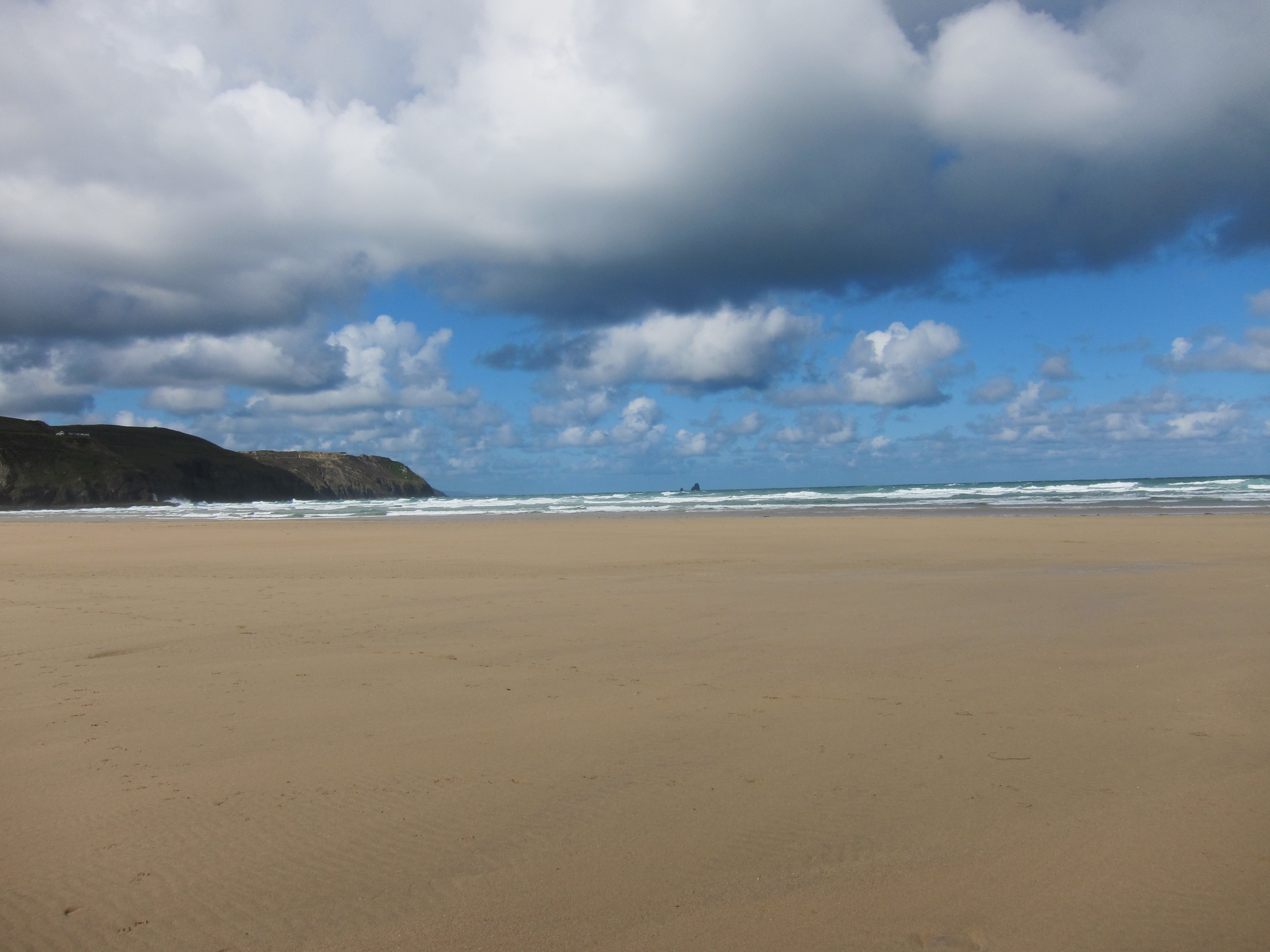
I slipped a Cornish pasty and some lemon cake into my rucksack. I was so full from last night and breakfast that I contemplated not taking lunch but everyone warned it would be a long tough day. The weather was blustery as we set out, blowing foam like confetti onto the land. img_1605The wind has been strong all day but although a few squalls crossed onto land, they were behind us, just giving us the odd shower. Not enough to get really wet.

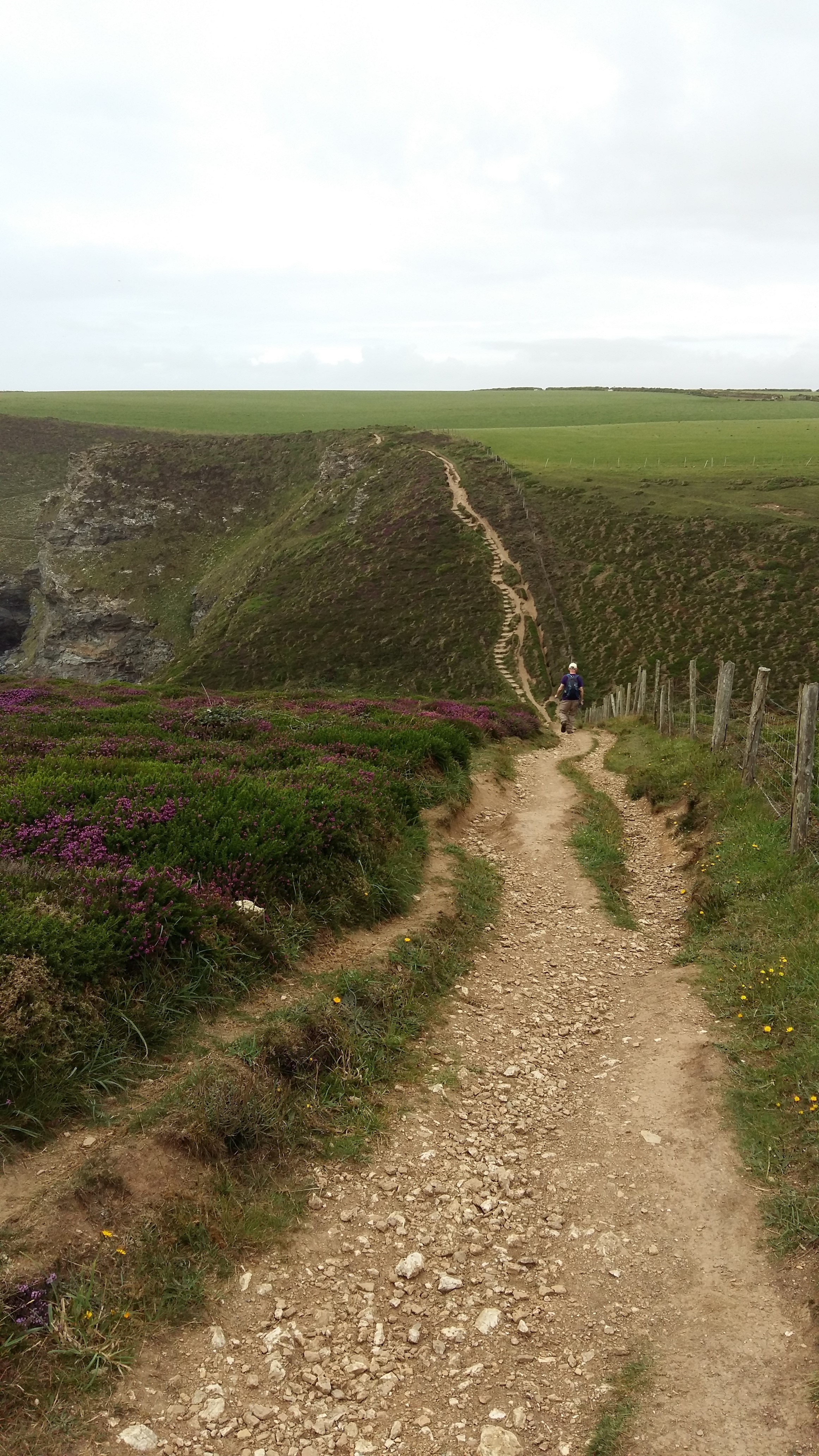
What has been so tough are the relentless ups and dens. At least twelve times we climbed down steep slopes or staircases from the top of the cliffs to sea level, and up the other side. Absolutely exhausting, especially as the wind was fierce at times, although blowing us onto the coast rather than off.

We could see Lundy getting and at the end of the day it was plain visible whenever the clouds rolled back, although it frequently was obscured by clouds.

Around 2pm, we finally left Cornwall and crossed back into Devon. The Cornish coast has taken me twenty-three days to complete – definitely the longest county coast so far.img_1684

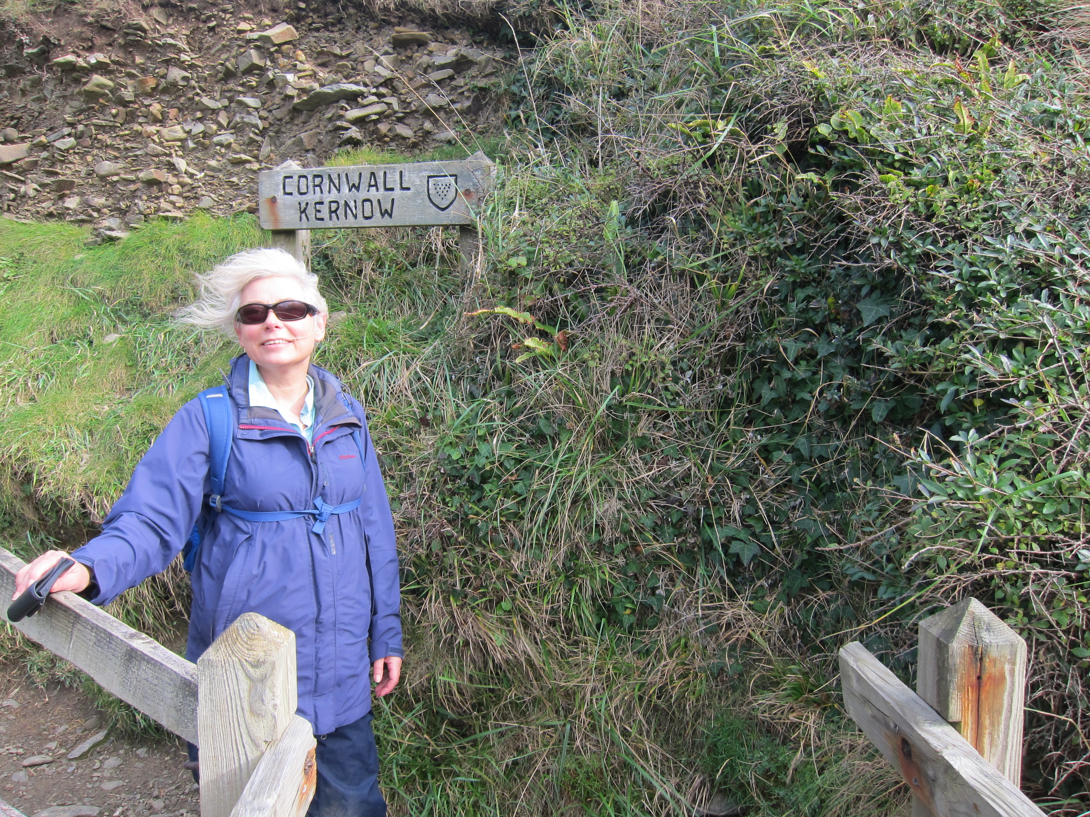
Above the long valley leading into Welcombe Mouth beach, we came to the writing hut of Ronald Duncan. I had never heard of him before, but Duncan was an important playwright and poet from the mid-twentieth century. Duncan was a pacifist and a conscientious objector, who, before the Second World War worked with Benjamin Britten, and is best known for writing the libretto to Britten’s ‘Rape of Lucretia’.  During the war, he began a co-operative farm near Welcombe Mouth, although not with conspicuous success. His little hut, which must have taken huge grit to complete, as all of the stone would have had to be dragged up or down a precipitous slope, made a welcome retreat from the wind.img_1694

Unfortunately we could not book anywhere to stay in Hartland Quay (the nearest settlement to the path), so had to go several miles inland to find one. It was getting dark and we were exhausted, so my navigational error that took us nearly a mile out of our way was not my finest hour. I must say,  Jon and Chris were very forgiving!

Pleasingly, we have a little suite to ourselves, and my bathroom has an enormous bath and numerous fluffy towels. Our hosts gave us a lift to and from the pub, for a rather indifferent meal.  I am now about to plunge into the aforementioned tub.

Save

Save

Advertisement
Day 82 – Crackington Haven to Bude

Day 82 – Crackington Haven to Bude

We left our excellent hotel bright and late but as we had only a short day to do, we were in no hurry.

It was an absolutely beautiful morning. After heavy rain in the night, which soaked everything, the sun was warm and everything sparkled, with the sea completely calm.

The path out of Crackington Haven is steep, sloping diagonally img_1499from behind the hotel across at a north westerly angle. From the top we could see back to Tintagel Head. The massive Camelot Castle hotel is a very handy landmark. From the first headland we could also see ahead as far as beyond today’s stop at Bude. There were another two big drops and ascents, but the countryside is becoming more like the south Devon coast – lots of up and down, but not as steep as much of Cornwall.

Around 12, we stopped to eat the pasties we had carried all the way from Tintagel. Despite being locally made there, they were distinctly second rate, compared with some img_1564I have had. Shortly after, it began to spit. Chris and Jon were quite a way ahead when Rachel suggested we put on our rain gear – but we were too late. Dancing about trying to get myself into my horrible plastic pants, the rain poured down in a flash squall. It persisted, less violently, for about an hour giving some amazing views of clouds and rainbows.

We eventually found a café at Widemouth Bay, where I had a rather good scone. The last hour and a half into Bude was uneventful. Bude does not seem very prosperous. We are in a very nice hotel, looking down over the town after an easy 10.7 miles (17.1km).

Save

Day 81 – Tintagel to Crackington Haven 15th October 2016

Day 81 – Tintagel to Crackington Haven 15th October 2016

img_1387Another bad journey down from Paddington yesterday. This time the trains were delayed for two hours because someone had been hit by a train at West Ealing. With nothing to do but wait we whiled away the time in the pub.

Two glasses of wine and a Cornish pasty, later we got on the packed train – along with all the other passengers from delayed trains. Including a dog, named Daisy. The dog was fine but its owner talked to it incessantly. At one point it made a break for freedom, Jon guessed in search of the quiet carriage.

It was noticeable how much shorter the journey was than the last one down to Penzance – progress measured in train journey times!

We managed to rearrange our lift from Bodmin and got to Tintagel around seven. Sadly too late to go to the headland, although there was a splendid moon.

This morning were delayed in setting off because the luggage people hadn’t confirmed the pick-up. We mooched around the village before concluding that we would leave cash with our B & B to send the bags on by taxi, if they weren’t collected. We also collected some pasties for lunch. We finally set out around 9.40, down the lane to meet the coast path just to the north east of the village.

Today is marked as strenuous in the book.  There were lots of ups and downs and, although no single one was as fierce as the days before Tintagel, there were fewer long flat bits. All the way, looking back, we could see the vast Victorian Hotel, the Camelot Castle, out on the headland. It never seemed to get much further away. Whilst the weather started sunny, by the time we got to Boscastle – the place almost washed away by floods a few years ago, it was beginning to spit.img_1417

We stopped in a very nice tea shop for coffee and cake, and as we ate the rain began to come down in stair rods. A vote was held to delay setting out for half an hour to see if it cleared. But it didn’t. So we left around 1.45, suitably plasticked up. It poured for another forty five minutes.

Strangely, it is easier to walk on a soaking path, than a damp one. Damp paths are far more slippery than wet ones. The views were tremendous – the autumn colours looking very dramatic against the grey sky. img_1428 The rain stopped and the sky turned bright blue, the water turquoise and calm, and the last couple of hours were gorgeous.

Now in the pub at Crackington Haven in what would be a nice room if the window were not nailed shut. We had an excellent dinner – I tried some Cornish gin very good indeed! Quite herby. We covered a pleasant 12.5 miles.

The moon was full so Rachel and I had a brief walk down to the sea front it was gorgeous in the moonlight apart from a very disconcerting shadow that looked like Quasimodo beating someone with a club.


Save

Save

Day 79 – Padstow to Port Isaac 16 July 2016

Day 79 – Padstow to Port Isaac 16 July 2016

Today was another glorious day. I really do love North Cornwall. I think it has overtaken Dorset in my favourite English counties. But definitely North Cornwall, rather than South which I didn’t especially like – although that might have been the bag carrying…

Last night we walked into Padstow from our excellent B&B (called ‘Tamarisk’ and run by Betty – definite recommend). We decided that we: a) would not eat in the most expensive place – meals here are equal or more than London prices, and it can’t be transport or staff  as they all claim to serve local produce and wages are low; b) would not eat in one of Rick Stein’s numerous places – not that we object to Mr Stein but after a day’s walking even following a shower and change we don’t really look the part, and c) we would not eat outside. The wind was very sharp and we had spent all day outside. So we went to Rick Stein’s Bistro, ate in the garden and paid a very fine price! But it was an excellent meal.

In the morning, we took recommendations from Bimg_1208etty on pasty shops and waited for 20 minutes for a gluten free batch to be finished for Jon.  We then hung around Padstow harbour waiting for the ferry across the Camel.

The first section of the walk was easy, from Rock on the east of the estuary to Polzeath where we had coffee. The weather was very fine, quite hot in fact and copious applications of factor 30 were required. Stephen, after feeling rather tired yesterday was full of beans today and in full snipping mode. I can’t remember whether I have mentioned that as an act of selfless public good, Stephen walks with a handy pair of small secateurs and clips over-exuberant brambles from the path.  It is a treat to walk in his wake with nothing catching at hair or legs.img_1296

From Polzeath the route became progressively more difficult, with a number of ups and downs. We reached Pentire Head around 1pm and stopped to eat our pasties, still slightly warm inside mmmm. The views were absolutely superb, particularly at the eastern side of the headland. Apparently, it is possible to see Tintagel Head, and possibly even Bude, but it was not clear enough for that.

Port Quin a very narrow inlet, also owned by the National Trust, was impossible to see until you were on it. We had promised ourselves ice cream when we reached it, but there was only a tea van with a very grumpy lady in it, who shut up shop promptly at 4pm.

From Port Quin to Port Isaac is somewhat over 3 miles, and a very steep three miles at that. The path drops and rises precipitately, with steps cut into the cliff that look as though they will drop right down into the sea at various points. img_1314We toiled and moiled slowly along, reaching Port Isaac, which is delightful, except for the stony beach. After being turned away by several restaurants (they claimed they were full, but I fear they thought we would lower the tone), we had an excellent meal in the Golden Lion pub, before ascending yet another hill to our B&B.  Today’s distance was 12 miles (20km).

Day 78 – Porthcothan to Padstow, 15 July 2016

Day 78 – Porthcothan to Padstow, 15 July 2016

img_1135Today has been a gentle day, 17.3km (nearly 11 miles) of fairly flat walking, with only one major down and up. We started late after a very convivial breakfast with our host, as the distance was not too great.

Yesterday’s sun had completely disappeared and the sky was overcast. The turquoise water had turned to a rather attractive petrol green. A couple of miles brought us to Treyarnon. Unlike yesterday, there were few surfers about, as, despite the chilly wind, there was no surf. After a coffee in the pub there, we carried on around another couple of coves, and crossed Trevose Head. This is yet another area of coast largely owned by the National Trust. From the tip of it, we could just about see back to St Ives. Because of the lie of the land, from this point onward, St Ives will be out of sight.

Moving north-east, we then skirted Harlyn Bay and eventually arrived at Stepper Point, the headland overlooking the Camel Estuary.  Just on the tip is the Stepper Point Coast Watch station. This is run by a charitable body which notes all (and I mean all) of the movements along the coast with watch points all around the Cornish coast. The public can enter and see the very fancy equipment that tracks vessels. For future reference, we were marked down as soon as we came within sight in the book as ‘1m white shirt (Jon) 1f green blouse (me) + 1m (Stephen).’img_1176

One of the most interesting things in the watch house was a map and list of all the wrecks along the stretch of coast since the early 1600s. It was a fascinating record, ships from Jamaica and Malaysia, Dublin and Falmouth, and even as close as St Ives, many wrecked on Doom Bar, a shifting sand bar across the Camel mouth. Where known, the cargo, the captain and the number of crew lost were noted. The charity is always looking for volunteers, so if you are on the coast, and fancy helping out, make enquiries.

After this, we turned down the Camel estuary. The sun had come out and we decided to make for the tea gardens at Prideaux house, a Tudor mansion where the Prideaux family has lived for 14 generations. Before we got there, we were side tracked by another tea spot, the Rest-a-While, overlooking the estuary. So we did, and watched the rather lovely yachts zipping up and down the Camel as we ate a very satisfactory cream tea.img_1183

It was fortunate we were weak-willed as Prideaux House was closed for filming.

We are now in a very comfy B&B in Padstow. Definitely one of the best of the trip.

Day 77 – Newquay to Portcothan 14th July 2016

Day 77 – Newquay to Portcothan 14th July 2016

Last night’s B&B was run by a lady who never stopped talking. Not loudly but just an endless wittering punctuated by giggles. We heard all about her allotment, her blackcurrants in particular and her new oven: its price, its provenance, its size, the delivery difficulties etc. Jon and I left Stephen being shown the utensil in detail whilst we popped out to fetch Cornish pasties for lunch and rest our ears.IMG_0983

The walk today was glorious. Out of Newquay and over a short headland to a very smart hotel where we had coffee. Like all really good hotels they paid not the slightest attention to our dishevelled state but served us like royalty.

Then over miles of headlands, mainly flat with huge views both north and south. The weather was fantastic. Hot sun, but a stiff breeze, the sea turquoise with flecks of brilliant white. We saw so many peregrine falcons we are becoming quite blasé about them. Twice we saw them hovering almost above us and had a wonderful view as they swooped down.IMG_1063

We stopped for our pasties – very fine, from Warrens, allegedly the oldest pasty makers in Cornwall. Then we had ice cream at Mawgan-in-Pyndar – honeycomb with strawberries & clotted cream. Yum!

We reached Porthcothan around five, and are in a really lovely B&B, set a good mile back from the coast. The village is very small, just a hamlet really, with no shops, other than a beach café, and a pub on the outskirts. IMG_1074We covered a gentle 16.3km (just over 10 miles) on probably one of my top 10 days of the whole walk so far.

Day 76 – Perranporth to Newquay 13th July 2016

Day 76 – Perranporth to Newquay 13th July 2016

Last night’s hotel rather grew on me as the maintenance man came to fix the lock on my door. When he isn’t maintaining he is either surfing or firefighting. He definitely brightened my day! The food was pretty good too.20160713_132459

I had no luck in Perranporth with finding a new memory card for my camera so I had to do a bit of judicious editing which was absolutely essential as there were certainly some fabulous views to take.

The path starts out along the glorious golden sands for nearly a mile (although it was not brilliant weather). Right at the end there were the rather pitiful remains of a whale that beached a few days ago – the pong was pretty fierce, and we were rather boggled at the number of people who seemed to see the poor creature as a tourist attraction.IMG_0962

At the end of the beach you climb up onto the dunes. We didn’t go quite far enough and made heavy weather of climbing up the dunes rather than going up the nice wide stoney track.  The path then skirts along the headlands, dotted with a few Shetland ponies. The wind was fierce, although other than a shower just when we were starting out, the day has been mainly sunny. This morning was cold though. I don’t know what the wind chill factor was, but it felt no more than on 12 or 13 degrees. Not good for mid-July.

Rounding the headland, you come to the little cove of Holywell. At the head of the beach is a pub, where we stopped for coffee and cake, then a stiff climb over dunes.  Always hard going and at one point I thought I had pulled a calf muscle but all seems well now.

Above the dunes we saw a kestrel, and heard what we thought were its chicks. Back out to a headland, and round a second, past what looked like an army training camp, before turning into another narrow bay, with good surf.  We saw another kestrel dive bombing a crow. The crow seemed unconcerned, just ducking as the orangey – brown bird of prey shot over its head, circled and came in again. We assumed the crow was too close to the kestrel’s nest, but we didn’t see any chicks.

The next bay is the Gannel estuary. The sun had come out and it was full of children and dogs enjoying the waves. I took my boots off to walk over the Crantock Bay sands which are very fine.20160713_143045

Unfortunately, at some point, I managed to lose yet another water bottle. Very annoying. It is only possible to cross the long inlet by ferry or going quite far inland to cross a footbridge. We were in time for the little ferry, which cost us the astonishing sum of 60 pence each as we only needed to take it halfway.20160713_163636

With the tide low, the ferryman came to a little platform half-way across. On the far side, there was a little shop with live lobsters and crabs, waiting to be chosen and sent on their way to the local dinner tables. The hotel at the top gave us our first cream tea of the trip. Around another headland, on top of which there was a mediaeval huer platform (where someone was posted to watch for the pilchard shoals) and then along the path above the beach at Fistral, past Rick Stein’s fish restaurant. Don’t think we’ll be eating there!

Day 74 – St Ives to Portreath, 11th July 2016

Day 74 – St Ives to Portreath, 11th July 2016

Today (11th) is my birthday, and I have spent it very pleasantly. We left our bags to be picked up from our strangely impersonal accommodation – there was never any interaction with a human, only a key safe and instructions. No breakfast, just a common room with tea and coffee for the morning, which was occupied this morning with a young man who exuded an astonishing level of grumpiness without saying a single word.IMG_0863

We walked down towards the sea front and found a lovely spot for breakfast. We were still feeling food deprived from yesterday so had an enormous bowl of granola with Cornish yoghurt and honey, with fresh fruit, followed by eggs benedict. The waitress looked a bit shocked. ‘Do you really want two breakfasts?’ she asked. Jon and I nodded, but Stephen sheepishly opted just for the eggs benedict.

Whilst we were eating a squall came over and we began to think it might be plastic trouser weather, but it soon cleared. IMG_0866The rest of the day there were odd showers but nothing serious. The walk to Hayle was straightforward, gliding along the cliff edge, but not too steep or narrow. I had definite house envy as we passed some of the cliff top villas. We passed Carbis bay and rounded into the Hayle estuary.

We had a peep into Uny Lelant church – more ancestors, although I couldn’t find any names in the graveyard that I recognised, although there were some fabulous pyramid orchids in the long grass. During the Civil War Lelant held for the King whilst St Ives was for Parliament so inside there was a much treasured transcription, in giant letters, of a missive from a grateful Charles I.

Rounding the estuary we stopped for elevenses and Stephen whipped out three little cup-cakes, one with a candle and an ‘M’ iced on it, together with a small bottle of Moët Chandon. A great way to celebrate my nnth birthday, although the picture makes us look like the three wise monkeys, and I appear to have eaten quite enough cake already!IMG_0904

We went on to Hayle Towans (I assume towans is the equivalent of Welsh tywyn – sands) and the path went up and down the dunes. Stephen left us to meet his daughter and Jon and I ploughed on, passing Gwithian, but on the dunes side, rather than through the town. I wonder how many of my ancestors were conceived on the beautiful beach of Gwithian Towans?!20160711_171343

The path then went onto the cliff tops. Easy walking, with lots of wild flowers – heather, oxe-eye daisies, vetch – yellow and purple, clover of all sorts, thrift and everywhere yarrow in such profusion that you can smell it.

The route was straightforward until a mile out of Portreath, when there was a huge drop into a valley and a steep staircase up the other side. At the top there were a few moorland ponies, then we rounded a bend to see Portreath at the bottom of the slope. It’s a lovely evening, fingers crossed for tomorrow to be sunny.

Day 72 Penzance to Mousehole 9th July 2016

Today is probably going to be the shortest day of the whole walk – a mere 3.3m from Penzance to Mousehole, where I started Day 69 last year.

The walk was simple – along the cob from Penzance to Newlyn. Newlyn was interesting: I enjoyed seeing a real working fishing port rather than the little ports that just seem to run pleasure craft. IMG_0704The warehouses were shabby, and the place does not seem to be very wealthy but there were dozens of ships crowded into the harbour and numerous fish wholesalers lining the streets.  I also came across another of the cycle way signposts – haven’t seen one of those for ages.IMG_0703

Just outside Mousehole there is a memorial garden to the volunteers of the Penlee Life Boat station. Closed now, it performed its last service in 1981, when the Solomon Browne set out in hurricane force winds and 50ft seas to help the Union Star. After initial reports that four men had been saved, contact with the station was dropped and both ships were lost with all hands. Eight men from Mousehole had been in the lifeboat, a very high number for such a tiny village, but within forty-eight hours sufficient volunteers had come forward to form a full crew. The replacement boat, the Mabel Alice, was stationed in Newlyn.IMG_0717

The weather was not much to write home about. The cloud stubbornly refused to lift and the west wind was quite strong.  I reached my destination by 10.45, and caught the bus back to Penzance. My original plan had been to return to Marazion to go into the castle at St Michael’s Mount, but my landlady informed me at breafast that it is closed on Saturdays.

I wish I had taken the chance to go around quickly yesterday. My second thought was the open air theatre at Mynack, which I missed last year through going inland, but the weather was so dull it hardly seemed worth the bother. In the end, I took a bus to Gwithian, a small town in North Cornwall where a branch of my family came from, before emigrating to South Wales in the 1840s. The churchyard was full of Hockins, Cocks, Andrewarthas and Pascoes, all cousins in the 99th degree. A swift bus ride back (First Kernow operate an excellent and comprehensive service) gave me time to go to the Penlee Gallery to look at an exhibition of sea painting.

Day 71 – Porth Leven to Penzance 8 July 2016

IMG_0582Today was a perfect day to get me back in the swing of walking – not too hard, not too easy, ideal walking weather and the right sort of distance – just under 15 miles, plus nearly two to get to the start point.

I took the train to Penzance yesterday lunchtime, and it was no more than averagely late, getting in just before six. The weather was poor. It began to spit just as I was popping into a pub for supper, and by the time I came out it was of plastic trouser proportions. Last year the walk up to the youth hostel from the town centre seemed endless, even though Chris carried my bag, but this year the nearly two miles were no problem, especially as the rain eased off, although it was dreadfully muggy. It’s a good youth hostel (Castle Horneck) and despite being in a dorm with four others I got a good night’s sleep – no snorers, and although it was fiendishly hot, as they always are, I managed to grab the bunk by the window.

I was able to drop my bag off early at tonight’s B&B so was just walking with a day pack – so much better! The bus dropped me at Porth Leven where I finished day 68. The path climbs up the headland, but none of it was too steep, and the weather, which started poor with a low sea fret, cleared around eleven, to give a mix of sun and cloud. Absolutely ideal.IMG_0603

This is the start of the tin mining area and there are a number of old wheals dotting the landscapes. In our trip to Geevor mine last year, Chris and I found out all about the mines – absolutely fascinating. They were copper and tin, and many of the shafts can go more than a mile out under the sea. I cannot imagine how terrifying that must have been. If a mine collapsed inland you might have some hope of rescue, but not in these.

I reached the gorgeous Praa sands around 11.30 and had my first paddle. Icey! I stopped on beach cafe for coffee and a square of lemon drizzle cake that would have fed a family.

IMG_0631Another couple of hours of gentle up and down on a good path brought me in sight of St Michael’s Mount.  It can be seen for several miles before you actually reach the town of Marazion. It is a quite remarkable construction, inaccessible on its headland other than when the tide is low enough to reveal the causeway.

I didn’t have time to look at the castle before I needed either to turn back or miss the tide, so I shall go tomorrow afternoon – it should only take a couple of hours for me to go from Penzance to the point in Mousehole where I started day 69. Originally a monastery, a priory of the IMG_0688Norman abbey of Mont St Michel, it was captured by the Earl of Oxford in 1473 and held for Lancaster against the prevailing Yorkist dynasty for nearly six months. After the dissolution, it was held by the Crown until it was granted to Sir Robert Cecil, later Marquess of Salisbury. It was sold to the Bassets, a prominent Cornish family, who supported the King during the Civil War. It eventually came into the hands of another old Cornish family, the St Aubyns, who are still in residence, although the place is managed by the National Trust.

I walked a long way across the beach toward Penzance. I am not generally a fan of sand walking it is very hard on the legs, but this sand was firm. The last couple of miles into Penzance are on a cycle track parallel to the railway, so easy going. A very fine day indeed.