It was getting light as I left this morning. With no decent breakfast to be had at the place I was staying, I had arranged a slightly earlier meeting with my friend Vicki and her dog, Bracken, at Combwich, to make up for it at lunch. To get back onto the coast, I had to go cross country. It was deeply uninspiring. Quite a long stretch was thought the fields of one of those farmers who clearly don’t want walkers on their land, but won’t actually break the law by closing paths: signs obscured with carefully untrimmed brambles; broken stiles and gates are tied shut with binder twine with tight knots. This resulted in a few tedious backtracks as I got stranded on the wrong side of the dykes that separate the fields.
 The weather was very different from yesterday. A cold wind, and overcast. I reached the path around 8.45 and followed it along tracks and ridges to Steart point. The last 1.5 miles out to the point is very dull indeed. The high rushes on both sides made it impossible to sea the sea, and the path was made of large shingle – clearly not designed by any one who actually does long distance walking. 5 minutes in shingle n the beach is ok, but over a longer stretch it is painful and slow.
Hence, wherever there is an alternative, people have come off the main tack. At Steeart there was little to see except more reeds. I then turned inland. Strictly, although I was on the England Coast Path, I was walking beside the river Parrett. The Steart Wildlife Conservation Trust has done a fine job of recreating salt marsh and mudflats. They breached the sea wall in 2014 and already the place is teeming (or teaming as they have on their signs!) with life. However, being the end of October, and chilly, there was little enough of it visible.
About half an hour north of Combwich, I met Vicki and the dog. He was having a whale of a time even though he had to remain on the lead for much of the way. We walked back to the village for lunch, then carried on along the river path. It was pleasant, but uneventful. My companions turned back around half past two, the bright sunshine we had enjoyed for an hour after lunch having disappeared.
I carried on – two cow-filled fields were negotiated, but although they looked at me, and in one I took a stout post from the floor in case of incidents, nothing excited them, so they let me be. There was then a detour along the road for a mile or so, before turning back onto the river path which carries on into Bridgwater.
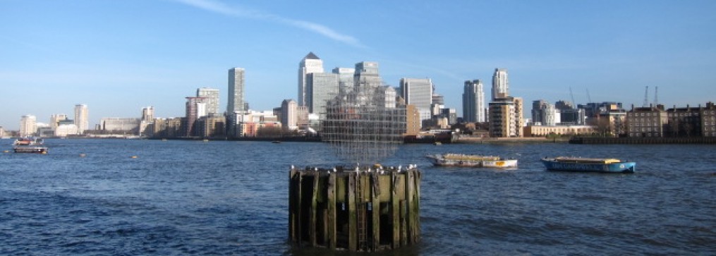
The town has a very interesting maritime history. It was a port from Roman times, and there were once big docks here. In the seventeenth century, it was the scene of several Civil War incidents, and a failed attempt to shoot Cromwell by Lady Wyndham, wife of the royalist colonel holding the town. She hit his aide instead. Thirty or so years later, James, Duke of Monmouth, illegitimate son of Charles II, was proclaimed king in the town. The failure of his claim led to the battle of Sedgemoor and the Bloody Assizes.
The loss of the railway station under the Beeching cuts reduced the use of the docks, and further damage was done by the collapse of the canal wall in 2011. The town is now rather faded.
Got to hotel to find a young woman doing some very complicated organisation with the receptionist over several rooms. She mentioned doing a show later. I pricked up my ears – a bit of stand up might be just the thing, but then she said it was burlesque. And thought maybe I might not like it. I replied that I did not think I was her target audience. ‘Not at all’, she said, ‘our oldest audience member is 90!’ Hmmmm.
18 miles on the nose. Today was a silver day – thanks to the company. Day rankings

I remember this stretch being rather tedious too, Bridgwater is a long way from the sea and it’s frustrating to have to walk all the way there and back again (though at least there is a decent path most of the way). I did this stretch of coast before the Somerset coast path opened, but it looks like the official route that is now open is almost exactly the route I followed other than they have finally opened up a path over a sluice gate at Brean I believe (it does not seem to be on the map yet), which avoids an unpleasant stretch of road walking. Though at least you still have some good bits to come before you get to all the estuary and mud as you get closer to Bristol (and later Newport). I enjoyed the longs beach at Weston, Brean and Burnham. Also some quite nice scenery at Clevedon, but it’s a back to mud, estuary and some industry after that I’m afraid.
Hi, As you will see when I update the next day, I couldn’t find the mysterious crossing at Brean whIch I have heard about, but was neither on the map, nor signposted. When did you do it?
I did it in 2012. I only heard about the crossing at Brean having opened from another blogger who followed the new Brean Down Way which crosses it. The Brean Down Way does not seem to be on maps yet, but there is a map on the website which shows the route : https://betterbybike.info/rides/brean-down-way
It’s probably a bit late for you now – but it’s near the town rather than Brean Down if that helps. I did walk up to it in the hope I could cross, but it was all barriered off then.
Ah yes – I did find it. I was mixing up the days in my mind. The missing crossing is the River Ax.