Day 25 – 21 July 2013 Weymouth & Portland

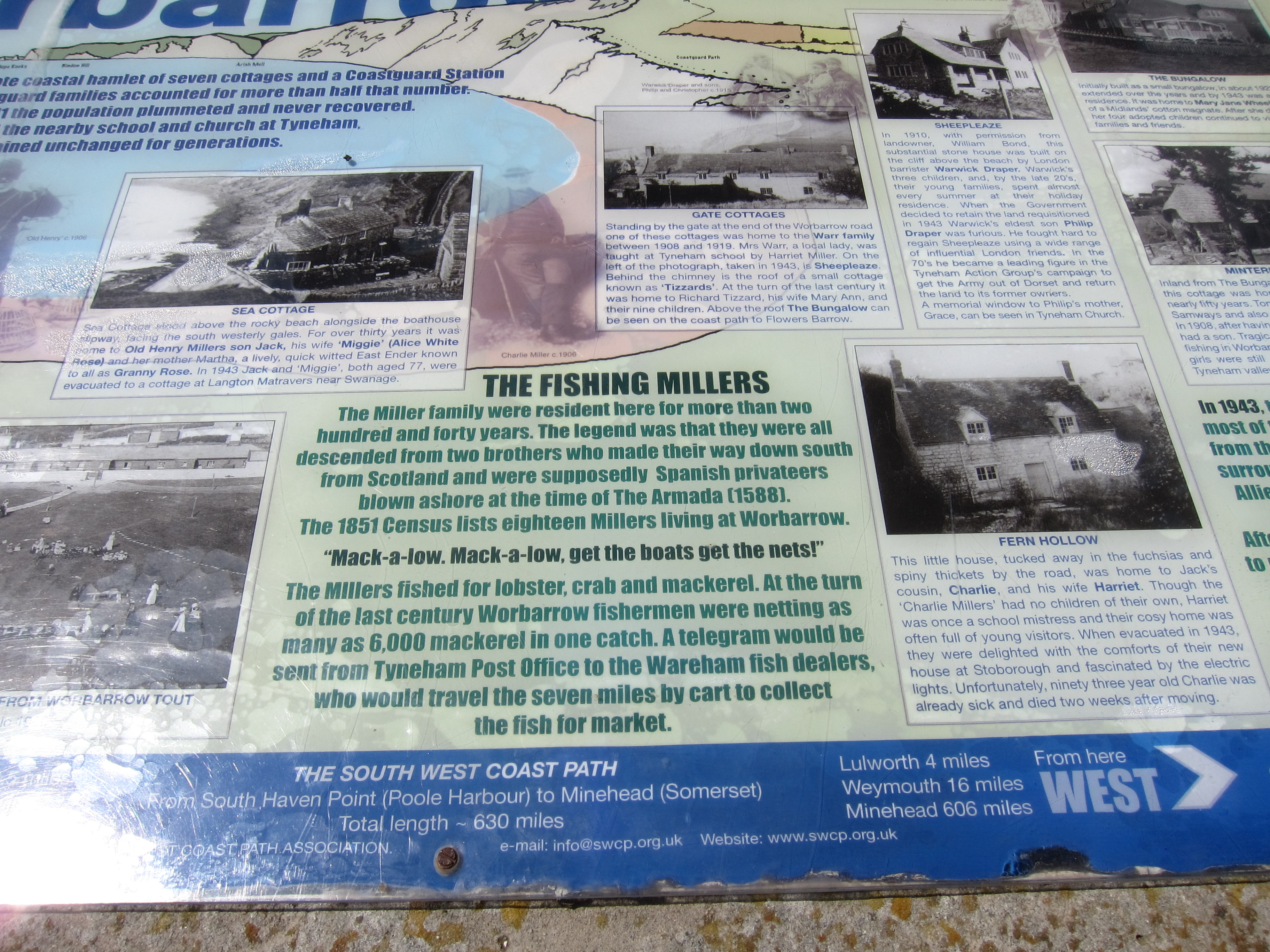
After the delights of yesterday, today was distinctly less picturesque and was also rather frustrating as the South West Coast Path as marked on the map bears no resemblance to the marked path on the ground.  I spent a good deal of time trying to find my way and having to back track as I reached dead ends. I met a fellow walker who informed me that the council has changed the route significantly – at least I haven’t lost all map reading skills overnight!IMG_4265

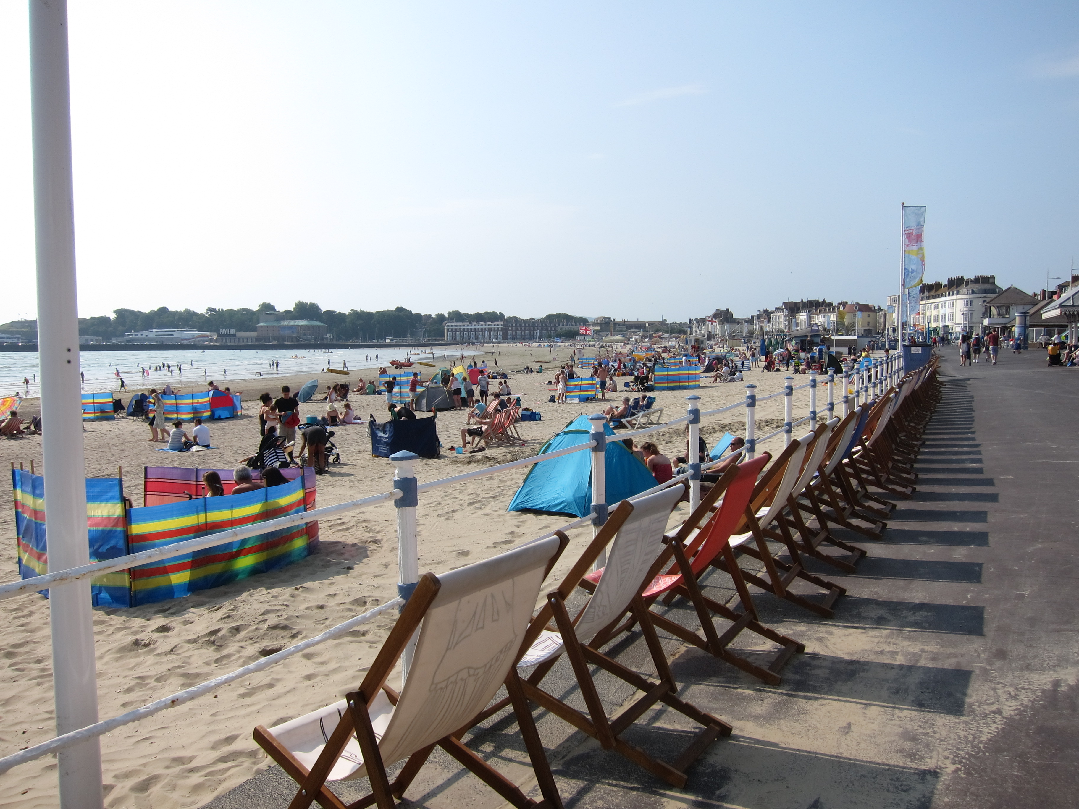
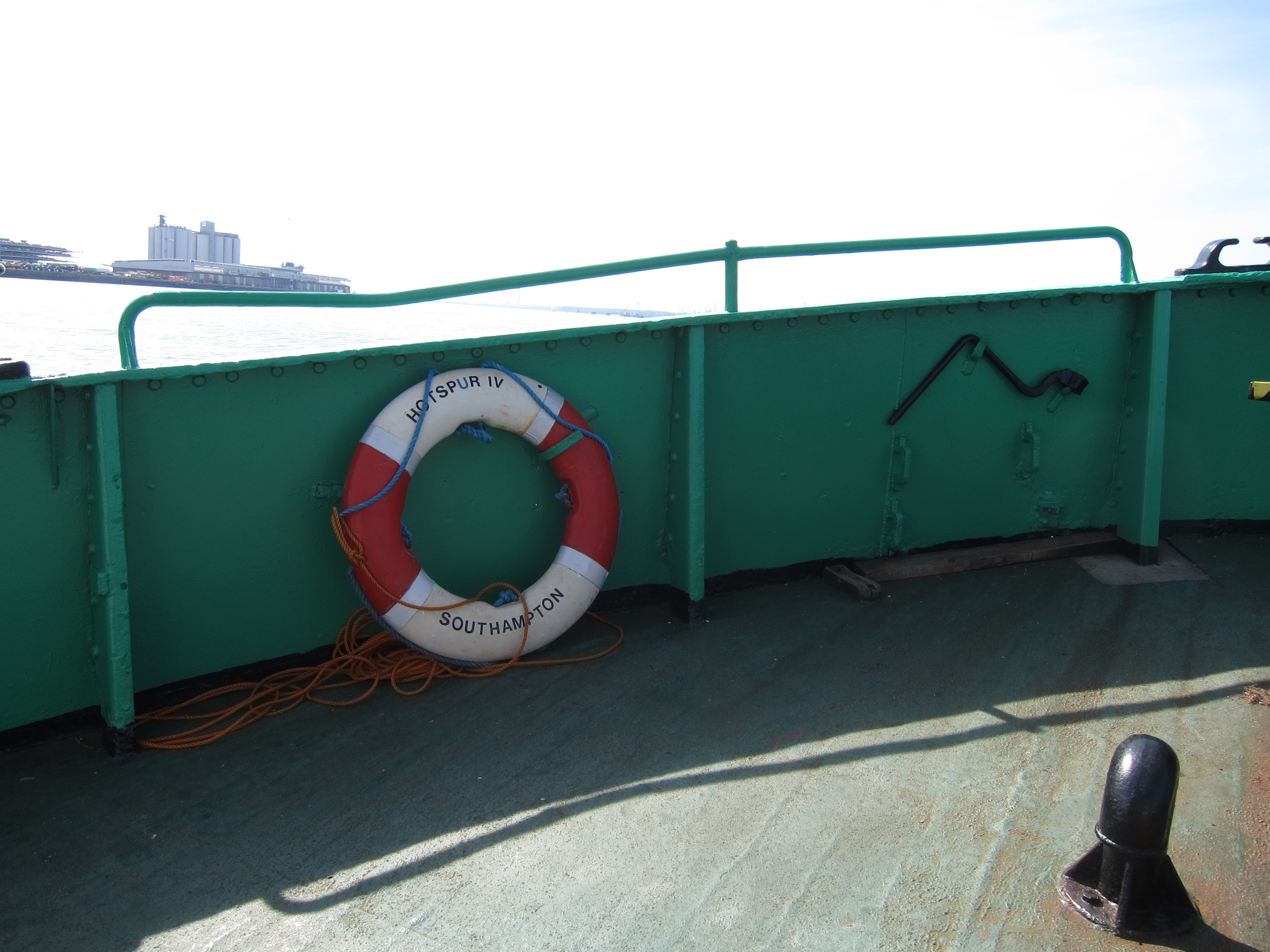
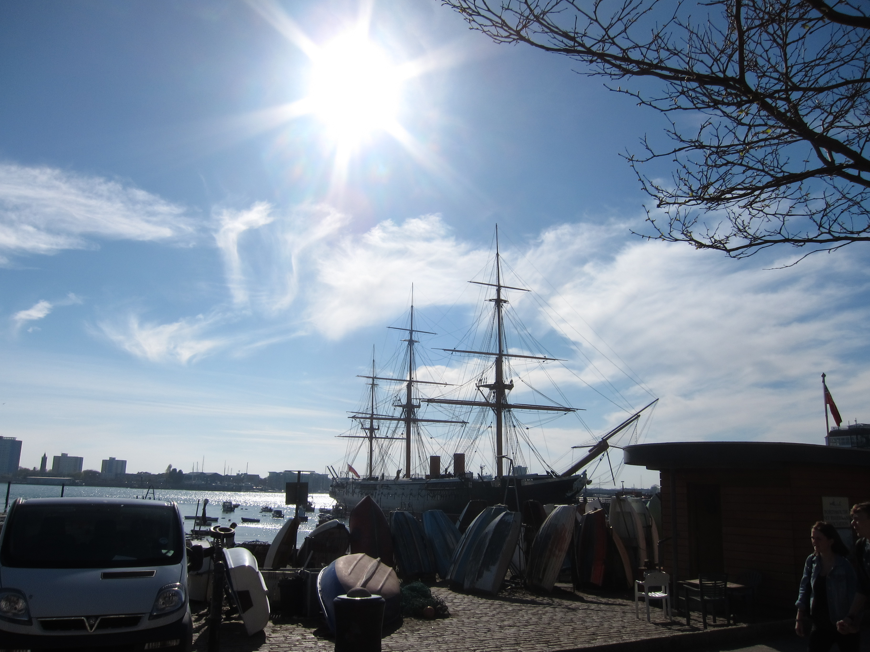
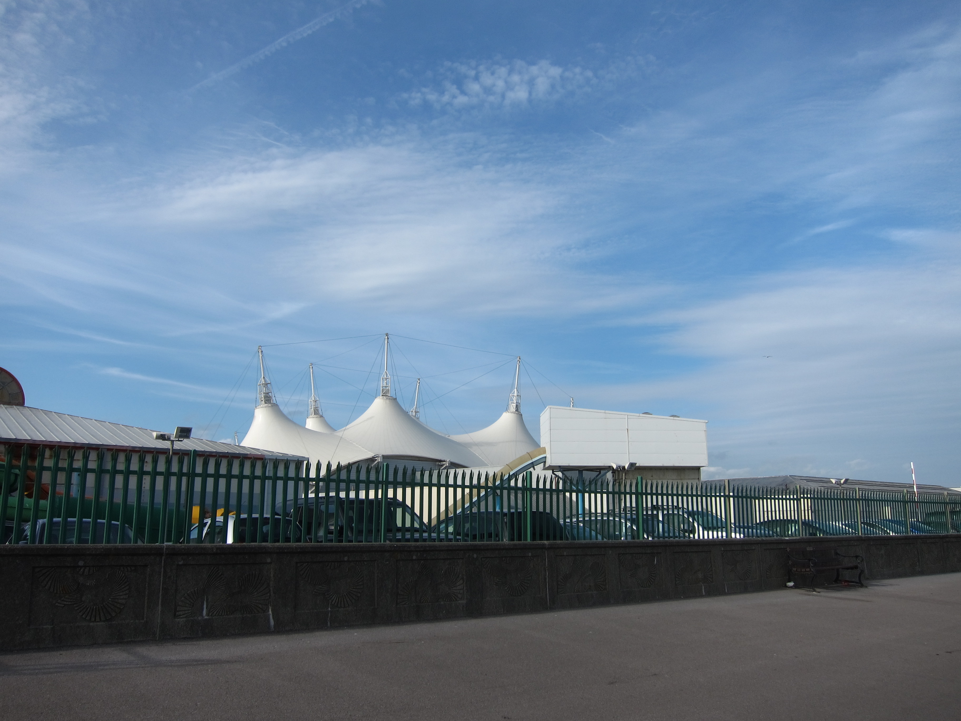
I drove to Weymouth and parked behind the station – there were already hundreds of people out, preparing for a day at the beach – children, prams, dogs, buckets and spades, beer coolers, parasols, towels, grandmas and bats and balls all crowding their way to the front.  The town beach is beautifully sandy, unlike the shingly north end, but I resisted the temptation to paddle immediately and instead made for the old harbour.  I crossed the harbour in a little rowing boat that plies back and forth for a pound – another form of transport ticked off! IMG_4273 
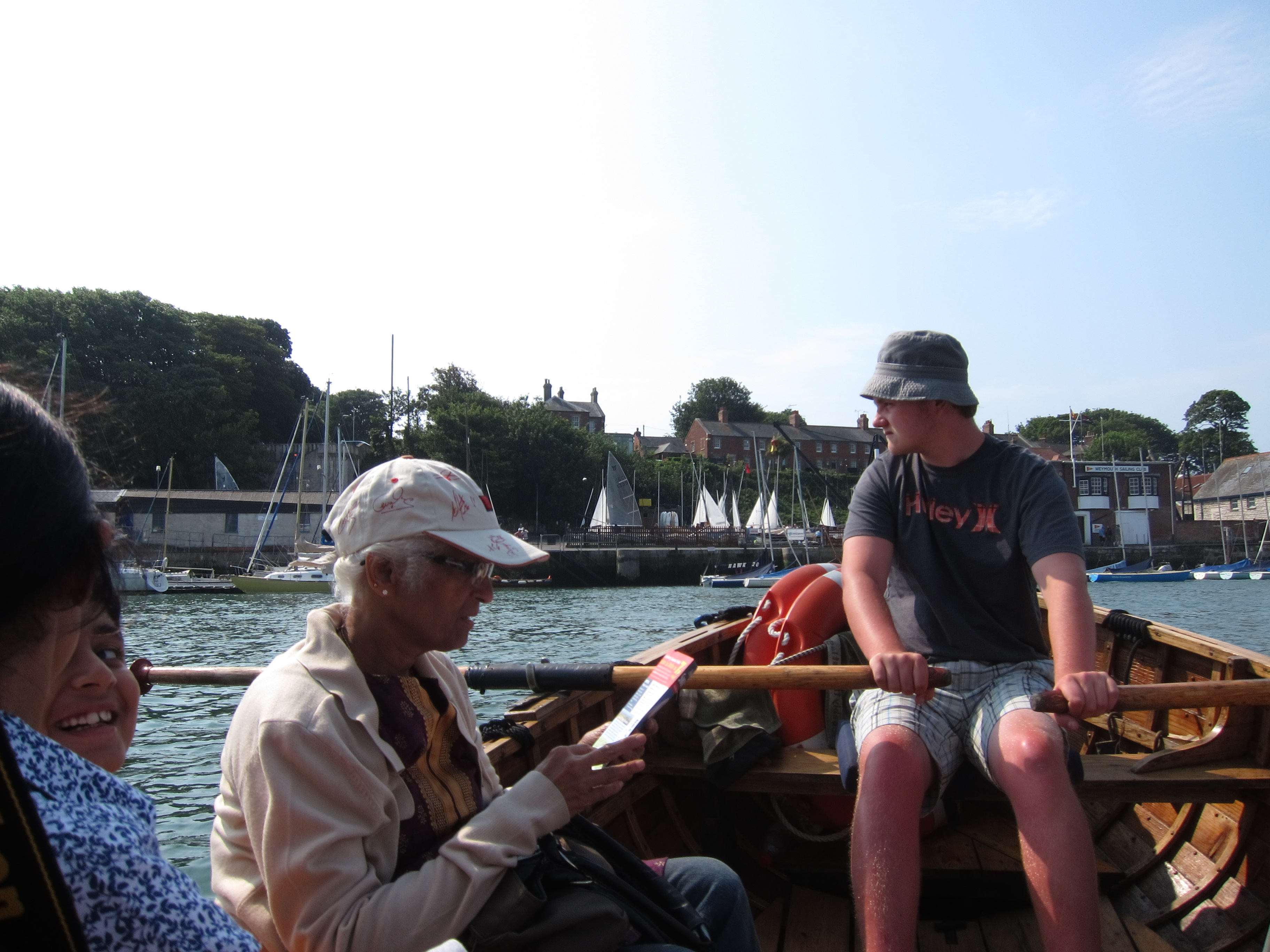
On the south side of the harbour are the rather attractive Nothe gardens, planted in a semi-tropical style, with South African and Australian plants, overlooking the enclosed harbour.

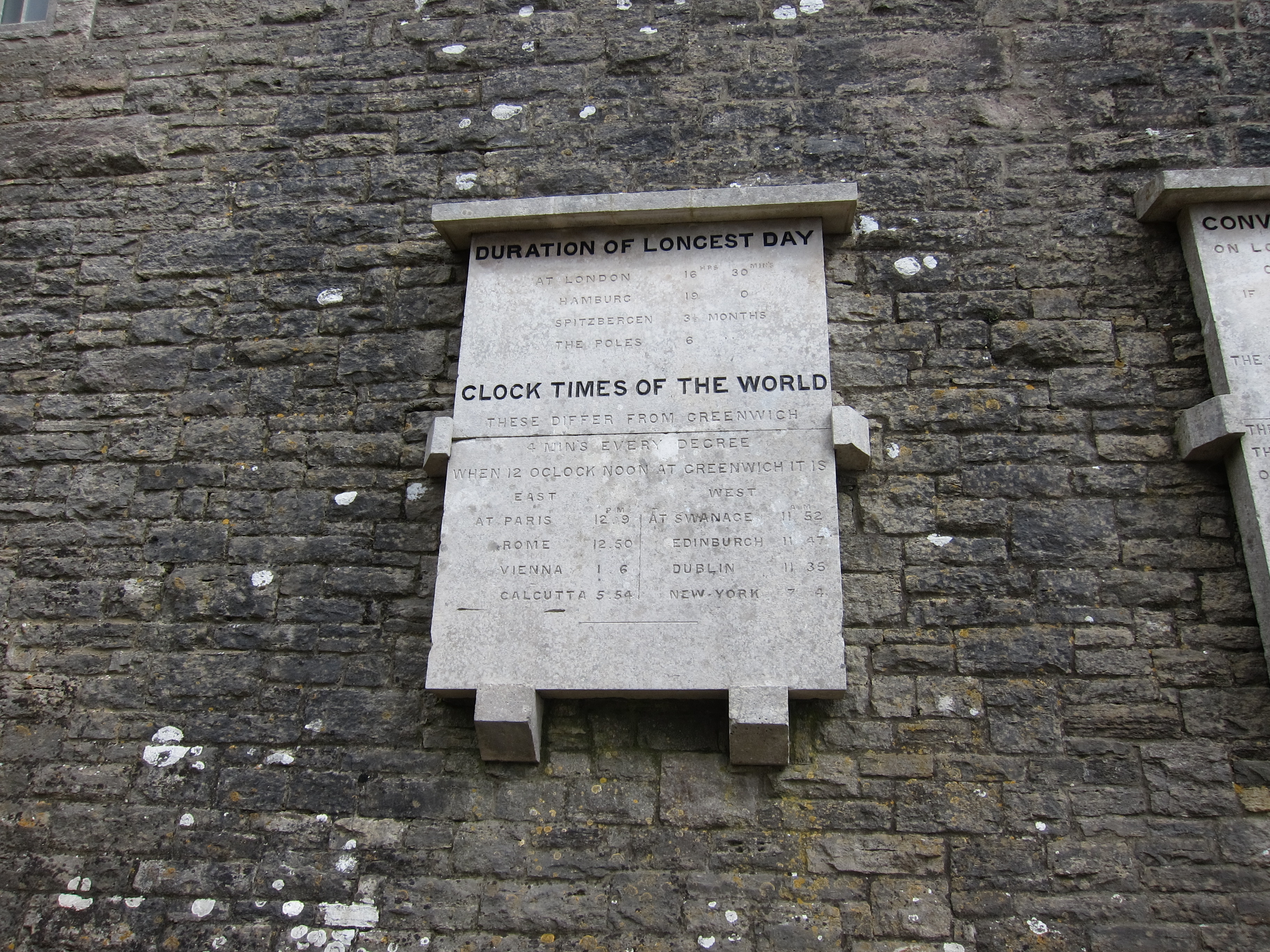
Weymouth has a fascinating history – in its early days it held a wool staple, until that was transferred to Poole after French marauding.  It was created as a Borough in 1571 combined of Weymouth and Melcombe Regis, the latter (the modern town centre) apparently being the place where the Black Death first arrived in Britain in 1348.  Subsequently, Sir Christopher Wren was its MP, and it became a hot tourist town after King George III began to patronise it.  For Jane Austen fans, it is the town where Jane Fairfax was rescued from certain death (according to Miss Bates) by Mr Dixon grabbing her sash when she nearly fell out of a boat.  The town remained an important naval base and saw the testing of the bouncing bombs in the last war.

The path continues to the tip of the mainland, and the Isle of Portland lies ahead – I was in two minds as to whether Portland counts as the coast, but decided, since it is firmly anchored by the north end of the 18 mile long Chesil beach that it should be included.  Crossing the 1.5 miles of causeway onto the island beside a busy road was very dull.  IMG_4279
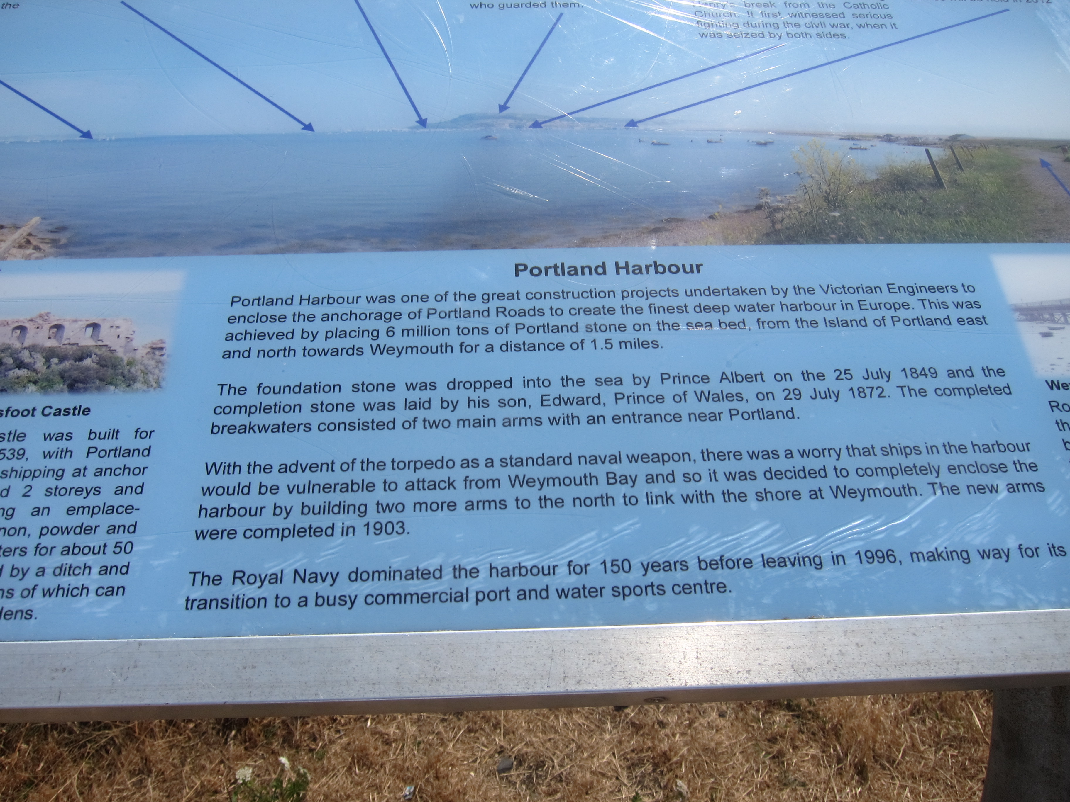
The path then winds (in fact, though not on the map) through the National Sailing Academy – interesting as this is where the Olympic boating events were held last year – to Portland Castle, another of Henry VIII’s castles. I am amazed at the number of fortifications he built – Deal, Dover, Portsmouth, Sandsfoot, Portland etc., largely funded by the wealth bagged from the Dissolution of the Monasteries.  Prior to the Reformation, the peasants paid the Monks to protect them from hell, and after the Reformation, they paid the King to protect them from the French – no doubt both causes have merit!

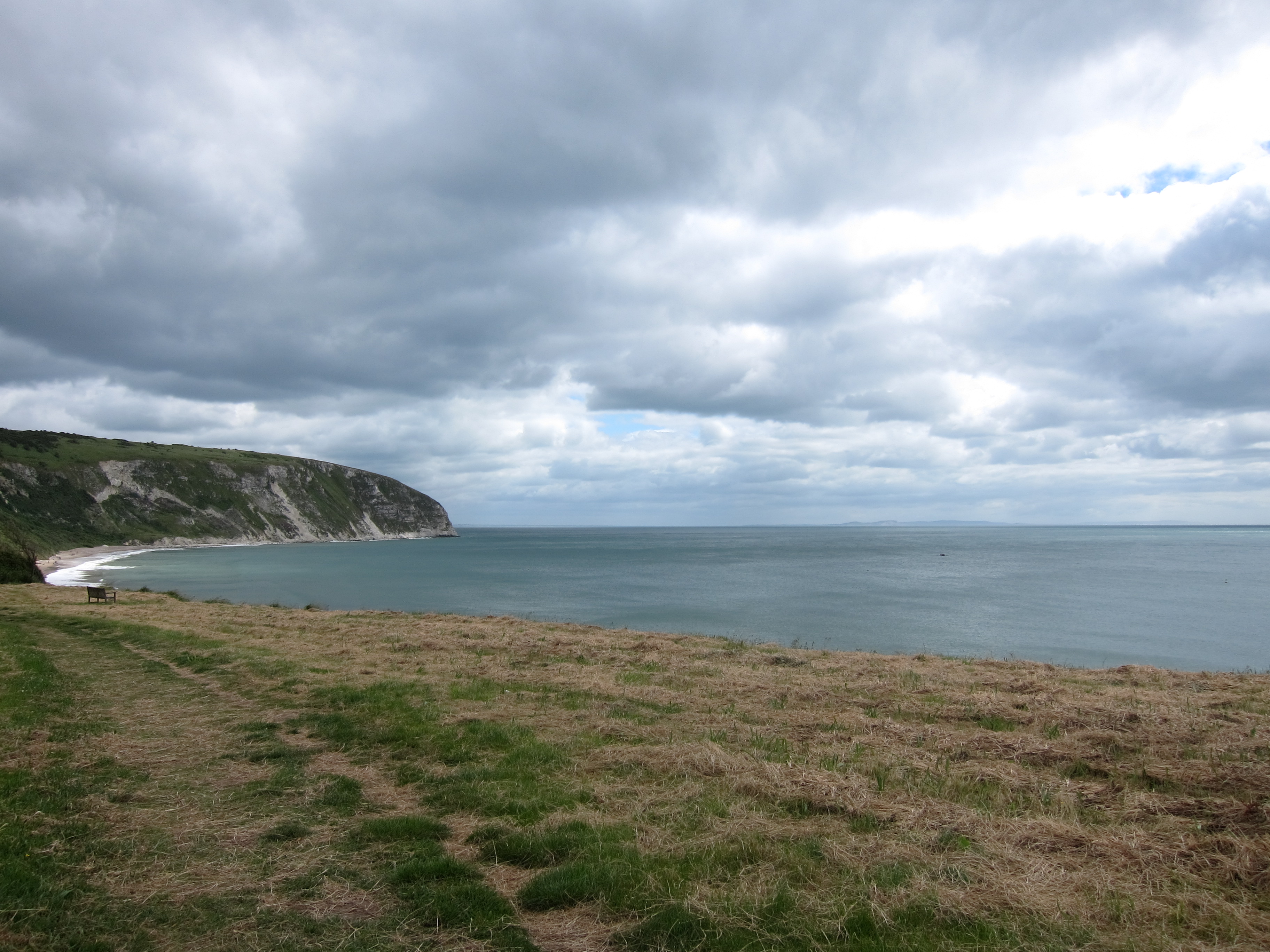
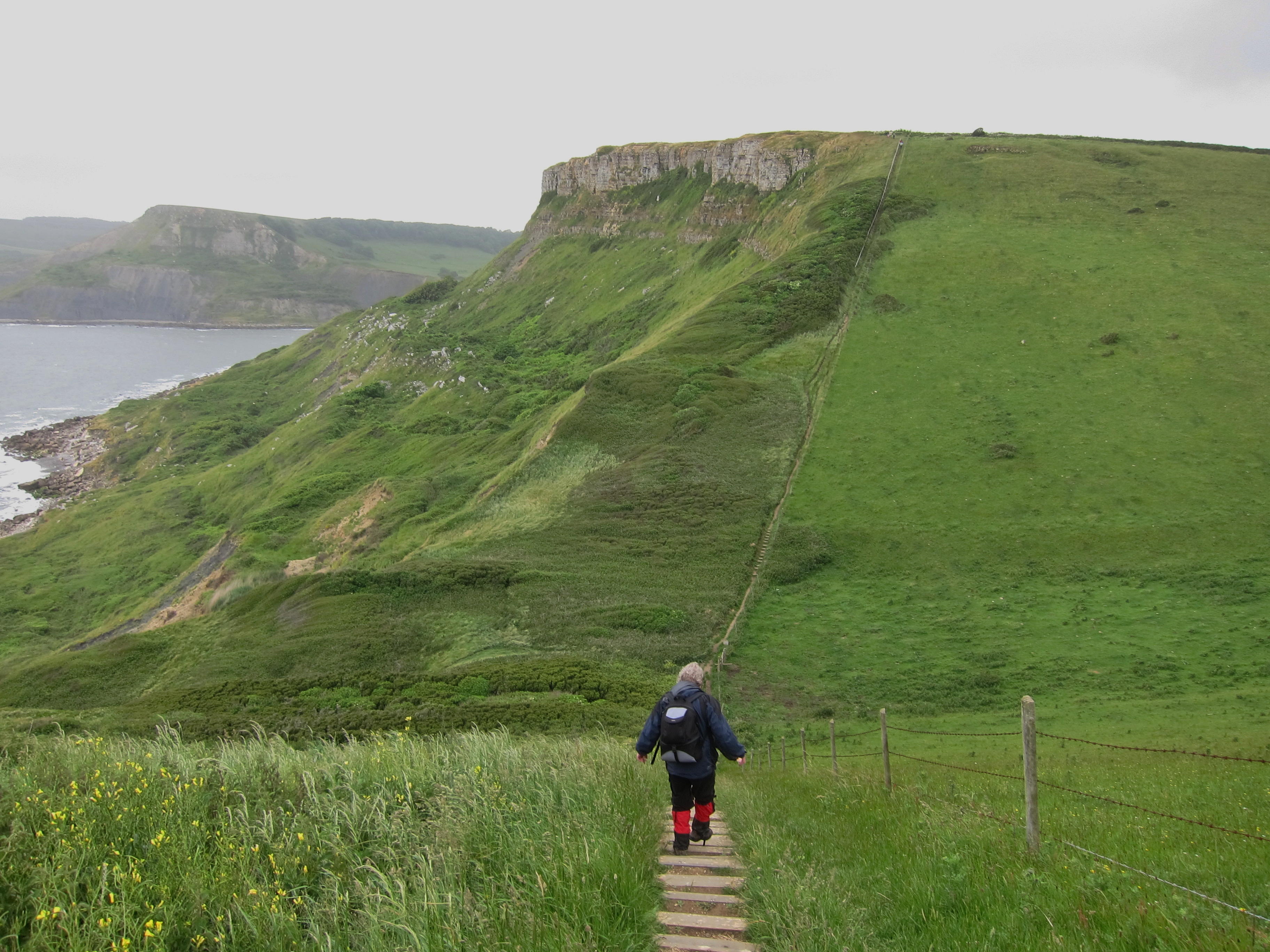
Eventually, there is a steep climb up to the cliffs, then along, past another battery and along the boundary fence of HM Young Offenders Institution.  I suppose there are worse places to be banged up than overlooking the Channel.

On the east side of the island where the cliffs are steep with a lower, rocky plateau, covered with valerian, are lots of areas where people were practising climbing – the porous limestone was covered with ropes and pulleys and little swinging figures. IMG_4301

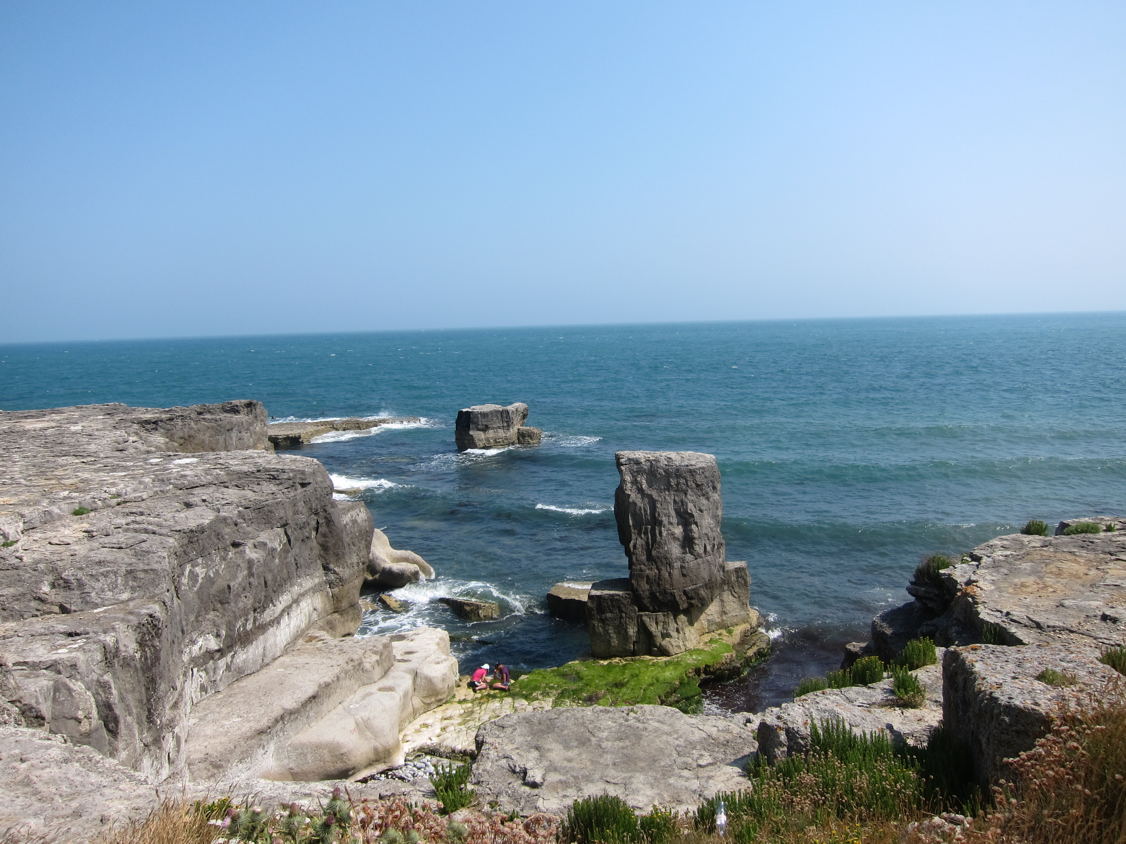
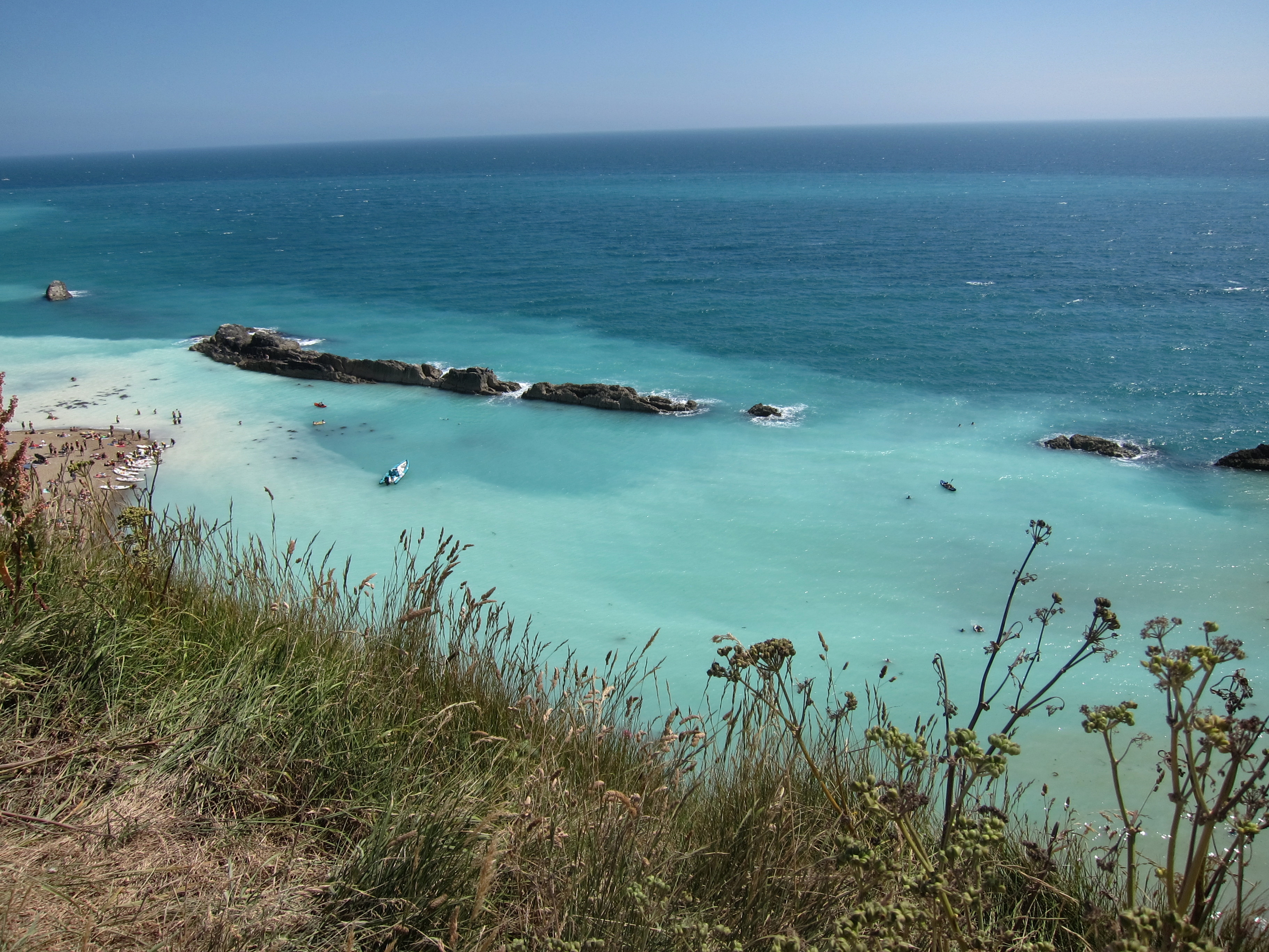
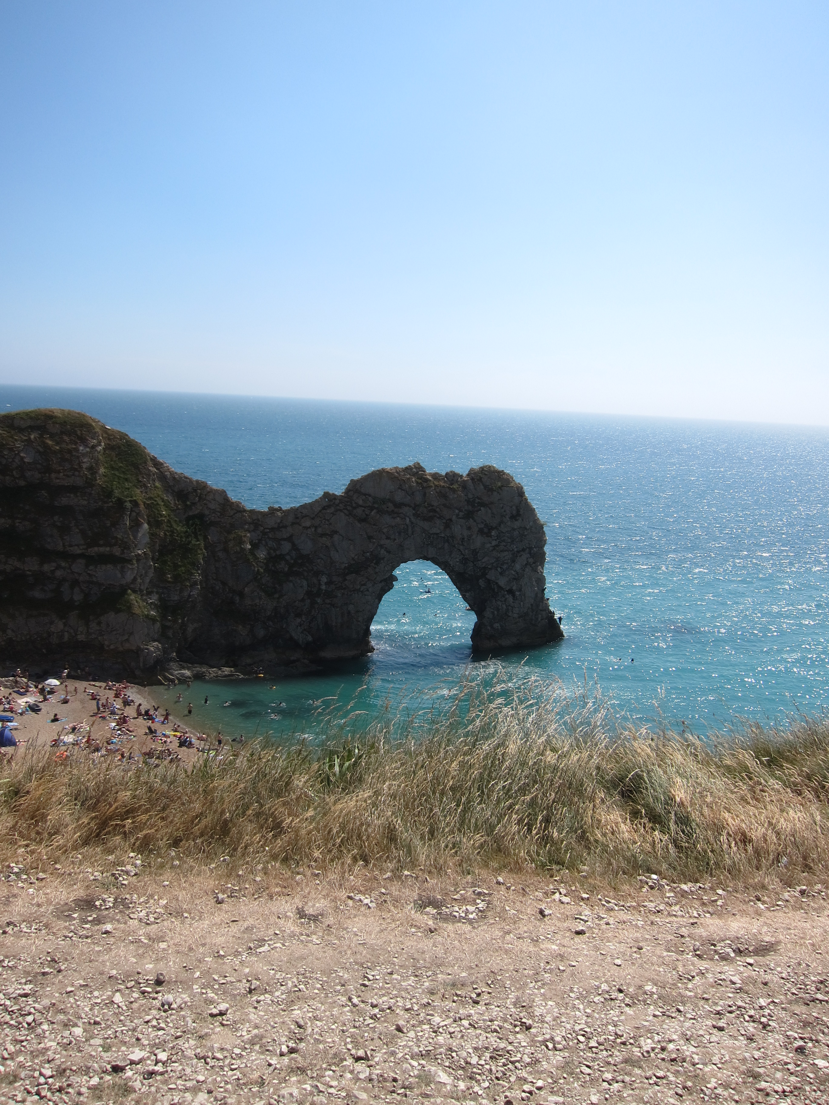
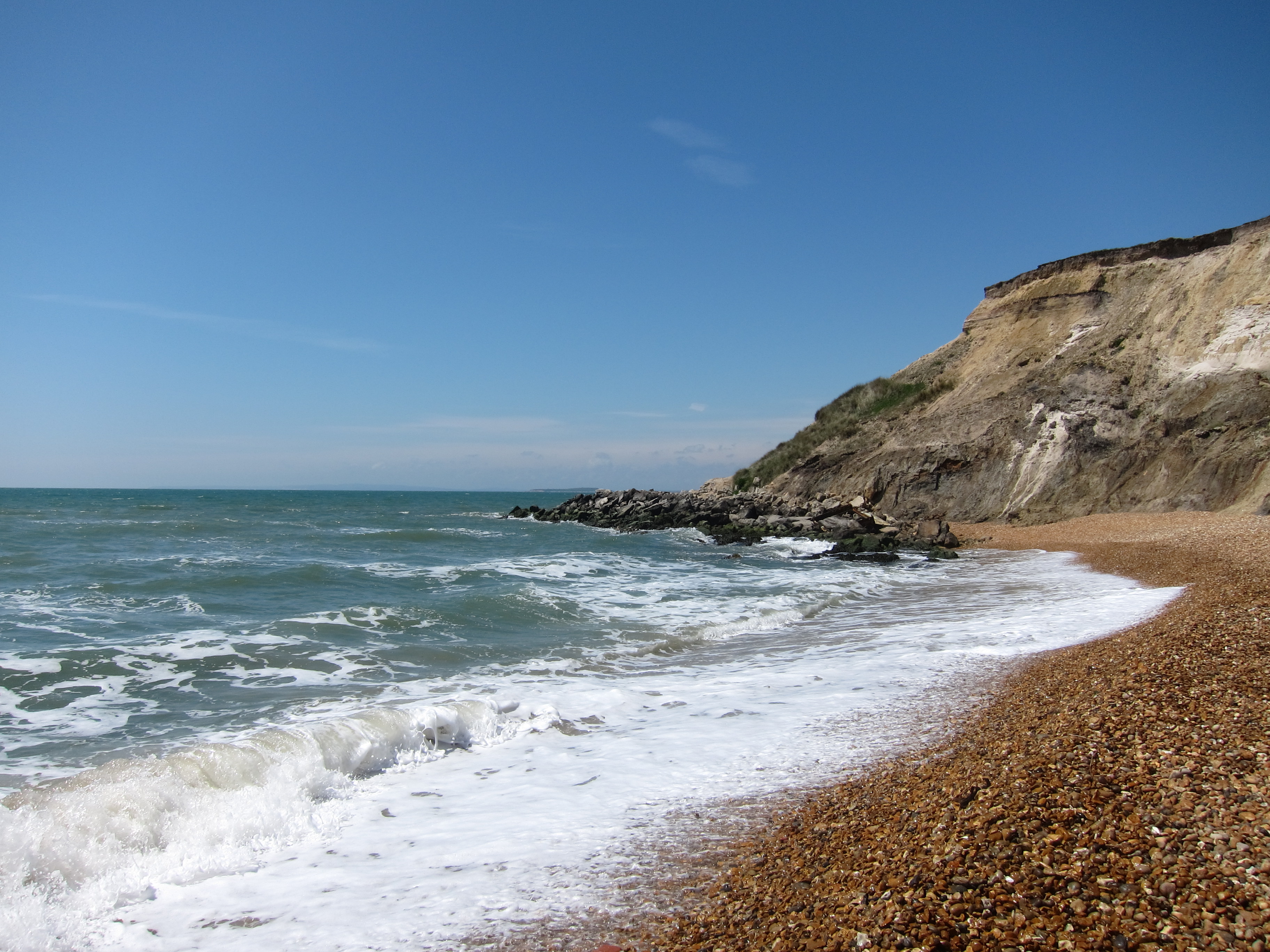
The path is uneventful round to the light house at Portland Bill, where I had a delightful Dorset cream tea. IMG_4306 
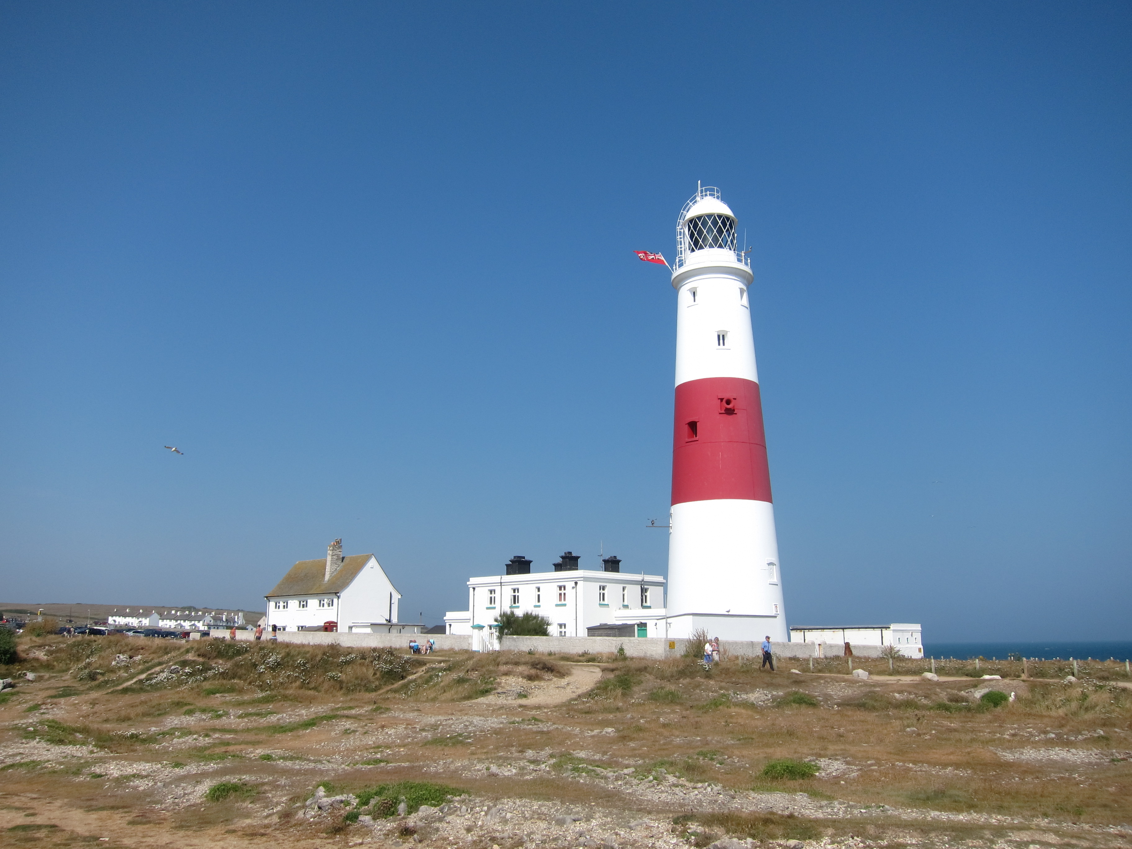
Rounding the headland, I carried on along the West side in the afternoon sunshine – with fabulous views of Chesil Beach. IMG_4316 
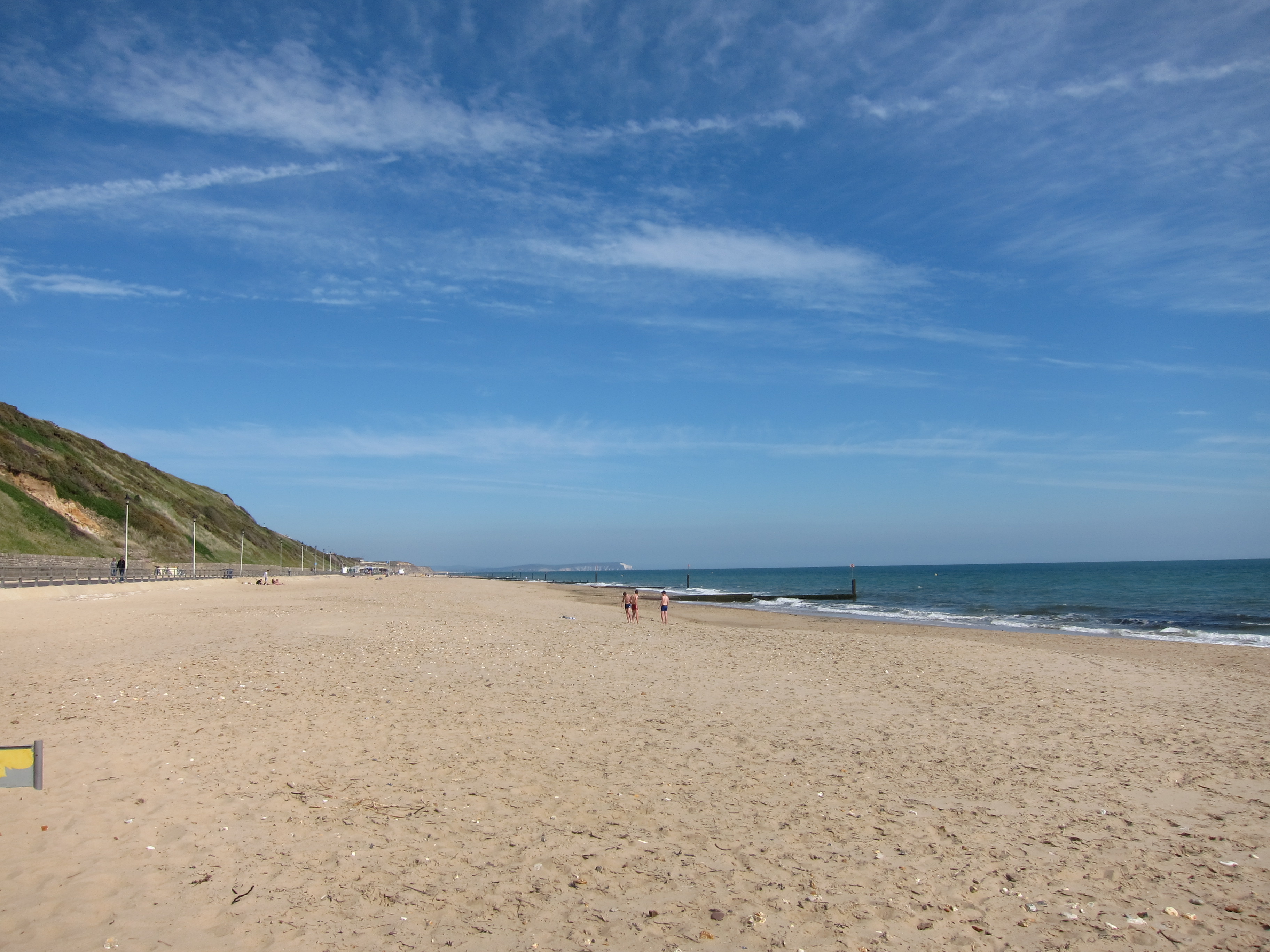
I arrived back in Weymouth around six and went for a delicious paddle to cool my tired feet.  The water was warm but felt strangely thick – presumably from the chalk which seemed to be in the water, being deposited on the sand as a gloopy white mass. I also received my first donation for Guide Dogs for the Blind – £6.30.  Very pleasing.

Day 24 21 July 2013 Kingston to Weymouth

I arrived last night at about 8ish, just in time to walk down to the Scott Arms in Kingston – the view is marvellous – overlooking Corfe Castle, the food is reasonably good (I had some very jumbo Jumbo Prawns), but the service is not brilliant.  I think the young lad is still washing the same pile of dishes as he was toying with last month when we called in for a drink after our diversion up from Chapman’s Pool.  The coast path is still closed because of landslides so I followed the diversion out of Kingston towards Kimmeridge.  Kingston is so improbably pretty that even a chocolate box might be embarrassed to sport a picture of it on the lid.IMG_4153

Today is easily the most spectacular so far.  The weather has been superb – at least 28 degrees all day with barely a cloud in the sky.  The colour of the water was so vividly turquoise it was difficult to believe it was the English Channel, not the Mediterranean.  The cliffs are a brilliant white, and oh, so steep!  The path climbs up, then drops steeply over and over again, for some 20 miles.  I can imagine it was an absolute haven for smugglers with tiny coves hidden between steep cliffs.IMG_4188

There were droves of people at Kimmeridge, and then further on at Lulworth Cove and Durdle Door.  The sun had brought out a wide expanse of flesh –a Tattoo Parlour’s Style book on the move.

One person I encountered was a complete mystery.   I have to say “person” as I am not sure of the gender.  I first saw what I took to be a woman coming towards me at Kimmeridge.  She had the musculature of a fell walker, but even more extreme, with every sinew showing.  Unlike everyone else she hadn’t a word of greeting, just a grim expression on her face as she raced along.  An hour or so later as I was toiling up the worst slope of the day at WoRbarrow, she passed me going up – from the rear, I decided it was actually a man.  I assumed he/she was doing a round trip to Kimmeridge, but then a couple of hours later, I ran into him again, moving back east a ridiculous pace, still with the same fixed expression.  Very odd.

As I walked along, I was amazed at the quantities of butterflies – clouds of them – peacocks, tortoiseshells and those white ones that look as though they have been embroidered all over with black thread.  I have never seen so many.  In the distance, I could see Portland Bill.

I passed Tyneham- a village that was requisitioned during the war by the army, and which has never been relinquished.  I did not make the detour to the village from WoRbarrow Cove but could see the houses from the cliff top.IMG_4202

On past Lulworth and Durdle Door, then down into the delightfully named Scratchy Bottom, before another haul up to Swyre Head.  IMG_4229Down again to Middle Bottom, then up to West Bottom, after which it became less vertiginous, but still drops fairly sharply to Ringstead.  IMG_4233IMG_4244Just after Ringstead I came to the Smugglers’ Inn – an absolutely gorgeous pub with an excellent garden and a very traditional pub menu – no pan-fried yam root drizzled with balsamic vinegar from Timbuctoo here – just excellent pie and mashed potatoes and very nice looking burgers.

I decided to stop for late lunch/early supper, before strollling the final 4.5 miles into Weymouth in the evening light.  I had considered paddling at the end, but, disappointingly, Weymouth beach is another shingle beach.

A very good day – 22.5 miles in total.  Probably the hardest day with all the undulations, but definitely the most rewarding.

Day 23 23 June 2013 Swanage to Bournemouth

I am afraid I went backwards today!  Racked by guilt at having done the Swanage bit before finishing Bournemouth, I was keen to get out early.  The logical thing, given car complications was to start in Swanage and go east.  Jane and I set out at about 10.30am.  The first leg was a steep drop and then up again onto the headland which leads out to the Needles.  The cliffs were quite different from yesterday – less wooded and flatter.IMG_4124IMG_4115

It was a beautiful day and there were plenty of other people on the walk.  From the headland, we could see all the way down to Studland, Poole Harbour and Southampton.  It seemed odd to be walking with sea on my right and the sun behind me.IMG_4122

We came down from the cliffs and reached the beach at Studland around 11.30.  From there, it was 3 miles or so of beach – trying to keep to the firm sand at the water’s edge, rather than the soft sand which is difficult for walking. IMG_4134The sand was much paler than that at Bournemouth, which is quite golden.  We crossed Poole Harbour on the incredibly noisy chain link ferry, and then continued along Sandbanks and Bournemouth beach before heading back up to the station.  The houses overlooking the sea at Sandbanks are very grand – apparently extremely expensive too, but I preferred Swanage.  It was an uneventful day – I am quite blasé about naturists now and took the naturist beach completely in my stride.   Having felt yesterday as though I were finally in the south west, I felt right back in a semi-urban world again – very keen to start travelling west again – in the right order and direction!

Day 22 22 June 2013 Swanage to Kingston

I have a confession to make, which will shock the purists amongst you.  I have done today’s walk out of order!

The original plan was to go back to Bournemouth on the train and walk to Swanage, but as I was showing the maps to Liz, Jane and Vicki, my walking companions of old, I let slip that the following section, Swanage to Kimmeridge, would be prettier.  Liz suggested that we do that first, as not all of them will want to walk tomorrow.  There was a stunned silence as the others saw my horrified face – walk out of turn?  How could I possibly do that?  My whole scheme would go to pot! However, after I had had a snort (or two) of brandy and been patted on the back I thought about it and decided that I need to get grip on these OCD tendencies before I turn into one of thosIMG_4064e people who constantly wash their hands and run home to check if they have left the gas on.  I took a deep breath and agreed.  In return, I bargained for setting off at 9am.

We are staying in a very nice hotel, The Pines, above Swanage which gives straight onto the South West Coast path.  We meandered through the town, stopping to chuckle at the Punch & Judy booth and admire the boats bobbing on the fairly stiff waves.  The sun had come out after a very wet night, but the wind was still fierce.  Just out of Swanage is Peverill Head.  A wonderful vantage point from which the needles at Studland, and the sweep of the whole bay is visible with the various headlands stretching west also visible.  This was followed by Durlston Point where there are all sorts of informative displays about the development of the earth and the time and tides although we were flummoxed by the information on the convexity of the earth.IMG_4078

The wild flowers were an absolute delight – valerian, thrift, buttercups and yarrow everywhere.  We travelled gently along, stopping for photos and to admire the view.  A fellow walker pointed out some puffins bobbing on the waves, but I could not see them.

There were traces of Purbeck marble quarrying everywhere, with old mine adits and scary caves with narrow columns that did not seem strong enough to support the cliffs above them.  To say the walk was undulaIMG_4087ting would not do it justice.  We passed the light house at Durston and the Coast watch at St Aldhelm’s Head, but did not stop to look in the chapel (Vicki and I having been their previously on our one and only attempt at camping – my psyche still bears the scars.) There are a couple of ridiculously steep drops down with almost vertical climbs back up that had the wind whistling through our lungs.  The countryside is superb, with beautiful Purbeck stone dry walls and pretty farm houses.  Even the cows were picturesque Jersey rather than grumpy Friesians.IMG_4104

After an unintended detour to Chapman’s Pool, we got back on the path, only to find that it was closed between that point and Kimmeridge.  Some young lads had walked it, despite the signs, but told us that the route was very narrow in parts.  Vicki and I have  no head for heights, and with us all having form for getting lost on mountainsides, we decided on discretion and walked up to Kingston, where we found a delightful pub (though the service was a little slow) and had puddings overlooking Corfe Castle.

The Isle of Purbeck feels completely different from any of the previous places I have been.  The countryside is more rolling and wooded and the architecture is gorgeous: houses of white Purbeck stone nestled into the valleys.  I feel like I am in a quite different part of the country from Bournemouth, even though it is the same county.  This feels like the South-West, rather than the South.

See review for dinner recommendation.

Day 21 27 May 2013 Lymington to Bournemouth

IMG_3916Made really good time today, and exceeded my plan for the weekend.  Woke early after a very poor night’s sleep again.  The hotel is by traffic lights on a busy secondary road, so all of the lorries heading for the port stop outside and the noise of them starting up is constant.  I drove to Brockenhurst and left the car there, taking the train back down to Lymington where I had an indifferent breakfast in one of those places where the customers are clearly there just to clutter the place up – signs saying don’t do this and don’t do that everywhere.

Started walking around 8.50 and was almost immediately back on the coast.  The walk broke down into three parts.  The first was the easy, flat walk from Lymington to Kesthaven, first through the marina then over the raised sea walls which surround the old salt works.  Apparently, up until the 1850s, salt was a major production of the area.  The sea water was trapped by sluices, then allowed to evaporate partially before the brine was pumped up and then dried out further.  The railways brought cheap rock salt from Cheshire and negated the need for sea salt.  The area is now a conservation and wild life reserve.  I did very well with recognising new birds and spotted a shelduck and a white throat as well as the oyster-catchers coots, gulls and egrets I have previously seen.  I also saw marsh marigolds in the wild for the first time. IMG_3920

I raced along and arrived in Kesthaven before 11am, then another half hour down to the spit leading out to Hurst Castle.  The Needles off the Isle of Wight were clearly visible.

The second part of the walk was along the shingle from Milford on Sea (the end of the Solent Way) to the ferry at Mudebank.  The shingle is very hard going, lots of undulations and it sinks underfoot.  The cliffs have now turned a beautiful golden colour, and I was surprised, assuming this is sandstone, that the beach is still all stone.  IMG_3966After Milford the shore was pretty quiet – at one point I was faced with either climbing over a rock fall or walking round through very choppy waters.  I sat and contemplated it for a while, hoping that the tide would reveal more room to walk round, but after about 10 minutes it didn’t seem to be receding at all (although I knew from the tide tables that it should have begun to go out.)  A walker from the opposite direction said the stone fall was fine, but, in the end, I tucked my map and camera in my rucksack, took off my boots and waded through.  It was not especially cold, but quite rough and painful underfoot. I came out wet well above my knees, but the sun was shining and I soon dried out.   The seclusion of the beach was obviously welcome to another few Naturists, the real thing this time, clad only in shoes – you’d be mad to walk on the shingle without.  I hope they had plenty of sun tan lotion on – the sun was fierce!

Up over another rock pile – easier this time, onto a populated beach below Christchurch.  I marched along briskly, heading for the ferry at Mudeford across the The Run – the entrance to Christchurch Harbour.  Just down by the ferry port there were literally dozens of people with their picnic chairs on the tarmac – don’t ask me why they didn’t walk a 100 yards to the beach!  There were lots of people crabbing and an interesting pile of lobster pots.

A ferry was arriving just as I did, and it cost me the princely sum of £1.30 to cross to Hengistbury Head and the delights, for the first time of a sandy beach! I took my boots off and danced along!  IMG_3995In this third section of the day the sandy beach reaches around to the location of the Iron Age fort that was, according to the signs, the most important port in pre-Roman Britain.  Eventually, I reached Bournemouth and took the steep staircase up to the town, to catch the train back to Brockenhurst.

An excellent weekend – 60 miles with glorious weather.

Day 20 26 May 2013 Southampton to Lymington

Today was a red-letter day – the first day out when I left my waterproof behind: and my faith was justified.  It has been a glorious early summer day.  I burnt my left arm yesterday so still had to wear long sleeves, but it was lovely not to cart the anorak around.

I had checked the ferry times, and since the first sailing on a Sunday is at 10am I had a leisurely walk down to the Town Quay, passing the interesting ruins of Holy Rood church – another victim of the wholesale bombing of the city in 1940-42 and now a memorial to all sailors.  There is also an interesting pair of plaques commemorating some 22 men and boys who perished attempting to extinguish a huge conflagration in the city in 1837.

The Hythe ferry (fare £4.50) takes some 12 minutes to cross Southampton Water – a tiny craft surrounded by the enormous cruise ships.  The Queen Elizabeth was in, looking like an oversized city block.   Yesterday, I saw the Queen Mary floating out on the evening tide.

The ferry had several interesting passengers I enjoyed chatting to.  We were on the Hotspur IV, built in Colchester and launched in 1946. IMG_3810 On the Hythe end, the ferry docks at the end of the pier – 700 yards long and the 7th longest in the UK.  A little pier train runs up and down, marvellous fun!IMG_3816

Hythe is more pleased with itself than is really warranted, so I walked through fairly briskly.  Because of the huge oil refinery at Fawley, the Solent Way goes inland at this point.  I could have walked along roads down to the sea but decided to follow the path and see a bit of the New Forest.  The way crosses Beaulieu Heath – a mixture of pines and gorse on fairly marshy ground with various cows and horses dawdling over it.  The path then runs into Beaulieu – beautifully kept, but everything clearly still owned by the Lords Montague.  All of the houses had the little coat of arms of three diamonds (I don’t know the heraldic term) on plaques by the front door.  No doubt the rent is paid by going up to the Big House on Lady Day and handing over the pennies whilst tugging your forelock or curtseying.IMG_3880

A very fine ice cream was had in The Chocolate Studio on the high street.

The path runs along the River Beaulieu to Bucklers Hard, through delightful woodland and managed grassland.  Bucklers Hard was full of families enjoying the day out.  More estate workers’ cottages, looking picturesque – one was turned into a tiny chapel in the 1850s and still holds Sunday services.  After Bucklers Hard, the way continues for several miles along the lanes – pretty enough, but hard on the feet.  The ruins of St Leonard’s Grange were a high point.  As the path approaches Lymington, the sea can be seen again, about a mile to the south, with the Isle of Wight looking close enough to touch.  The walk then crosses fields on the outskirts of the town.  Having had a run in with Bluebell, Daisy and Buttercup on the Coast-to-Coast walk a few years ago, I am rather more chary of cows than I used to be, so was not thrilled to see a warning against a bull. IMG_3903 Happily, I arrived unscathed in Lymington around 5.15 – a shorter day than yesterday at only just over 18 miles.  I had plenty of time for an excellent supper (see review) before taking the train back from Lymington Pier to Southampton – very handy.

Day 19 25 May 2013 Portsmouth Harbour to Southampton

Today was my longest day to date – 22 miles (including about a half mile to get to the station.)  Fortunately, it was a superb day for walking, which was a surprise as, when I dropped my sister off yesterday, en route to Southampton, it was freezing and wet.  I got to my hotel at just about 9pm last night, on the north side of the city centre.  First impressions made me homesick for the classy Hotel Salubrious back in Cliftonville – there was a live banjo evening in full swing when I arrived and my room was right over the bar.  However, I have been pleasantly surprised – they made me supper, although it was 9.05pm, the room was clean and I even have fresh towels today.  The staff couldn’t be more helpful.

Because the place was a-jumpin’ and a-jivin’ until late, I didn’t get the early night I had planned so missed getting the 8.05 fast train back to Portsmouth, however the slow train was very pleasant, stopping at all sorts of interesting little stations, and got me to Portsmouth at about 10am.  I crossed to Gosport on the ferry which was super – an excellent view of the Victory and the Spinnaker. IMG_3649IMG_3642A quick breakfast (see review) then I was off around the edge of the marina, admiring the yachts.  The Solent Way quickly gets back to the sea front at Gilicker Point, another site of special conservation value along the coast.  I spotted white sea campion, lots of thrift, sea kale, and spiral dock.  Still not much good at birds, but today included a heron, a lesser-crested grebe, wagtails and a shoveler duck as well as the usual swans and oyster catchers.

Most of the day was walking on shingle, which is very hard work – I am so looking forward to the sandy beaches in the west!  There were lots of people about enjoying the sun and there were dozens of yachts, water boards, sail boards and those rather interesting things like surfboards, but with the person standing and paddling – I’d like to give that a try.

The Isle of Wight seemed very close, today, I could just about make out buildings.

As I passed Lee-on-Solent I came to a secluded part of the beach which was not exactly a naturist beach, as I understand that Naturists eschew all clothing, but it was not a normal beach either, as generally, people are clothed (to a greater or lesser degree) from the waist down.  These people were fully dressed from the waist up.  It was very – well, I was going to say disconcerting, but, I think discombobulating is a more apt description!.

I reached Warsash about 3.30pm and crossed to Hamble-le-Rice on the little ferry service – 10 minutes on a tiny pink craft for £1.50 – marvellous! IMG_3701 Hamble is rather full of itself – and despite being only 4pm on a sunny Bank Holiday Saturday most of the cafes and bars were no longer serving food, however I did eventually find an excellent spot for a late lunch.  (See review).  Leaving Hamble, I was back onto the shingle, marching on to the amazing ruins of Netley Priory.  A former Cistercian House, it was founded in the 1220s by a bishop of Winchester.  After the dissolution it became a manor house, owned by Sir William Paulet, a big noise from Henry VIII’s days to those of Elizabeth.  It was abandoned in the 18th Century but the ruins are very impressive. IMG_3731 I was getting rather tired now but still had 6 miles to go.  I crossed into Southampton over the Ichenor Bridge.  I assume Southampton suffered extensive bomb damage, as although there are fragments of the old town wall and one of the Bars, the majority of it is one of those hideous concrete 1960s cities – all dirty concrete and underpasses leading nowhere.  I crawled back into the hotel at around 8pm, and am writing this in the bar after an excellent supper and with a very good glass of red in hand.

Day 18 (Again!) 6 May 2013 Southbourne to Portsmouth Harbour

A glitch in my numbering system has been pointed out to me.  This is actually day 18!

In keeping with my decision that river estuaries are not part of the coast, I took a straight line north from the point where I turned inland yesterday, at West WIttering.  This took me to Southbourne, so I left the car there and began walking around 8.30am. The first little village was Prinsted, a picture post card place with thatched cottages and lots of beamed houses.  It is just to the north of Thorney Island.  In the morning light the calm waters of Chichester Harbour showed barely a ripple – it promised to be a glorious day.IMG_3582  I crossed Thorney Island and came into Emsworth, crossing the county boundary into my fourth county – Hampshire.  Emsworth is also a lovely town, with boatyards and little waterways emptying into the Harbour.IMG_3579  I walked along the sea front for quite a few miles – and then decided to have my first proper paddle (not counting the escapade on the Cuckmere!)IMG_3594 The water was chilly but very refreshing on hot feet.  Just by the Hayling Island crossing there is a little settlement with a nature reserve attracting a range of wild fowl.  My bird spotting is improving a bit, but is still not great.  Today, I saw black-headed gulls, coots, moorhens, dunlin (I think) and, very exciting – Little Egrets.  I also saw a family of swans in great distress, as two of the three cygnets had tumbled over the little weir on the millrace under the old water mill.  The parent birds were frantic as the chicks tried to clamber up, but it was far too difficult.  The other cygnet stayed glued to one of the adult’s side.  IMG_3603Apparently, someone had gone to fetch a net to rescue them.  I did not wait, but hopefully all ended well.  Passing Hayling Island (not en route as an island) I walked through Farlington Marshes – again a vast array of birds and wildlife.  I was interested to see a swan on her nest – never seen that before.  Quite a few butterflies as well – painted ladies and peacocks, as well as cabbage whites.

I stopped for lunch at a Harvester Pub – no further comment!- then continued down the east side of Portsea Island.  The sun was blazing and I was actually able to walk in shirt sleeves for the first time.   On the south side of Portsea is Eastney beach, along which I walked – still quite shingly but with enough sand to make it reasonable under foot.  When I got to Southea I was horrified to see that the fun fair was in town – there were literally thousands of people milling everywhere – quite a shock after the almost silent marshes.  Heading up round the west side, I admired Southsea Castle and the fabulous Spinnaker tower as well as the Victory. IMG_3633 I stopped for tea (see review) then caught the train back to Southbourne.  All in all, a really fabulous day.

Day 18 5 May 2013 Bognor Regis to Itchenor

I met a fellow traveller today on Wittering Sands!  John (known to his mates as John the Rambler) is also walking the whole coast – I felt a bit of a fraud as John is clearly more of a purist than me and is doing all of the islands as well, and all the inlets and creeks   Basically, I am just skimming…  It was a delight to meet someone to share war stories with, and we commiserated together over the horrors of the Isle of Grain and reminded each other of the delights of the Seven Sisters.IMG_3547

Today was a great day altogether.  I managed to set out at 8am – I wish I could always begin that early but most B & Bs won’t serve breakfast early enough.  The sun was shining already and I was feeling very sprightly as I hit the seashore.  I walked along the prom from Bognor – the tide was high so I didn’t go down onto the beach, having suffered enough from walking on the shingle yesterday.  Eventually, I came to the end of the prom and had to weave in and out of the rather plush housing estates to the West of Bognor, before emerging back onto the beach – I had to do a little trespassing through a private estate, but I couldn’t face going back to the main road.  By now, the tide had receded sufficiently for me to walk on the finer shingle at the water’s edge for several miles until I turned inland to manoeuvre my way round Pagham Harbour.  The further shore was so near across a channel of some 100 yards, and yet so far with the waves churning too wildly to even contemplate wading across.  Nevertheless, the route around Pagham is very interesting, skirting the mud-flats which are an important bird sanctuary: there were plenty of specimens around – although I could only recognize the swans and the mallards.  I reached the little village of Sidlesham Quay around 10.45 and had a coffee in the very attractive Crab & Lobster Hotel.  The waitress, after one horrified glance at the trouser legs that had just navigated the mud-flats, served me an excellent cappuccino.  I then broke out across country, heading south-west rather than directly south back to the beach.  The lanes were full of bluebells and woodruff, and even the odd cowslip.  Regrettably, the farmers of Earnley are no better at keeping the public footpaths clear than those of Littlehampton, and on one occasion I had to struggle across a heavily ploughed field.IMG_3557

I reached East Wittering at around quarter past one, where I met the aforementioned John (who, spotting a fellow walker, asked me the name of the village we were passing, he having come all the way along the beach). IMG_3564 IMG_3562 We walked along to West Witterinig, admiring the fabulously sunny afternoon, with the water sparkling in the sun and fleets of yachts bobbing up and down.  In the distance, the Isle of Wight is now visible.  At West Wittering, John and I parted ways and I carried on, unfortunately taking a very long diversion out to a sandy spit of land in Chichester Harbour, rather than finding the path (the New Lipchis Way) immediately.  I reached Itchenor around 4.30, with the intention of crossing on the ferry to Bosham (apparently pronounced Bozzam), but I suddenly was overcome with tiredness (having covered 20 miles with my diversion), so fell into the pub.  I then decided that I would sample the delights of Chichester (according to the taxi driver it is pronounced Chidester).  It is certainly a very attractive town, and I will make a plan to come back when I have time to look around.IMG_3567

Day 17 4 May 2013 Shoreham-by-Sea to Bognor Regis

I drove down yesterday – it took a ludicrous four hours, owing to problems on the M25.  My  Sat Nav directed me through Staines and Kingston to avoid it – it would probably have been quicker to sit in the queue.  My B & B is pleasant – clean with a friendly landlady, very glamorously dressed in a maxi dress yesterday and a leopard skin print today.  Think south-east Bet Lynch, but a bit more classy!

I was beguiled by yesterday’s weather into thinking that today might be a beautiful walking day.  Unfortunately, the elements were not in my favour.   The wind blew relentlessly into IMG_3515my face all day – it did not let up for 5 minutes together, and at times was so strong I had trouble walking in a straight line.  My face is now on fire with windburn, despite having factor 25 on.  It rained a fair bit too: nevertheless, I made excellent progress.  I took the train back up from Bognor to Shoreham and began walking at 9.30.  It was very straightforward all of the way – along the promenade with occasional sorties onto the shingle (very tough walking) or into little parks or nature “greenswards” as the Council interpretation boards call them.  In one of these seafront parks there is a National Lottery funded set of fitness machines and I had fun for 5 minutes playing on equipment it would cost me a fortune to use in the gym.  I was chatting to a fellow user – Vinnie, an Irishman from Tipperary, living in Lancing for 25 years.  He kindly took my photo to prove I can lift my own body weight.  Vinnie looks after people’s IT, so if you have any problems check him out on http://www.vinnie-the-computer-man.co.uk/

I reached Littlehampton at around 2pm for lunch – see review.  The young lady serving told me that West Beach where I was headed was a nudist beach, but, given the insane wind, I didn’t think it likely that I would see anything of interest.  I left Littlehampton, crossing the bascule bridge and followed the road for about half a mile, before breaking off onto a public footpath, or rather, what should have been a public footpath.  The field has been laid to oil seed rape with no path left across it.  By the time I emerged on the other side from the chin high crop, I was head to foot with yellow powder and sneezing my head off.

The path continued along the edge of the beach, then, for the very first time since I began, I came to a sandy beach.  Without Chris to lead me astray, I decided that it was too cold to take my boots off but it was lovely walking on the pale grey sanIMG_3531d.  Back up to the shingle as the tide came in fast, then another long trudge along the tarmac prom into Bognor, with the amazing pavilions of the holiday camp showing the way.

Apparently, Bognor gained its “Regis” because King George V liked to visit, however his last recorded words were, it seems, “Bugger Bognor!”  I can’t say I disagree with him!  The west enIMG_3536d of it is shabby and rather grim and there are some very tasty characters about in the evening, I noticed, as I scuttled back to my B & B, after an indifferent (but friendly) meal in a bar/pizzeria/chippie combo.