Day 42 – Felixstowe to Aldeburgh 19 April 2014

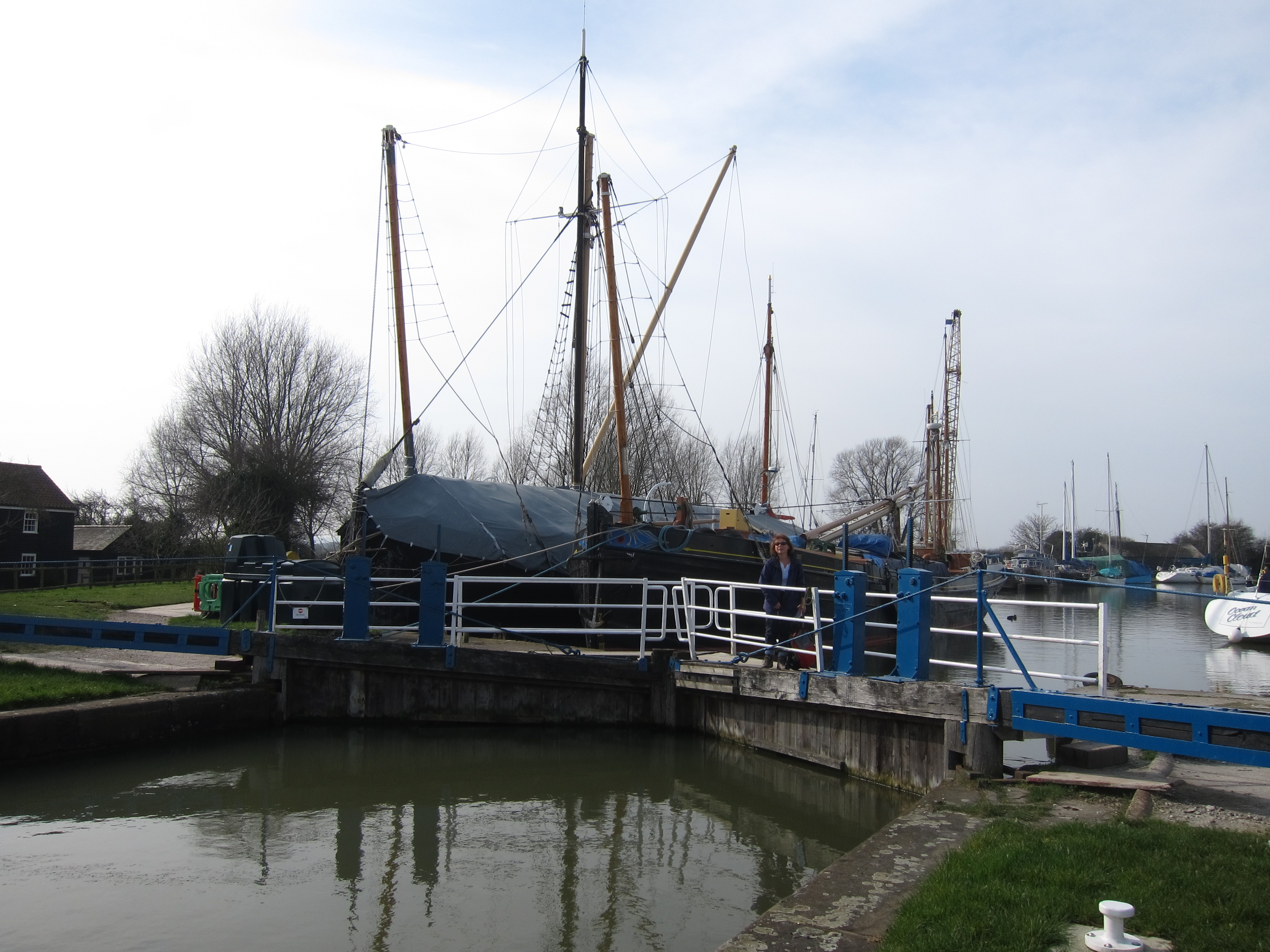
What a great, but exhausting day, in a new county. Suffolk. Trevor (may the gods of walking smile upon him) made the day very much better than I could have planned. To begin, he offered to pick me up in Aldeburgh and drop me back at Felixstowe, leaving at 7.45 from Aldeburgh, which saved me a long trip and a considerable amount of money at the end of the day. He also arranged the last, marvellous crossing of the Alde in a little tender owned by his friend, Alistair, without which I would have had to make a long cross country detour. IMG_5633

Tempted by the thought of multiple river crossings (and the promise of a bacon butty in Felixstowe, Chris was persuaded to join me again, despite having finished his duty of keeping me under surveillance in Essex when we reached East Mersea yesterday. So, an early departure from Colchester, creeping out so as not to wake Rita, brought us to Aldeburgh just before 8am. IMG_5655

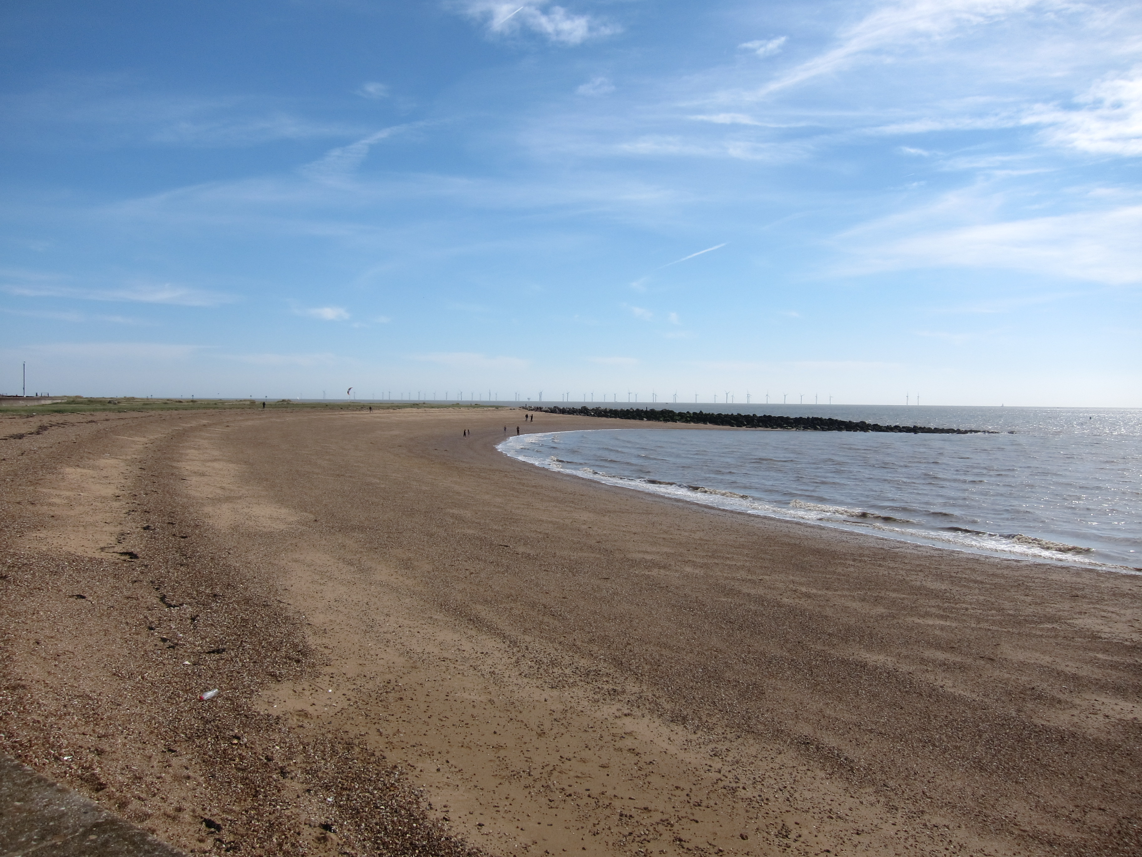
We reached Felixstowe just before 9, and set out more or less from the point where the foot ferry from Harwich arrives. The ginormous cranes I mentioned in the Harwich walk looked even more impressive close to, and, in fact, remained visible for the most part of the day. The morning was bright, although we could see thick black clouds out to sea. The wind however was roaring in from the North East and howled all day, resulting in burnt faces and achey ears.

We stopped on the sea front for the promised bacon butty. It proved to be authentic seaside fare – white bread and marg (ugh), but good crispy bacon and excellent coffee.

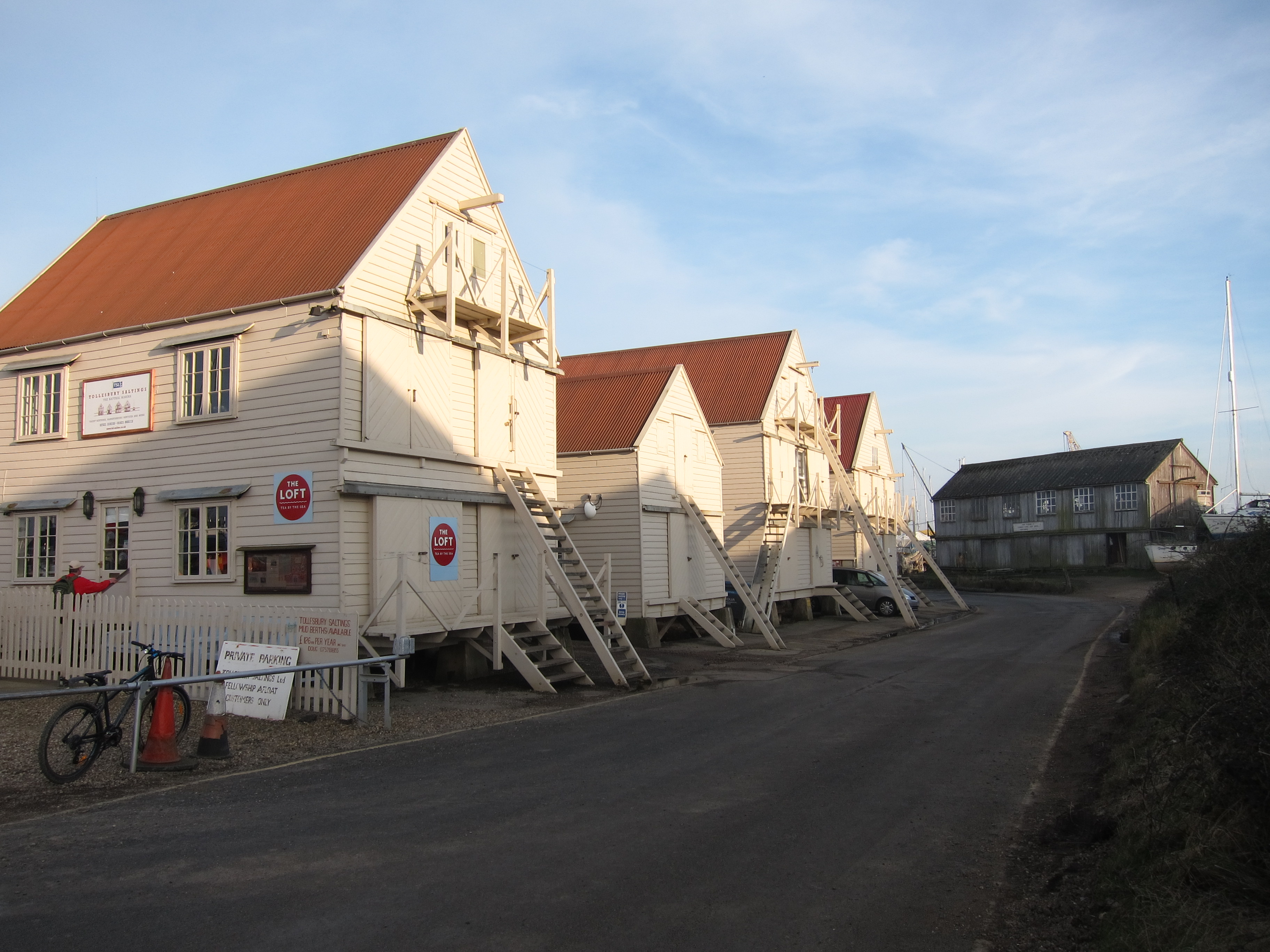
Felixstowe sea front is an interesting mix of kiss-me-quick shacks and sheds, curvaceous 1930s architecture, and at the northern end, some Victorian splendour. We set off at a cracking pace, as with well over 20 miles to do and a tide to catch, we couldn’t hang about. The first excitement was the ferry across the river Deben. The river is some quarter mile across, and a ferry service runs in summer. As we walked inland, with the river to our left we speculated on which of the many craft could be the ferry. We followed the instructions at the tiny jetty to wave the ping-pong bat attached to a rope to call it in. IMG_5675Helpfully, a little boat with sign saying “ferry” in black hand-writing on white board was attached to the little cabin. The ferryman was unimpressed by our banter, but pulled himself together enough to wish us a good trip.

We crossed the choppy waters in a few minutes, and rang Trevor who was to meet us on the coast just east of Alderton. The walk round Bawdsey point was tough going. The path is on shingle which is very hard to walk on, the sky was lowering and the tide was coming in briskly. A number of signs saying beach impassable at high tide gave subliminal messages to go as fast as possible, which on shingle is much like running on the spot with weights attached to your thighs. We came to a narrow set of stairs up to the cliff top so decided to go up. The cliff top was covered with undergrowth, in particular Alexanders some 4 foot high. The whole of the inland side was fenced with a high mesh and stern MoD signs. The cliff top had eroded in parts, so some of the narrow bits were a bit unpleasant for someone who is not comfortable with heights. Still better than the shingle, though.

Far out at sea, we could see container ships, some so large we couldn’t believe they were ships and wondered if they could be gas platforms, but no, just ships.

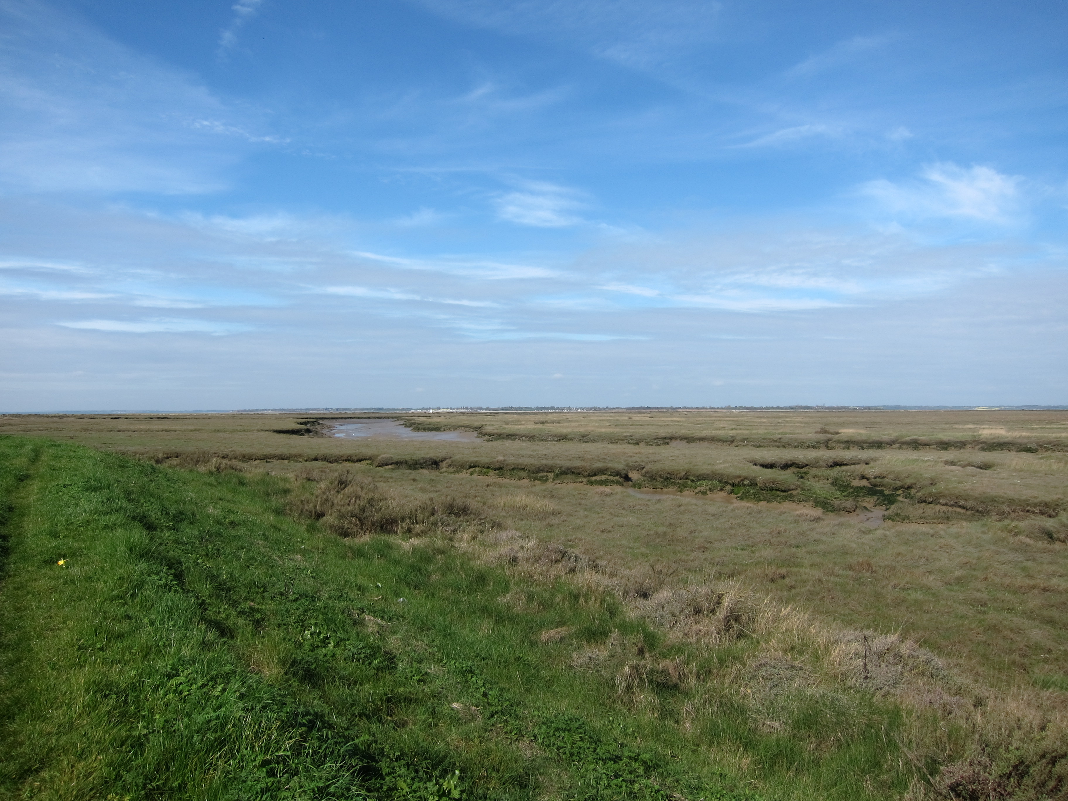
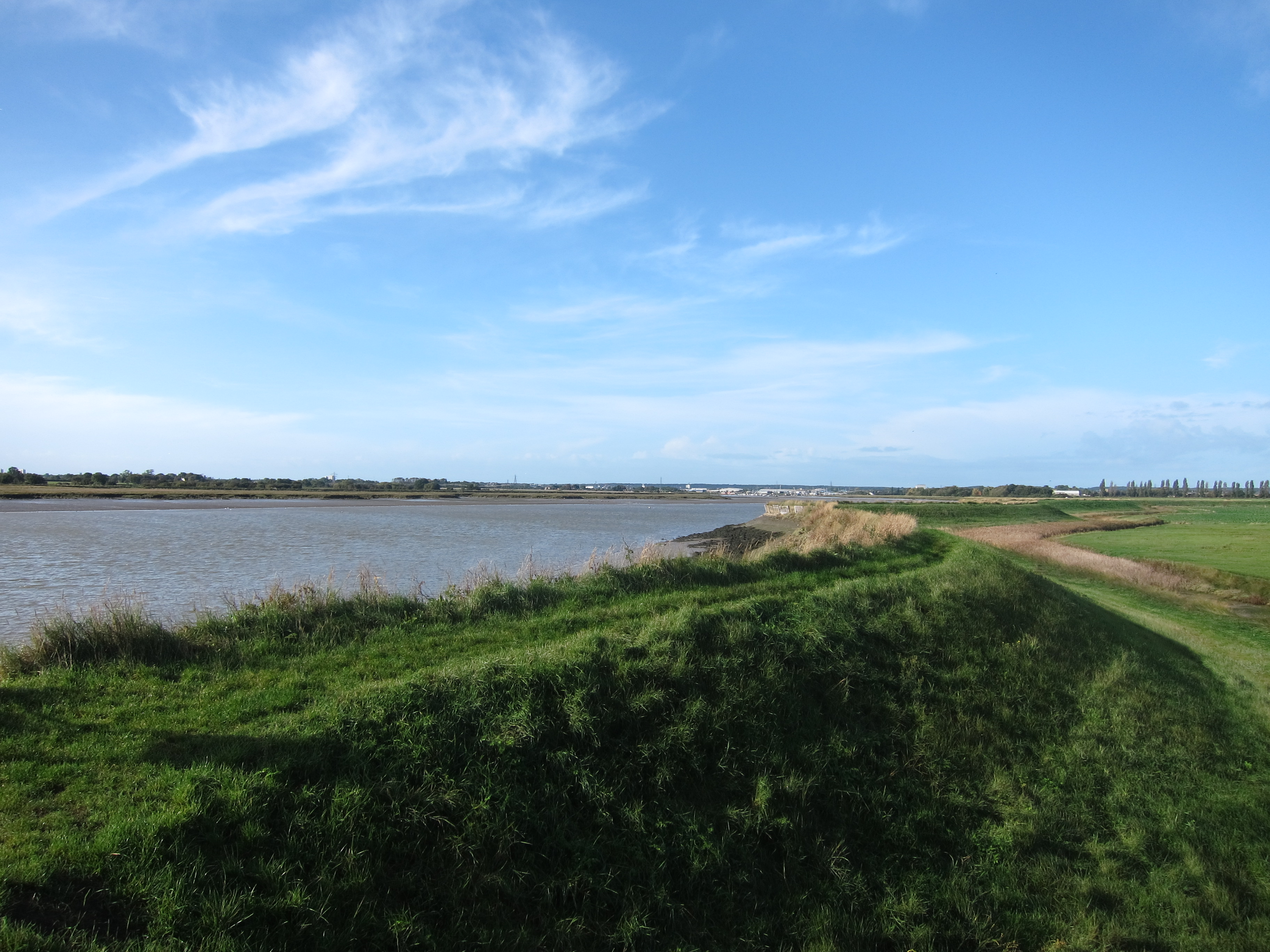
We met Trevor on the sea wall just east of Alderton. The sea wall is not dissimilar from that which I have been following in Essex, but the countryside seems completely different – a much broader view all round, and the marshes are more like reed islands with much less mud.

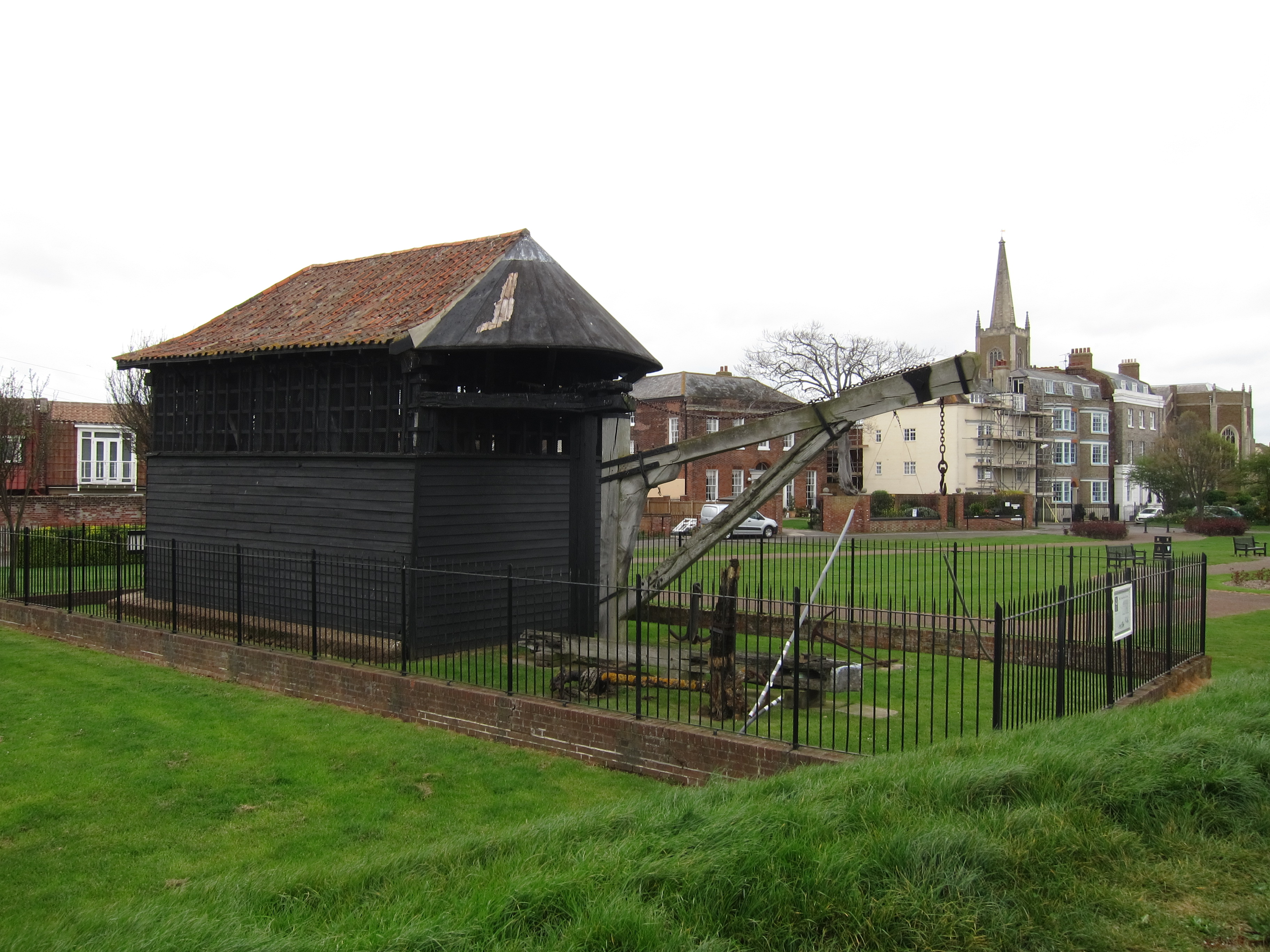
An interesting feature along the stretch of coast is the prevalence of defensive military structures. Martello towers line the coast at half mile intervals, apparently there are 103 between Seaford (where I was last 6th April) and Aldeburgh, so I suppose I must have seen them all. There were pill boxes everywhere and mysterious other lumps of concrete. IMG_5669IMG_5783

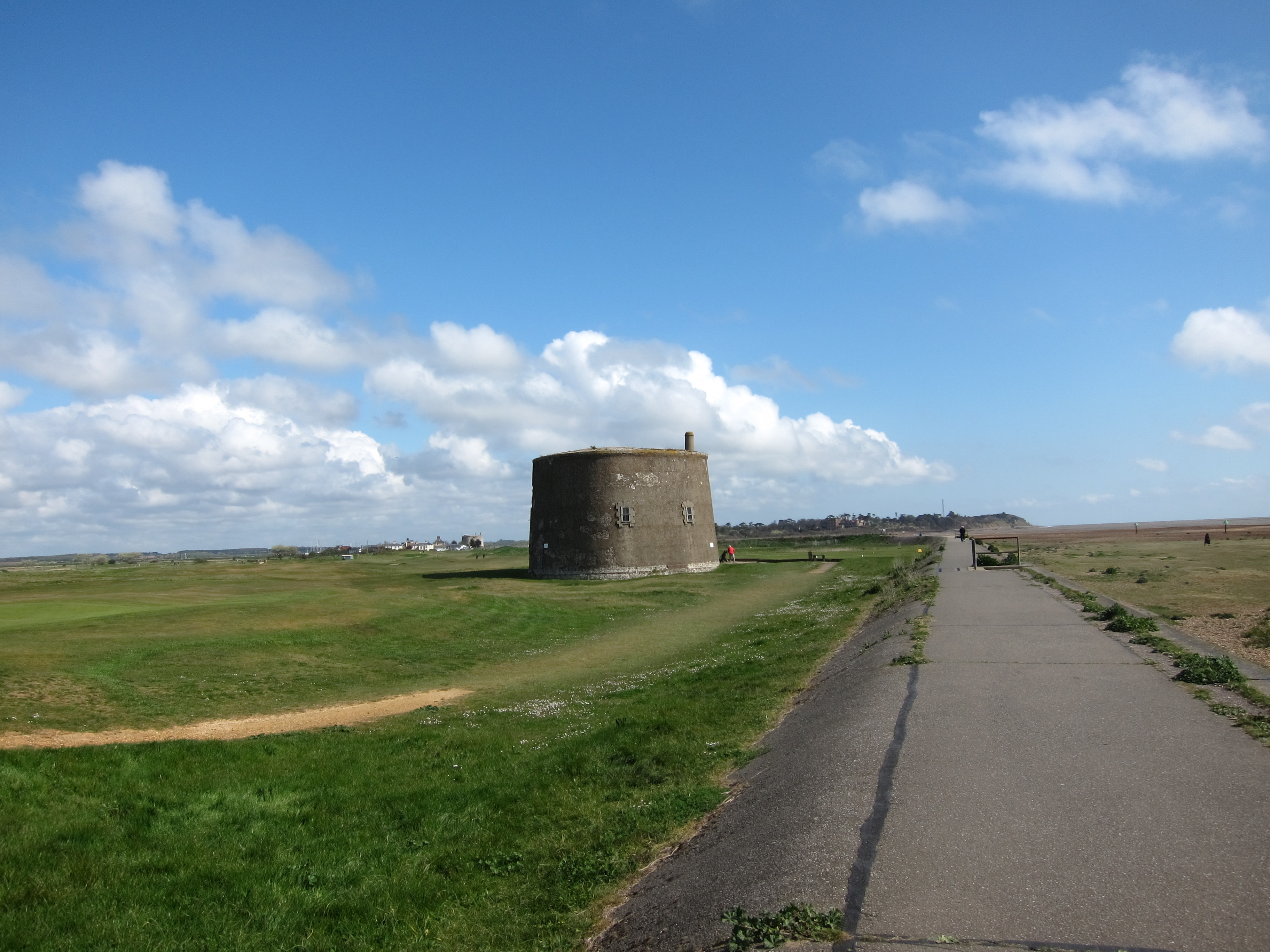
After a further five or so miles, we met Sally, Stephen, Sarah and young Benjamin at the delightful Butley ferry. Run by volunteers it takes walkers across the river to Orford, saving a long trip inland. Overhead were egrets and even a couple of marsh harriers. The ferry was a rowing boat with no outboard, and our ferry man did a sterling job, taking us all over in one go. Sally crossed with us and a couple of miles through fields brought us to the chocolate box town of Orford, heaving with visitors. We stopped for excellent cake at the Riverside tea room (crunchy lemon for me – desperate for sugar by now as I had forgotten to bring my chocolate) and sticky date for Trevor and Chris. Sarah, Stephen and Benjamin then walked along with us, well, Benjamin rode in his father’s backpack, for another 4 miles along the sea wall. The wind was still frightful but the sky was blue and the views across to Orford Ness were lovely. Eventually, just opposite the Aldeburgh yacht club, where the Alde turns inland, Trevor’s colleague met us in his little tender and ferried us across. I was extremely grateful as 21.5 miles had taken it out of me. We were delighted to be reunited with Rita, whom we had missed at Orford, owing to the vagaries of phone signals.

I can confirm that my pedometer is nearly spot on – I measured it between two marker posts in Felixstowe, and am under- recording by a mere 1%, which I will adjust from now on.

Day 41 – Salcott to East Mersea Point 18 April 2014

I am sitting comfortably up in bed in Rita and Chris’ delightful spare room, after a day which hasn’t been remarkable for scenery, but has been very social. I left home ridiculously early to pick up Chris in Colchester. He and I then returned to Salcott where we finished back in March. After a very short walk across a field, we walked for nearly five miles along the B1025 towards Peldon to take the only road onto Mersea Island, across the Strood. It was not very pleasant, as there was a huge volume of traffic – I have no idea where everyone can have been going, but there were something like 40 cars passing every five minutes: no pavement, so we sIMG_5576pent a good deal of time leaping onto hedges. Spring has arrived earlier in east Essex than in Herts – the lilacs are in full bloom and the bluebells richly carpeting the roadside verges. We stopped for a swift coffee at the Peldon rose pub – road walking is fast and we were ahead of time. Eventually, we crossed the bridge (which is impassable at high tide and walked along the north coast of the island towards West Mersea. Along the shore we could see hundreds, if not thousands of dead crabs, caught up in the reeds and seaweed – presumably carried up by a surging wave.IMG_5582

Mersea Island is a community all to itself, the islanders are proud of their traditional fishing, and tales of smuggling abound, particularly the famous (in Mersea, at any event) tale of Mehalah which was written by Sabine Baring-Gould, the author of “Onward Christian Soldiers” and some 1200 plus other works. Apparently, the tale is not for the faint-hearted! http://www.allthingsransome.net/literary/meh_top.htm  It is also the setting for the 1930’s detective writer, Margery Allingham’s, first work.

We were planning to meet Rita and two other friends in Mersea and go to the famous Company Shed, a no-nonsense eatery where enormous amounts of fresh fish are served, and you bring your own wine and bread. We got there just before 12 but couldn’t get a table till nearly three, so we canned that plan and ate elsewhere. Rita, Julia and Martin had walked around the north side of the island to join us, accompanied by the delightful Harvey, a gorgeous liver cocker spaniel, who leapt and frolicked with boundless energy. IMG_5611After lunch Chris, Martin, Harvey and I walked along the south side of the island. It is unremarkable, to say the least, the most interesting thing is seeing all of the fresh fish being sold, and the oysters being scrubbed. IMG_5594The beach, along which we walked for several miles, was littered with oyster shells. Chris picked up a few live ones, but decided to throw them back in, as the idea of eating them after a a few hours of being carried around was unappealing. We ploughed our way to Eat Mersea point from which I could see Point Clear, my previous set-off point.

The weather was fine, but the wind was bitterly cold. To combat its power, I put on my exceptionally becoming snood to keep my ears warm and attracted glances of what I believed to be admiring attention, although there were other interpretations!

A straightforward 13.5 miles, with some hard going on the road and beach walking.

Day 40 – Walton-on-the-Naze to Harwich 6 April 2014

Today was a bit different from yesterday, in that there was more estuary walking again, followed by a walk through the docks at Harwich. I also had company – Tom, Chris and Chris’ friend Alan.  Alan is a veteran walker – he has crossed Scotland coast to coast twenty-five (yes, that is twenty-five, not a mis-print) times for charity. He was keen to get a bit of practice in for his next Scottish trip in late May, so was walking with a very large, full rucksack.

Tom & Chris picked me up from Squeaky-clean pub, which sadly had only provided the first “B” in the “B&B” combination. I had managed to find a sandwich in a conIMG_5451
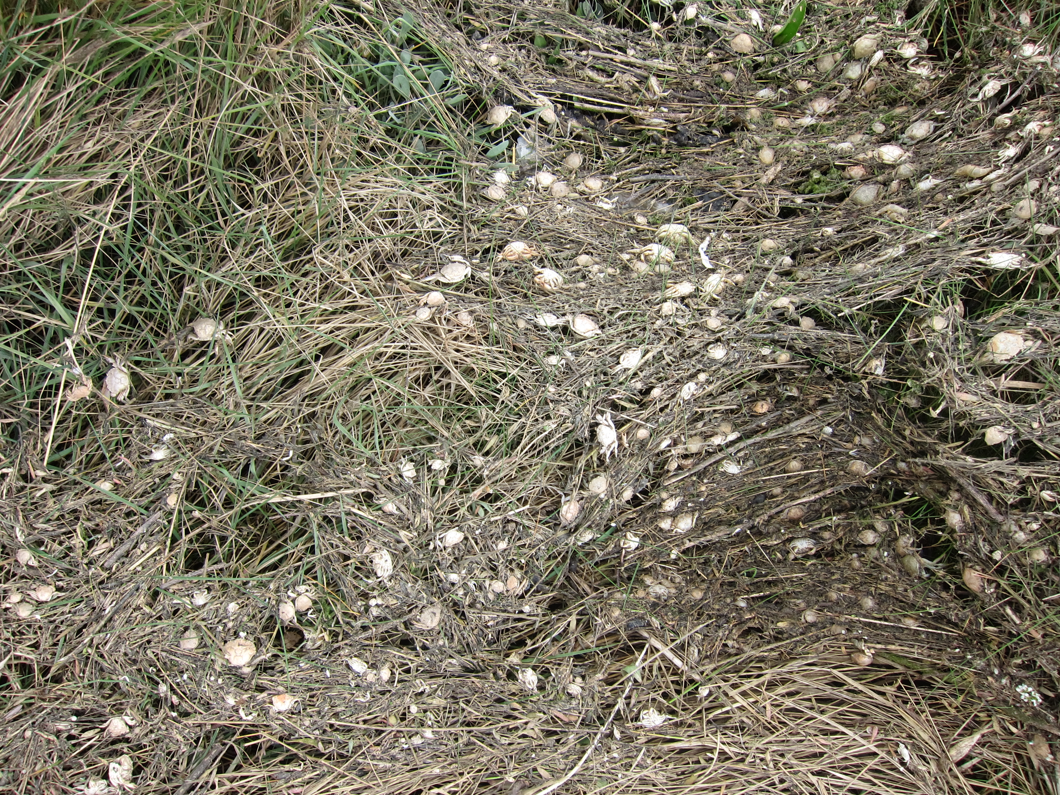
venience store, but was feeling somewhat disappointed that no bacon and eggs had materialised. We drove back to Walton-on-the-Naze to meet Alan. As I was gasping for a cuppa before setting out, we stopped at the local Hell’s Angel café for a brew to put hairs on my chest.

Walking through the town, it began to rain, so there was a good deal of waterproof firkling before we could really get into our stride. IMG_5452Naturally, the rain then stopped. IMG_5464Alan’s preparations were a revelation – he had a huge thermos flask of coffee made from Bailey’s Irish Cream – it kept the coffee hot, and put a spring in all our steps!

The path runs inland around the marshes for about 8 or 9 miles. There was the usual bird life to be seen – black-headed gulls, ducks of various sorts and oyster catchers.   In the distance we could see the tower at Walton. Because of the presence of a factory which seems to produce explosives or something equally hush-hush, walkers are directed inland. But that was fine, as, in due course, we came to a pub at Little Oakley where we partook of fine roast beef sandwiches – almost made up for a limited breakfast.

We then picked up the Essex Way, which led back to the coast and walked along the prom into Harwich. As we walked we could see the enormous cranes at Folkestone and watched a huge Maersk container ship heading out to sea. Looking at the size of it, and counting the hundreds of containers above the water line, it is almost impossible to imagine how they stay afloat – how come the containers don’t fall off in a heavy sea? I know they are tied in, of course, but it is still difficult to understand how they stay upright. Behind it was a tiny tug. We couldn’t decide whether it was actually pushing the container ship, which seemed unlikely, or if it contained the pilot, who would then be dropped off once the ship had reached the channel:  maybe it was just being dragged along in the ship’s wake….. IMG_5492

As we passed round the promontory into Harwich harbour, we passed the treadmill crane, dating from the 17th century. More information on it here http://www.harwich-society.co.uk/old/info_treadwheel.htmIMG_5497

We then walked around to the foot ferry which takes passengers across to Felixstowe before a tedious couple of miles racing down the A120 to pick up my car.IMG_5501

The day ended with some serious debate about distance travelled – my reckoning on the map had given me a target of 17.5 miles, and my pedometer gave me 17.6 – all well and good, and consistent with other days, taking my total to 700.8 miles. Alan’s pedometer, however, maintained that we had done some 21.7 miles in total. If he is correct, then I have done another 15-20% overall.  Next time I am walking in an area with mileage on the footpath signs I will check. Alan’s pedometer also shared the information that we made a total ascent of 367 feet, and reached a maximum height above sea-level of 92 feet.

Day 39 – Point Clear to Walton-on-the-Naze

I am sitting in probably the cleanest pub bedroom I have ever seen! It is agonisingly clean! There is not a speck of dust or dirt anywhere in the entire establishment. The downside is that it is very close to the docks in Harwich and the clients are a little more grubby than the pub!

I have had a very pleasant day – not difficult, some 17.7 miles, mainly along hard surfaces (which is not so comfortable for the feet) from Point Clear near Brightlingsea to Walton-on-the-Naze. Naze apparently has the same meaning as “ness” in Dungeness or Shoeburyness. It is derived from the Saxon naess and means a promontory or headland.IMG_5417

I hope I won’t upset the strict-minded amongst you, as I have skipped a bit from Salcott, in order to do that on Good Friday, in company with Rita and Chris who have promised an excellent lunch at The Shed in Mersea.

I started at Point Clear at just after 10am, parking up near one of the vast caravan sites in the area.   Ten minutes’ walk took me through the village, then I turned down a lane, through a farm and along a track, before hitting the sea wall again, just before Lee-on-Sands. I wended along that for two or three miles, accompanied by a random black Labrador, who spotted me as a likely walking companion and danced along ahead of me, until he reached the end of his territory and turned back. I then came to Jaywick. IMG_5430Suffice to say that I shan’t be selling up to move there any time soon, even though it does overlook the sea: although, to be fair, it is better than the Isle of Grain.

I must say, it was good to be on the actual sea shore again – I haven’t, in fact, been walking on the coast since Tom and I finished at BradwellWaterside, back in December: my most recent outings have been along the Blackwater estuary. IMG_5420

Once past Jaywick, there was some marginal improvement in the built environment through Clacton, then a further gentle increase in liveability in Frinton. The weather was exceptional – I was walking in shirt sleeves, and it must have reached 18 or 20 centigrade, despite a forecast of showers which never materialised.

The coast off Frinton is dominated by a large wind farm, which I found rather mesmerising as the blades spun lazily in the moderate breeze. In due course, I arrived at Walton, where I had an excellent tea (see review), before making my way up to the Naze.IMG_5446 The tower originally built in the eighteenth century as a seamark is an interesting feature, as are all the WWII pill boxes. Erosion is rapidly changing the coast – the tower, originally 200 yards from the cliff edge is now only 50 yards inland as the sea creeps up some 2 yards each year. One can see some of the pill boxes have already tumbled into the ocean. My map has not kept up with the changes and I ended up walking in circles, rather than getting as close to the sea as I would have liked.  I took a taxi back to the car, rather than the Sunshine Coast railway (as the route from Walton is apparently called) and drove to my B & B in Harwich.

Day 38 – Maldon to Salcott 8th March 2014

I met Chris at Salcott, and left one car there, driving back to Maldon to have another vast bacon bap on the barge before setting out.

Maldon is a really interesting town being one of the oldest recorded settlements in East Anglia.  It was the site, in AD 991, of the Battle of Maldon where Aethelraed the Unready, King of England, was defeated by a vast Viking army, despite the valour of Byrhtnoth, earldoman of Essex.  Following the defeat, Aethelraed began the practice of paying “Danegeld”- effectively protection money – the first payment being of 10,000 pounds of silver. IMG_5340

In the centre of the town is the delightful Thomas Plume Library, built in the late 17th Century, in what was once St Peter’s Church and housing some 8,000 antiquarian books.  More information can be found here http://www.thomasplumeslibrary.co.uk/

Leaving the town, we passed a fair number of Victorian mills and workshops, then turned to walk down by the side of the canal to the waterfront.  Maldon has been a centre for working boats for centuries, and, although there were a few pleasure craft around, it was most interesting to see the old barges, many now restored.IMG_5351

Leaving the town, the walk continues along the sea-wall – not varying greatly from previous stretches, but delightfully warm, with none of the howling gale we encountered last time.  A collection of almost derelict summer houses on stilts overlooking the mudflats caught our eye – Chris was ready to start renovating there and then.IMG_5359

As we walked out of the estuary, back towards the coast, I could see Bradwell Power station, which I passed back in December – I am not feeling as though much progress has been made so far this year!

We promised ourselves tea and cake in Tollesbury, but, unfortunately, all of the cafes had closed by the time we arrived.  The boat sheds were attractive, though.IMG_5381

Finally, as the shadows were growing longer, we passed an area that had originally been salt marsh, and then was drained about a hundred years ago, but over the last 15 years has been allowed to return to salt marsh by the deliberate breaching of the sea wall.  We met a very chatty lady and her labradoodle who told us all about it, and that the local landscape was used for the filming of Great Expectations.IMG_5386  The drowned trees have a very eerie appearance.

We covered just over 19 miles to make a total of 666.2 (I include the 0.2 to avoid the whole number!), and I am delighted to say that I have now passed the 10% mark!  I am thrilled with this milestone.

How come I have now settled on 6,500-6,600 miles after not being sure before?  Well, my kind friend Graham found and gave me a copy of a rare book called “Turn Right at Land’s End” – written in the late 1970s by John…  who was the first person to walk around the whole coast.  He completed 6,824 miles in total, and since his rules did not permit the taking of ferries, but insisted on walking up the estuary, I conclude that my total will be a bit lower.

My plan was previously to go back down to Plymouth for two weeks over Easter, but this is not going to be possible, for a variety of reasons, so for the time being I shall continue to chip away at East Anglia.

Day 37 – Bradwell to Maldon 8th Feb 2014

Finally, I have managed to get a walk in!  I was beginning to think I would never get started again, especially as the weather made me wonder if it would be sensible to do a coast walk. Certainly, the night before, the wind was howling and making me think that staying snuggly indoors would be the better option.  The pictures of the railway line at Dawlish, where I walked back in August, are a shocking reminder of the power of the waves.IMG_5215

However, reassured that Essex is not given to extremes of weather, I set off and met Chris in Maldon.   Before going back to our start point we had a quick refreshment stop – see review.

Fully fortified, we drove back to Bradwell Waterside to pick up where Tom and I left off last year.  It was tempting as I drove past some very large pools of water on the road to whoosh through and soak a clutch of cyclists, but my better nature took over, and I resisted.

The walk continued pretty much as it has been since Shoeburyness – along the raised sea wall, with the mudflats undulating between the wall and the water.  IMG_5221The ground was muddy, but not flooded, other than at one point where a footbridge had been washed away and we made a detour of about a mile (only to discover that if we had turned at one point we could have picked up the path only yards away) and another short piece of path that was completely inundated.IMG_5232

The wind, however,  was another thing – howling in from the west it was so strong that a few times I felt it would take me off my feet, and land me on the inner side of the wall in the soaking marshland.  Fortunately, it died down to merely blustery at around lunch time and the day was pretty sunny on the whole.

Not as many seabirds about as last time, but we did see the most enormous flock of Brent Geese.  There must have been hundreds, if not thousands, all collecting in a single field.

We stopped for a quick pint, which proved a bad move, as Maldon, although visible in the distance never seemed to get any closer as the path wound in and out of the marshes.  IMG_5239Eventually, the sun went down. We were charmed by the sight of an owl busy working a field in the dusk.   The moon rose early and, being nearly full gave a light bright enough to see our shadows, which was lucky as we had a good 45 minutes of walking in the dark.  As we approached the town the mud got claggier and claggier – probably a couple of pounds of extra weight on each foot!  By the time we had slipped and slid our way back to the Hythe at Maldon, I was painted in mud up to my hips.

It was splendid to be out again, and we covered just under 18 miles.

Update on timings

Unfortunately, I was unable to walk on Saturday, 24th as planned.  Maybe not such a pity as the rain was horrendous.

I will now be doing Bradwell to Maldon on 9th February, followed up by the next section on 8/9th March – more details on that to follow.

On a more successful note, I have now completed Peddar’s Way in Norfolk.  Sally and I have done the whole 47 miles, accompanied in parts by Trevor, Ann, Rita, Chris, Tom, Graham, David, Yos, Robin & Jenny and their family (including the Staffy).

Day 36 – Burnham-on-Crouch to Bradwell Waterside

I have done my last walk of the year, starting from Burnham-on-Crouch, more or less opposite Canewdon on the north bank of the river Crouch.  Burnham is an attractive town, with a row of seventeenth century mariners’ houses overlooking the river.  They are distinguished by the huge dormer windows, that enabled the waiters at home to see the ships coming up the river in a time when travelling by water up and down the east coast was far easier than travelling by land.IMG_4905

Tom joined me again, and gave me the benefit of his encyclopaedic knowledge of the wildfowl which inhabit the salt marshes that line the estuary and stretch along the coast.  We saw egrets, pied wagtails, a kestrel, starlings (I spotted those!), lapwings, which I have learnt have fingered ends to their wings, and lots of brent geese.  Tom also spotted a marsh harrier and a barn owl, but they just looked like tiny blobs to me.

The weather was kind – a slightly bracing north-east wind, but nothing too cutting.

The path continues, as it has since Shoeburyness, as a walk along the embanked sea wall.  In a few places the wall has been breached to allow managed flooding and encourage the return of salt marsh.IMG_4918

The absolute highlight of the day was the visit to the tiny church of St Peter-ad-Muram.  This is one of only 5 seventh century churches in England.  Dating from the 650’s it was founded by St. Cedd, from Lindisfarne, so was a Celtic Christian church, rather than one of those founded by the new followers of the Roman Christian Augustine.  It was built on the old Roman fort of Othona.IMG_4941

More history can be found here http://www.bradwellchapel.org/sphistory.htm

The light on the marsh and on the sea was superb – cloudy to begin, then a couple of hours of bright sunshine, followed by black clouds inland contrasting with golden afternoon sunlight on the rustling reeds.

I am very sorry to be hanging up my walking boots for six weeks or so, but I shall return in late January.  I am pleased with progress for the year – 629 miles over 36 days: an average of 17.5 miles per day at a rate of about 2.3 miles per hour over all terrain.

The map shows the two points that I have reached – Plymouth in the south-west and Bradwell Waterside (or Bradwell-juxta-mare to give it its traditional, Latin version) in the east.  Map 2

Day 35 – Rochford to Canewdon 20th October 2013

IMG_4884Today’s weather was almost the opposite of yesterday’s, warm and quite sunny during the day with an absolutely tremendous squall towards the end of the day that left us soaked to the skin.

I met Tom and Chris at Canewdon, and then we drove back to Rochford to continue walking along the banks of the Roach, but this time on the north side.  I was thinking how unpleasant the name “Roach” is, but Tom assured me it was named for the little fish, rather than the scuttling insect, which made me like it better – although it would be more interesting if it were named after the illegal substance…. perhaps all of the fishermen of Rochford sit on the banks in the summer puffing away on bhang.

The path continued much as before, up on the embankment a few feet above the salt marsh, which had a tasteful collection of shopping trolleys and old junk visible nearer the town.  There were very few houses, but quite a lot of boats out in the main channel, which Chris and I recognised from yesterday.  To break the day up, we stopped at the village of Paglesham Eastend for lunch.  There is a little boat yard there and we were delighted by a half rowing boat that has been ingeniously turned into a little sheltered view point.IMG_4891

The pub was run by an absolute dragon of a land lady who was extremely harassed by the Sunday lunch rush.  We were so intimidated we had to take it in turns to make our various requests as each of us had to retire after receiving what Pooh might have referred to as a very hard stare indeed! IMG_4894

Munching on our excellent roast beef sandwiches outside the pub, we got chatting to a gentleman who seemed to know a bit about everything.  He and Tom were soon deep in a discussion on the military tactics of Boudicca.  This meant we left the pub a little later than intended, but as the day was only 15 miles, it didn’t matter.

Striking back to the water’s edge, the path runs north for a mile or two then turns west into the estuary of the river Crouch.  This is wider than the Roach estuary, but otherwise practically identical.  We could see Burnham on Crouch on the opposite bank.  Because of all the inlets, one can see the sails of ships without the water being visible – it is quite strange, the sails seeming to be rolling along the land.IMG_4889

We could see Canewdon church tower on a slight rise to our left, at least, we could see it until the sky turned inky black and the heavens opened.  Even my rainproof trousers eventually sank under the weight of water and began to seep.  The rain shower lasted for about half an hour, then gradually wore off as we walked up the slight rise into Canewden.  There was just time for a swift half in the pub there before heading home.

Day 34 19 October 2013 – Shoeburyness to Rochford

IMG_4869Just got back from a satisfactory day, beginning the east coast, accompanied by Chris.  As anticipated, it was flat and also rather rainy, not very heavy, or windy, but relentless.  Since the previous very wet day, near Beachy Head, was with Chris, I am beginning to wonder if he is the culprit!

We set off from Shoeburyness around 9.45.  It was not raining at that point and we could see the Kent shore with the various power stations and sewage plants I walked past back in the winter.  It doesn’t seem very long ago, but I have covered a pleasing distance since.  It was a bit odd to be walking with the sea on my right, but I am sure I will get used to it.  The contrast with the South West is amazing – from the relentless ups and downs over the chalky cliffs to a vast expanse of mud flats.  When we started out the tide was a long way off shore and there were people and dogs dotted across it.  We walked past a group of chaps setting themselves up for wind kiting on the mud.  It looked like great fun, but the geese who were circling ready to land did not seem so happy to see what they were sharing the coast with.

After a mile or so we had to turn in land to avoid the defence works at Shoeburyness – the road took us through a residential area and we had the bizarre sight of some dismembered mannequins in the street.  They would be very creepy at night!IMG_4873

Eventually, we turned back to the coast, but not much further on we turned in again to walk along the Roach estuary.  The island of Foulness was next to us, apparently you need a pass to go onto it as it is used for something terribly hush-hush.  The swing bridge to the island was up, so, given there is no land access I am comfortable that it is not on the route!

The path runs along a low embankment, built up, I suppose, to make the river Roach navigable.  It was not an eventful day, the path just would in and out of the various inlets with boats in various stages of dilapidation dotted around.  There was a curious section of bumps in the landscape, which we concluded, owing to the smell and the little pipes dotted around, was landfill.IMG_4877

In total we covered just under 19 miles, and, happily, towards the end, the rain finally stopped and we were able to dry out before getting back into the car.