I had a lovely drive through the autumn morning, stopping for a very nice piece of orange drizzle cake at Llanddymyfri. I saw Jane come up behind me, but apparently she followed me for 30 miles without realising it, even though I waved frantically out of the car window at her – I hope she’s a bit more attentive to other activity on the road! After a not very brief and totally unnecessary detour through Aberteifi/Cardigan, we stopped for a quick lunch in the nice little café at Poppet Sands, then took Jane’s car to Trewyddel/Moylegrove. It was a rather steep and twisty route. We then walked up through the woods where Rachel and I had stumbled in the dark last year – they looked very different in daylight, and approached from the opposite direction – definitely less spooky. The weather was changeable, but stayed pretty dry. The views were excellent, but sadly there were no seals or dolphins.
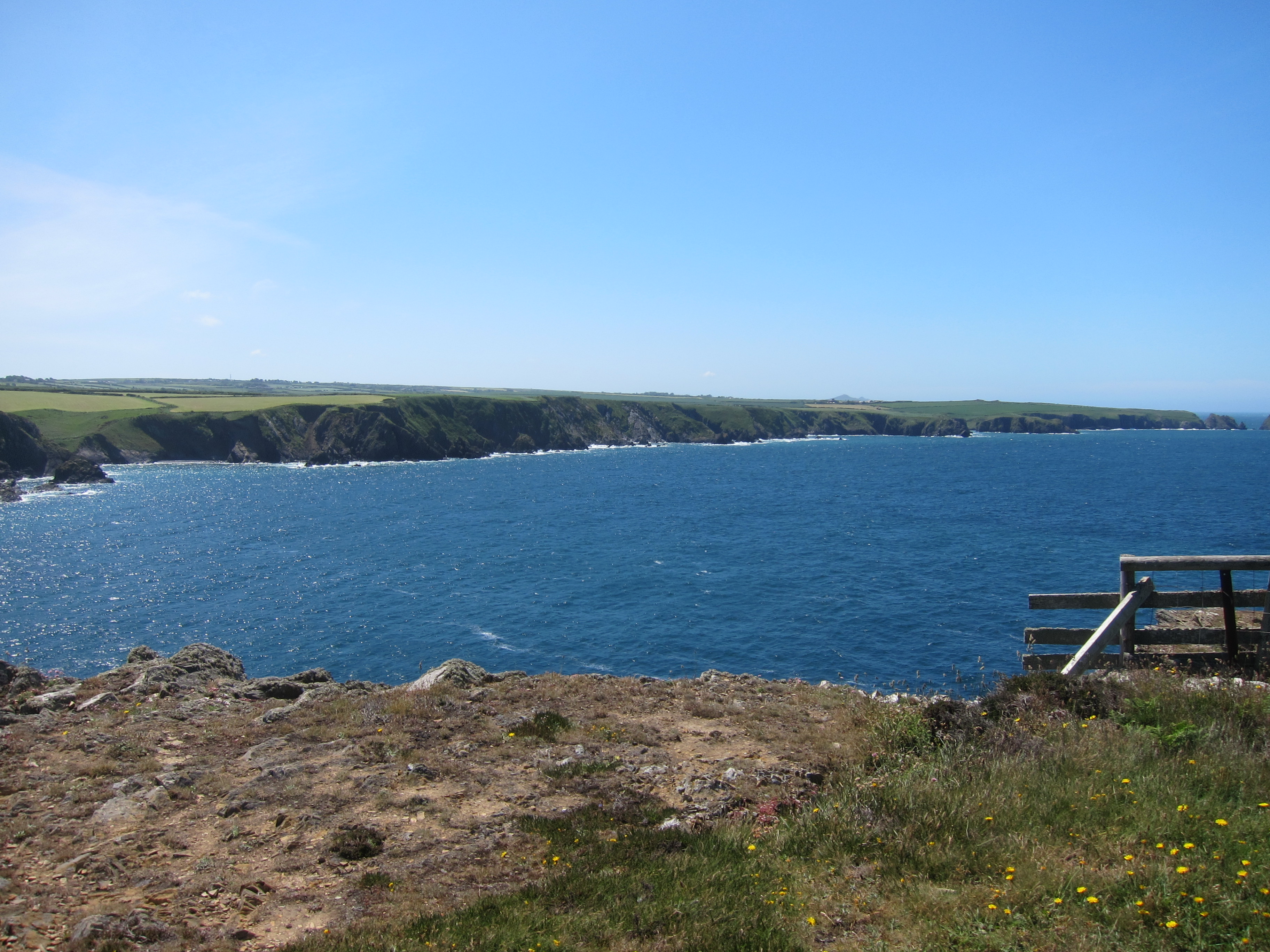
Hitting the coast near Trewyddel/Moylegrove
We had a straightforward walk, with some excellent views and superb autumn colours.
Autumn colours
We got back about 5pm and walked along the lovely beach at Poppit Sands. We sat down against a rock, and were just thinking we should turn back when it poured, so we got very wet in the last five minutes, nevertheless, an excellent day.
I have now finished the Pembrokeshire Coast Path – utterly magical from start to finish.
We are staying in the Castle in the town – it is absolutely excellent – can’t recommend highly enough. The room is spacious and airy, and the staff are lovely. We are on tenterhooks as Jane and her partner are hoping to hear that the offer they have made on a house has been accepted.
Just had a good curry not far from the hotel – although it was BYO, which we did not realise. Jane stepped swiftly into the breach and nipped to the Spar for some red.
A mere 6.2 miles to get my legs in and another gold day.
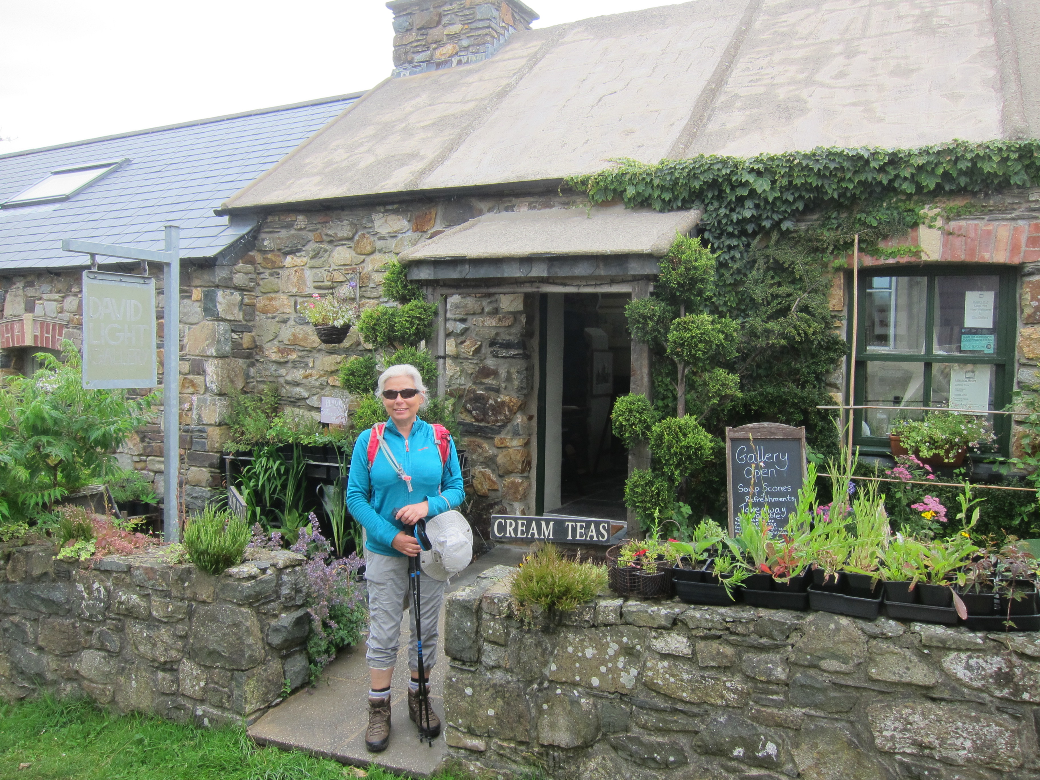
After the bus problems of yesterday the itinerary is shot. We parked at Trewyddel/Moylegrove and waited for the Poppet Rocket bus, which I’m glad to say appeared on time. In a slight vindictation of yesterday, the card reader wouldn’t work, so we ended up travelling for free. Although the bus does go to Pwll Gwaelod, only on its return from Abergwaun so we elected to jump off at Dinas Cross and walk down. We were rewarded by a lovely little gallery and cafe, where we had coffee and Welsh cakes and I bought a post card. I don’t generally buy souvenirs since I am waging a never-ending war on the creeping tide of stuff, but it was pretty.
Setting out from Dinas Cross. Excellent Welsh cakes
Having been disappointed last night that the cats we were busy naming had been reserved, I had enquired about others and was delight to get a call a mile or so in about them. After three long conversations the deal was done and I pick up Lulu (will definitely have to rename her!) and Teddy on Friday.
Cofiwich Dryweryn!
At the farthest point of Dinas Head, is the trig point, painted with the slogan ‘Cofiwch Dryweryn’ a reference to the outrageous drowning of the village of Tryweryn in Gwynedd by Liverpool Council in 1965 to create a reservoir to supply the city.
Just after Dinas Head, we came to a place called Cwm-yr-Eglwys, where it is easy to see how the coast has changed. The ruins of the old church are almost on the beach. It was a busy place, with lots of badly behaved children, and well-behaved dogs, as well as vice-versa.
Cwm-yr-Eglwys
We arrived at Newport about 2.45 and walked up from the beach to the town, but at that time of the day, there was no food available, so we picked up a snack in Spar, then had an excellent ice cream.
It was a long walk in the afternoon. The weather was fantastic but we saw only one seal and none of the promised dolphins or porpoises.
Close to the end, we were pretty tired, but the scenery around Pwll y Wrach/Witches’ Cauldron was absolutely spectacular.
There was then a final walk down the river valley, rapidly getting darker, till it was almost night. There was nowhere to eat again, so another emergency trip to Spar was needed.
Above Pwll-y-Wrach
16 miles in total, and the view if nothing else, made it a Gold day.
Today was a logistical failure. I had carefully, or so I thought, checked the bus timetable from Trefdraeth/Newport and decided that the 11.25 bus would be fine. We got to the bus stop at about 10.45 and glancing at the timetable were disappointed to see that we had missed one at 10.25. We decided to walk around the little village, and found a café after talking to nice woman with a cat. Cats are on my mind, as last night Rachel was encouraging me to look on the Cats’ Protection League cat homing page and so I submitted an enquiry for a sibling pair – one black and white, and one tabby and white. We got back to bus stop and amused ourselves with thinking of cat names. We then looked at timetable and realised that the Sunday bus was 12.25. So back to the cafe for another coffee and a cat name discussion. Chairman Miaow, Franz Katka, and Advocat are strong favourites, along with Bramble and basil, Treacle and Pudding, and Rasputin.
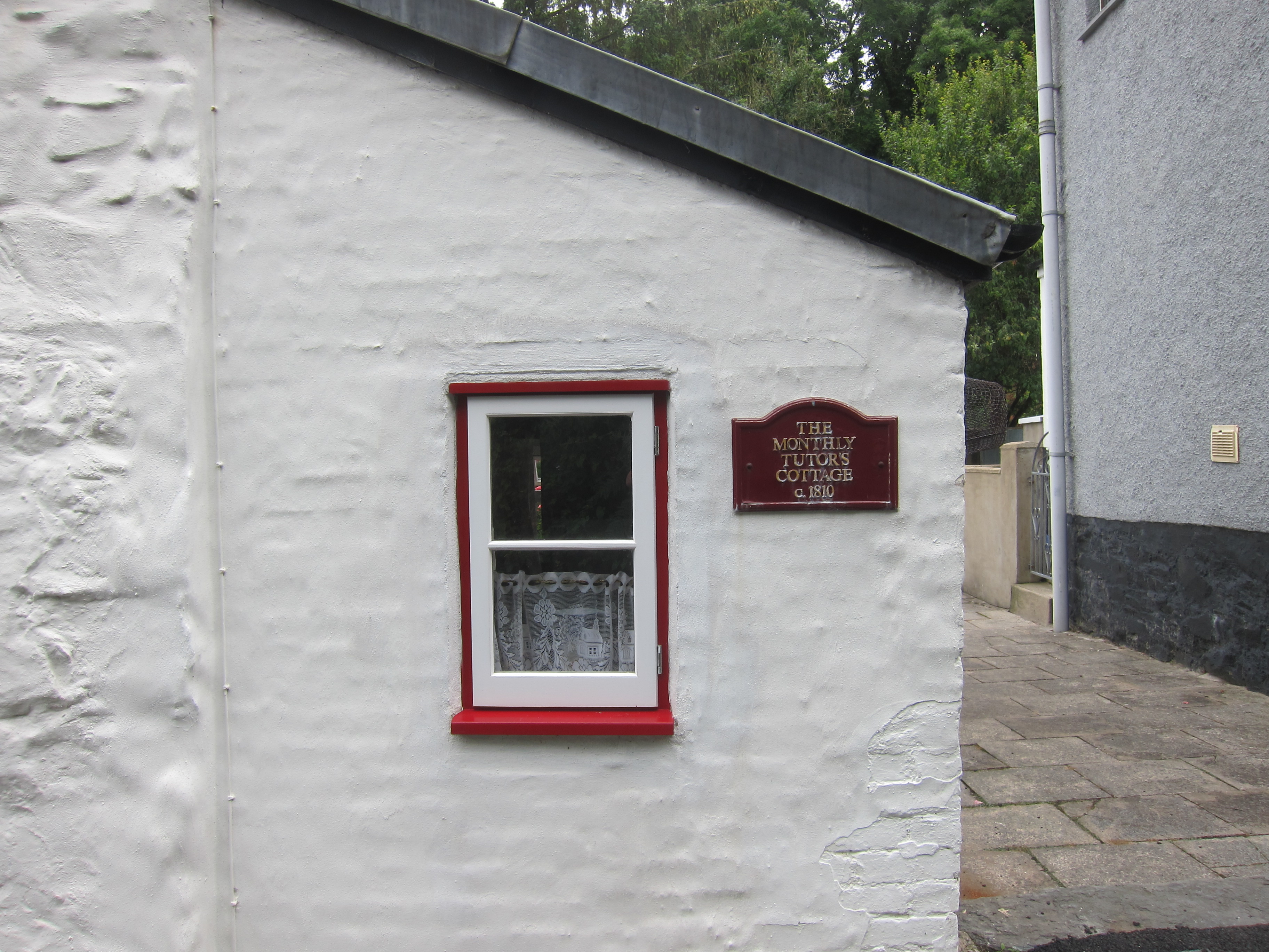
The Monthly Tutor’s Cottage, Abergwaun
12.25 came and went. No bus. After 15 minutes, I looked on line and it appeared that there are no Sunday buses, despite timetable. We decided to drive back to Fishguard, walk out and then back again. The route was pleasant, down a steep hill to the lower town, past the charmingly named ‘The Monthly Tutor’s Cottage’, then up past the harbour to the old fort at the headland where we took turns to pose on a canon.
Looking fab on a canon!
It was overcast. We met a man with an enormous pack that made us glad to be travelling light. We passed through a campsite with lots of people, and got to the hill just above Pwll Gwaelod. It was getting late, and we were concerned about being back before dark. We had heard rumours that there were dolphins playing off the coast, but we did not see any. The sun came out at last, giving us lovely views – it’s always quite different covering the same ground in the opposite direction. Hopefully, the bus arrangements for tomorrow will work! Only 5 miles covered – my shortest day, so far, I think. A silver day today.
Rachel came down yesterday to join me for this leg. I also invited friends for supper, so with clearing up, I was feeling rather bleary eyed setting off at 8am for Abergwaun! However the road was clear and we arrived at Aberteifi/Cardigan in plenty of time for the bus up to Strumble Head – which was fortunate as there was no bus stop where I was expecting a bus stop to be, having checked it only yesterday. Enquiry produced the information that there was a new bus stop on the other side of the town. As I noticed elsewhere in Pembrokeshire the bus driver was an older woman, originally from the north of England. Good to see some diversity in bus drivers. There was an older infirm lady, whom the bus driver patiently talked to the whole journey. We arrived at Strumble Head and set out, having admired the lighthouse again.
The countryside was far less dramatic than the last day I did, coming towards the lighthouse from the south. The cliffs are lower with lots of heather and gorse, but the excitement of the day was the quantity of seals near Carreg Wastad, bobbing on the waves.
Seals near here, but hard to see.
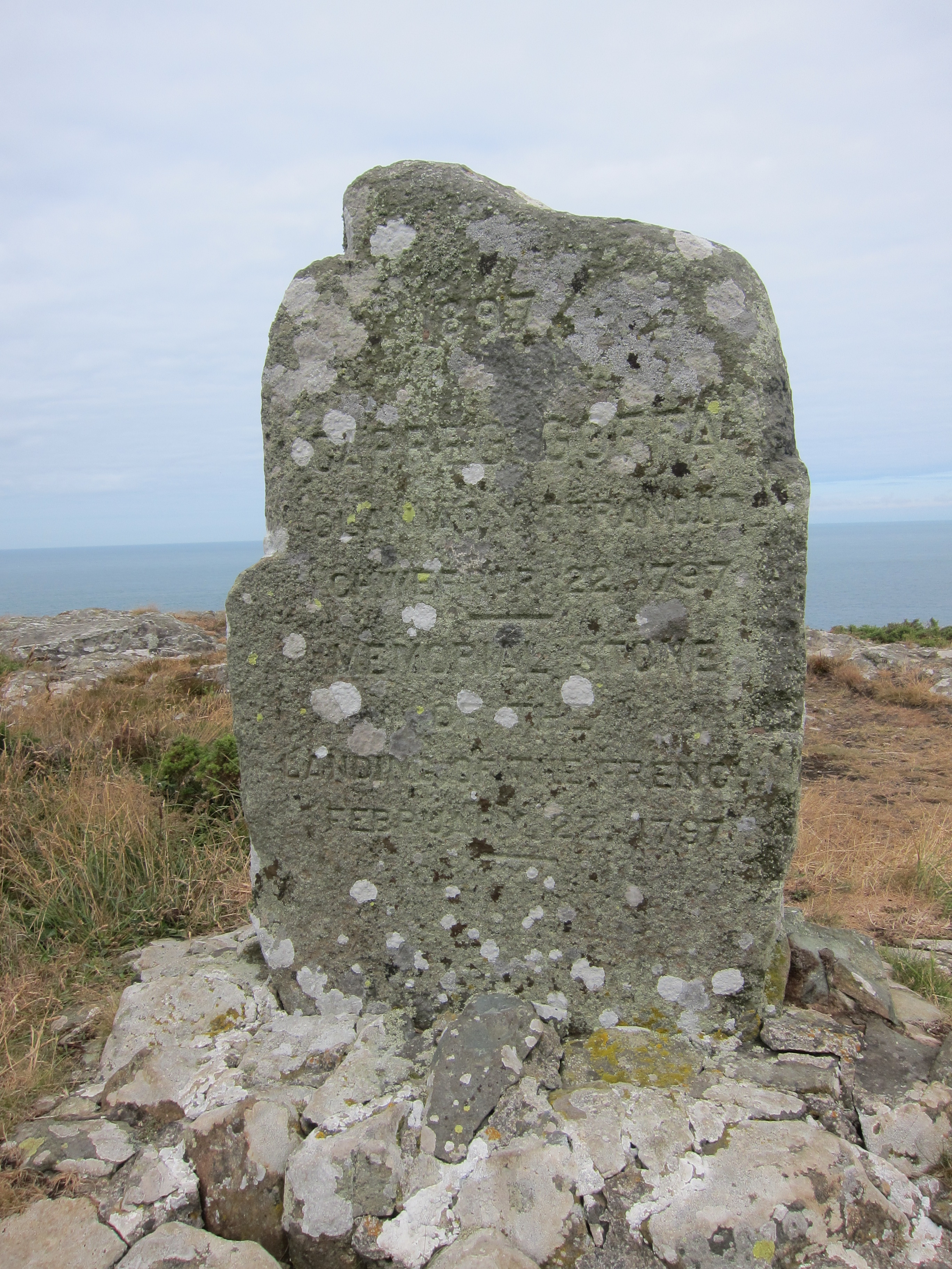
Stone commemorating Jemima Nicholas and the women of Abergwaun who captured French soldiers in 1797.
Another interesting area was just west of Abergwaun, where the French landed an invasion force of some 1400 men in 1797. Legend has it that Jemima Nicholas, brandishing a pitchfork led a group of women from the town to the top of the headland, where their traditional red flannel petticoats led the French to believe that the redcoated militia was on its way. The intrepid women captured about a dozen drunk French soldiers, and locked them in the church. Jemima received a pension, and is a heroine in the town.
Abergwaun just around the corner.
It was an easy walk of about 10 miles, although the final paved section into Abergwaun was a bit dull. We had fish and chips at the excellent Hook 31. Highly recommended. Our B and B is near Aberporth, which is nearly 30 miles away, and proved rather complicated to find, with a road that got narrower and narrower to the point where I was concerned that we’d get wedged between the hedgerows! Total distance just over 8 miles and a gold day – everything went smoothly!
I parked at Strumble Head Lighthouse and waited for ages for the taxi booked to collect me. He had asked me which carpark, and I said the one by the lighthouse, but no sign of anyone and no phone signal. Some kind people offered to phone when they got within signal, and eventually the taxi turned up. Apparently, there is a second car park, but I definitely said the one nearest. The journey to Porth Gain took ages, and then he sprang a large surcharge on me, claiming it was required by Pembrokeshire County Council. At the time, I paid up, but thinking it over during the day, I think I’ve been scammed…oh well.
I’d planned to have breakfast at the Sloop Inn, but, rather than the juicy bacon bap I had been fantasising about, they only had pastries. Nice, but not the full-on breakfast I like to have before a walk. Today, although equally sunny, was much windier than yesterday – in fact, I couldn’t keep my hat on, despite it having attractive strings that set it off elegantly. I had a clearer sight today of the marker beacons around Porth Gain, for directing shipping. The scenery was similar to yesterday afternoon, but the path was much quieter. The first place of any note was Trefin, where there was once a mill, and the ruins and the little bridge over the millstream are very picturesque.
Ruins of mill at Trefin.
After Trefin, there is the lovely little port of Abercastell then Abermawr, another long beach, although this one is pebbly rather than sandy, then Aberbach. (Aber is the Welsh term for river mouth or estuary).
Abercastell.
On the whole the cliff tops seem to be getting flatter, with very steep craggy sides, and as I noted yesterday, there are few trees. Coastal erosion is very obvious along this stretch, with walls close to the cliff edge, and quite a few places where fencing dangles over a steep drop. Although today was shorter, it felt much longer, partly because, once I could see the lighthouse, I felt I should be getting close, but there were so many inlets to walk around that it often felt like it was getting further away. I passed a few wild ponies, just before a slightly tricky scramble, which I fondly thought would bring me close to the end point, but when I reached the top, I discovered another whole headland to get around.
Cliff erosion.
Still lots of wonderful wildflowers, although not so many as yesterday. As I tootled along, I was turning over in my mind the birds I had seen and regretting not having seen any choughs. Weirdly, I looked around, and there was a chough immediately in front of me. I can’t quite decide whether I had heard it (although I wouldn’t have expected to recognise its call) or had caught sight of it unconsciously and my brain then presented me with the idea of choughs. Or something more spooky. Sadly, thinking about winning the lottery has failed to present me with a winning ticket immediately thereafter so I should probably discount any supernatural powers of seeing the future.
Chough.
The wind dropped off a bit, and altogether, it was another fabulous day, although by the end I was quite tired. I finished off the holiday with fantastic fish and chips in Fishguard.
If I never have another day as good as today, it will all have been worth it. Today was definitely a diamond day. The view was spectacular, the weather was perfect, the public transport was punctual and the food I eventually had was excellent. My only concern is the nagging misery in my left knee, which kicked in this afternoon. Hopefully, a slug of ibuprofen tonight and in the morning will keep it under control. I left the car at Porth Clais, which appears to be a busy little working port. The Strumble Shuttle took me from the end point into St David’s, and then the Celtic Coaster took me down to my starting point at a Porth Clais. Unfortunately, it had not crossed my mind to apply the time I had in St David’s yesterday to the useful purpose of buying provisions, hence, once again, I had no breakfast other than the handful of cashew nuts that remained. I was too early for the kiosk at Porth Clais, but had checked that there was a restaurant at Whitesands.
Ramsay Island, not, as I had thought, St David’s Head.
The west side of the steep valley at Porth Clais has ruins from what appeared to be industrial buildings of the 19th century possibly for exporting some sort of minerals or slate. I noticed in the rocks a fair bit of green suggesting copper, or perhaps green slate. There are also two whitewashed stone erections on either side of the harbour mouth, the one on the south-west side being like an obelisk whilst that on the north east is like an old fashioned sugar loaf. Presumably they are to guide shipping in. The path climbed immediately up to the cliff, and wound in and out of the various coves and inlets. I could see what I thought was st David’s head and then the path turned east, as expected, but the inlet seemed far too deep for St Justinians which was the first bay I was expecting. Eventually, it became clear that the whole long arm that I had taken to be a peninsula, was in fact Ramsey island. On the map, it is not shown in its proper place, but in a separate box and I had no idea that it was so close.
Busy St Justininian’s, with lifeboat.
St Justinians has the lifeboat, and also a brisk trade in island tours to Ramsey, Skomer and others. There was a boat load preparing as I arrived. I had a faint moment when I thought the thirty odd people were queuing for the coffee kiosk which was a site for sore eyes, but fortunately not. I listened to the guide. Apparently, there are some 40,000 breeding pairs of puffins on Puffin island. Ramsey used also to be full of them, but shipping run aground in the dangerous waters of the Sound, had brought rats to the island which had eaten all the eggs, and presumably the pufflings (my new favourite word) as well. The rats have been eradicated now, but the puffins have not yet returned, although the guide said that the conservation body has planted decoys and played what she ever referred to as ‘puffin music’, but so far, although the birds have been seen in the water, they have not returned.
Whitesands Bay from the south-west
I went on to Whitesands which is a lovely beach, very popular with surfers. It is not exactly Manly, but I imagine in rough weather that the waves would be impressive. There was a café there, but it had a long queue, and looked uninspiring so I decided not to bother – the double layer Victoria sponge at St Justinians had staved off the worst pangs. From Whitsands the path goes to St David’s Head, and then turns north-eastish, beginning the coast’s long stretch south of Cardigan bay. Not far past the headland, I coaught site of the flashing light of Strumble Head lighthouse – tomorrow’s destination. The path was very busy, and I chatted to quite a few people. Beyond Whitesands, the scenery changed noticeably. Although the coast is still punctured by inlets, the rocks have changed, no more of the dark red stone visible near St Bride’s, or the sandstone along the stretch to Newgale; here it becomes slate and granite. Inland, too, the slopes are rolling moorland, with lumps of uneroded granite making peaks. I didn’t spot what made it feel so different until I heard someone on the path saying that the difference between north and south Pembrokeshire, is that in the former, there are very few trees, and thinking back over the day, that is true. I met a nice couple from Ross-on-Wye, not far from my new home and had a bit of a chat.
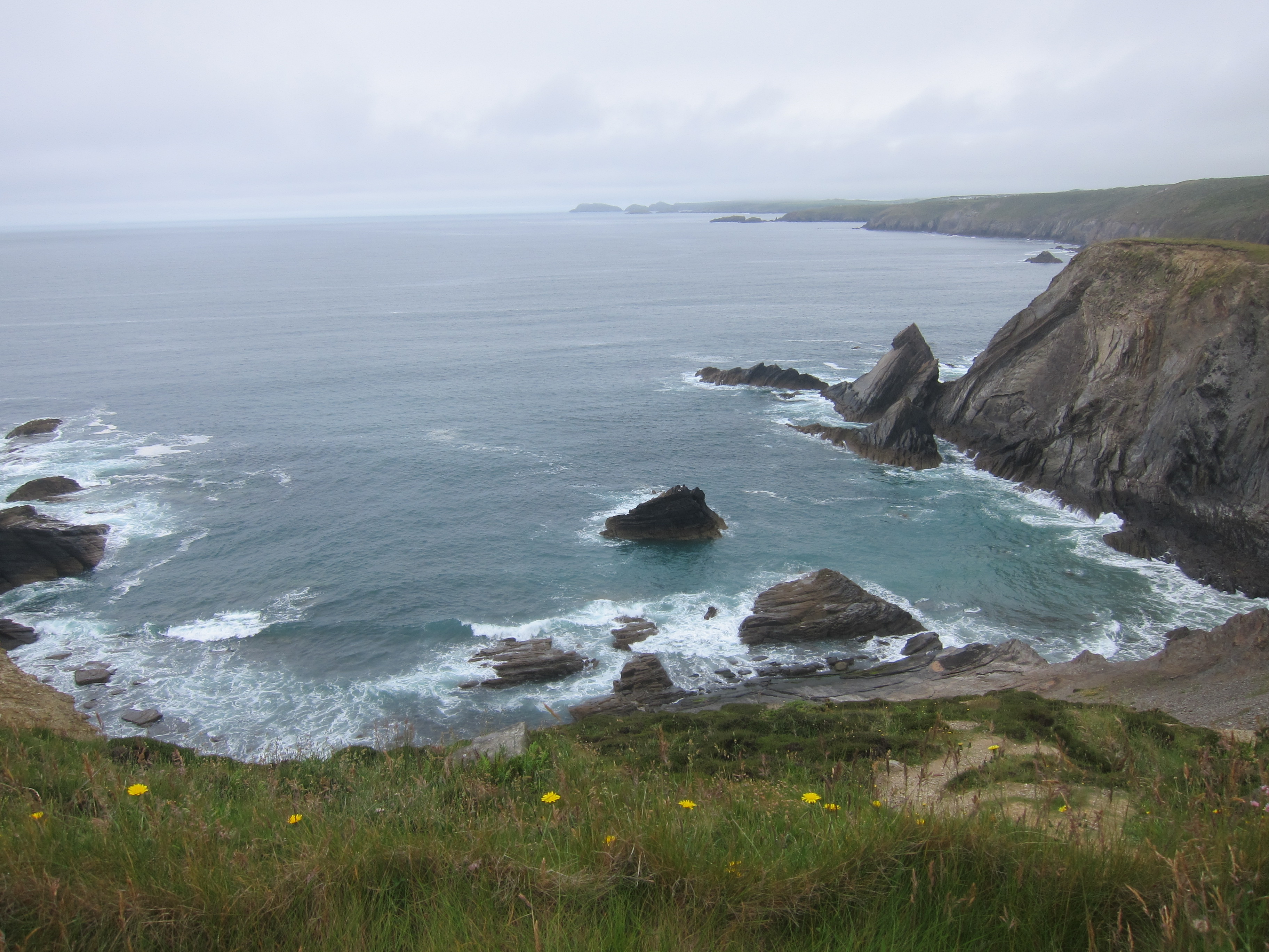
Seals between Whitesands and Abereiddy
The wildflowers were amazing. Although the daffodil is the national flower, I think a case could be made for foxgloves. They are everywhere, along with thrift, vetches of various sorts, ox eye daisies, lots of red campion and purple scabious. Even a few late patches of bluebells were clinging to the cliffs. I was lucky enough to see some seals, 5 or 6 of them playing in the waves. It is 7.6 miles from Whitesands to Abereiddy, another little surfing beach. I was tiring by now, especially as there was a long steep down and up just before. But from Abereiddy, once you have climbed up, the cliff top is very flat, until Porth Gain. The remnants of industry were easier to see here, I assume slate mining. Then there was a wicked slate staircase, more like a ladder down to the quay, just to aggravate my knees.
I had an excellent meal in the Sloop Inn. I believe the Ship is more famous but the Sloop was excellent.
When I woke this morning, the weather could not have been more different from yesterday. The windsock outside my window was horizontal, and a thick blanket of mist covered everything. I did not really want to get out of bed at 7, but had planned to do that in order to drop car in St David’s and get the shuttle bus back at 8.40. I thought maybe an extra hour in bed wouldn’t hurt, then it occurred to me that the shuttle bus might only go at 2-hour intervals, so I stuck to plan. Just as well, as in fact the bus was at 4-hour intervals. A happy occurrence on the shuttle bus put me in a good mood for the day. The driver had picked up a woman walker in Solfach and we were trundling down the steep hill, when the woman exclaimed that she had left the lights on her vehicle on. The bus driver immediately stopped, turned round, and took the bus back up the hill so that the woman could leap out and turn off her lights. Everyone on the bus was happy about this – I can’t imagine that happening in a big city! People are definitely kinder to each other in the country. Walking leads to cutting edge insights like that.
Newgale from the north.
There is no breakfast in my accommodation, so I had planned to grab a bacon roll from the pub once the shuttle set me down at the starting point, but despite signs I had spotted yesterday, promising breakfast from 9am, there was no sign of anyone at 9.10, so I set off with just an apple in hand, hoping that the weather would clear. It was not especially cold, but the mist was thick and the rain persistent, although light. I don’t have my waterproof with me, just a light showerproof jacket, that I was glad of, although it was at full capacity. The path starts with a stiff pull out of Newgale. The surf on the beach was higher than yesterday, but still only gentle. Before long I ran into three chaps clearing the path. It is very well maintained.
Although there were more ups and downs than yesterday, most of the path was on the tops. As I dropped down into one valley, I could hear a couple of women behind me. One had a very high, carrying voice, which was a bit odd in the mist as I could not see them, but I heard a lot more than I wanted. ‘..gave it to him both barrels, first off, that isn’t…..Anthea said….a job for the paramedics…came undone…..not sure after seven months off…’ the last comment gave rise to the thought that, for her colleagues, there might have been a slight silver lining even to COVID. Eventually, I slowed to let them pass me, after I had heard about the dog, plans for a night out, and the iniquitous behaviour of the gas board (couldn’t argue with that one!). The wind then carried their voices forward.
There were far fewer insects or birds around today, although the stonechats were busy.
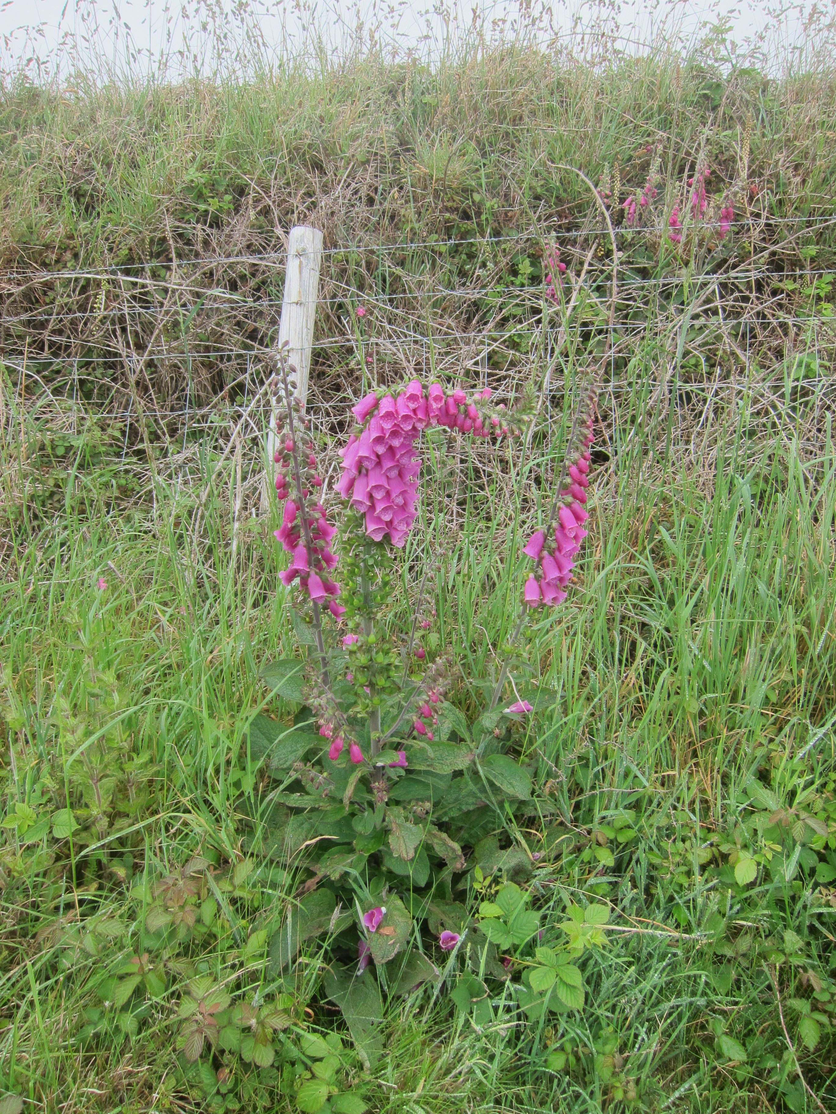
A foxglve sagging under the weight of its own bells.
The names of two of the headlands – Dinas Fawr and Dinas fach – suggest that, at one time, there was an Iron Age settlement, ‘dinas’ being the word for city in modern Welsh but also for a Neolithic fort. With not much of a view, I stopped for fewer photos than yesterday and made good time to Solfach. I walked into the high street to the attractive cafe, and queued for several minutes. Unfortunately, the two people in front of me took the last table. The nice waitress suggested an alternative , so I went in to be told that breakfast had finished and lunch wouldn’t be served for another hour. I was starving now. The waitress must have seen my depressed expression as she asked the chef if he could rustle up a final breakfast. Vindicating my point about people being kind, he did, and I polished off an excellent eggs benedict. (See review). I sat there for an hour, with a second coffee and was rewarded with improved weather. Not sunny like yesterday, but the clouds lifted and the rain stopped.
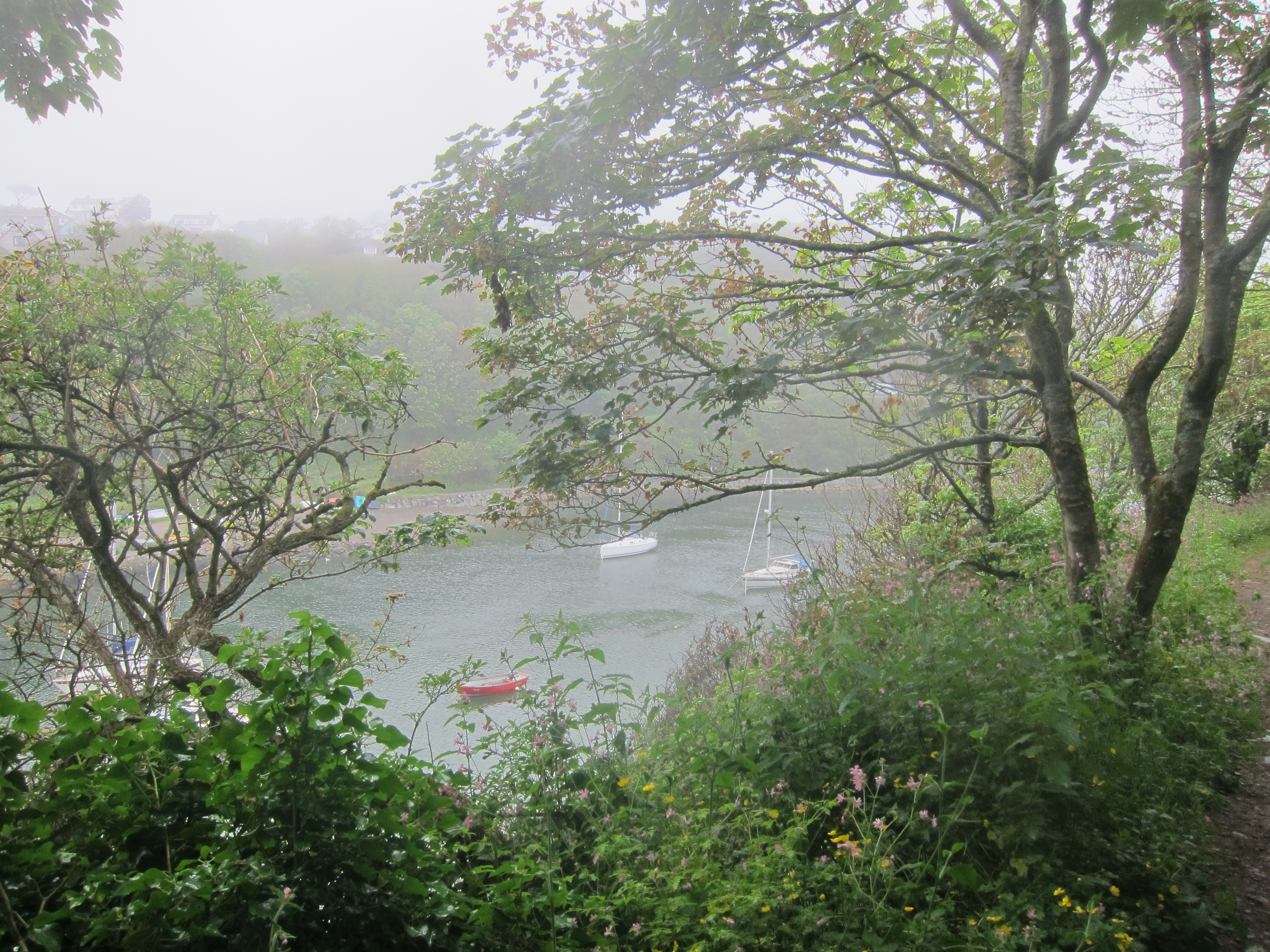
Solfach/Solva from the east.
Solfach is a long, narrow inlet, with quite a few little yachts bobbing gently. The path out climbs quite steeply, and then closely follows the cliff edge. At last I could see the southern arm of St Brides Bay, where I had walked yesterday. I met another lady who is doing regular coast walking. We compared notes about the steepness of the Cornish coast. Whilst this area is similar, it does not have the long steep ups and downs that nearly killed me a few years back – why I wasn’t using poles, I’ll never understand. I love them now.
St David’s Head on the horizon.
The path now became very busy, especially as I approached St Non’s chapel, just south of St David’s. According to legend, St Non was the mother of St David, the patron saint of Wales. To all appearances it looked like a Celtic chapel from the early Middle Ages, there were at least 10 other people milling, waiting to go in. I was struck inside by how Catholic it seemed, which surprised me, as the Anglican Church in Wales tends to be ‘low’. The mystery was solved when I saw an information sheet, saying it had been built in 1934 by Mr Cecil Griffith, using stones form surrounding buildings that were probably originally from ecclesiastical buildings, whilst the nearby holy well was restored by the Passionist Fathers in 1951. http://www.stnonsretreat.org.uk/history.html
The holy well of St Non.
As I left, two men who had been ahead of me on the path stopped and began chatting to me. Something one of them said led me to say ‘Cymro cymreig ydach chi?’ That is literally, Are you a Welsh Welshman? meaning Welsh speaking. He replied that he was and asked me if I were a Welsh Welshwoman. My Welsh is very rusty after over 35 years living in England, but within one sentence he had picked me as from North Wales. A regular diet of Welsh television is reviving my skills, but the part of Wales I now live in has few native speakers, so I was glad to practice a little on these two, who were from Aberhonddu and Abertawe. Unfortunately my little chat with the Welsh Welshmen meant that the 15.40 shuttle was just sailing up the hill as I came down into Porth Clais. Rather than wait half an hour, I decided to walk up to St David’s and began toiling up the narrow lane, having hesitated as to which of two to choose. A car stopped – I thought it might be kind people offering a weary walker a lift, but it was just somebody asking if I knew where the road led. ‘St David’s, I hope.’ ‘No, we’ve just come from there.’ ‘Really? I was sure the map said this road.’ ‘No, definitely not, we’ve come from there.’ ‘Did you come down that road?’ I gestured towards the one I hadn’t taken, more or less parallel, but further left. ‘Yes. We were hoping this led to St Justinians.’ ‘Well, I don’t know. As you can tell, I’m lost too.’ I returned down to the port and took the other road. After 10 mins, I heard someone behind me and turned to ask ‘does this lead to St David’s?’ ‘No, not this road.’ ‘But someone just told me they had come down it from there.’ ‘They must have come from the other road.’ She pointed back behind us. You can see the cathedral there. I was totally confused. But all became clear when I got back to the port. I had assumed I needed to go left out of it, but I had forgotten that Porth Clais overshoots st David’s to the west, so I needed to take the right fork. I decided to wait for the bus, since it was now 16.00. When the bus eventually came, it turned up the road I had originally taken! Having had a not brilliant but quite expensive meal in the pub here last night, I thought I would eat in St David’s. Unfortunately, as I had been between breakfast and lunch earlier, I was now between lunch and supper, and had to make do with a stodgy panini. I need to rethink my plan for tomorrow to make sure I get some breakfast as there is no lunch stop.
Things did not start particularly well. First, I discovered that I’ve also mislaid my pedometer in the house move. I bought a cheap substitute, but it is not very accurate. Then, before I left home I managed to put a weight on my water tube, soaking my rucksack and the floor, finally, when I was 2 or 3 miles from home I realised I had forgotten to bring any face masks. I couldn’t really carry on without, as the taxi driver I had booked might not have been willing to take me maskless, then the traffic was surprisingly heavy. All the way to Newgate, I don’t think there was a single moment when I was alone on the road. Consequently I was late arriving at my AirBandB, which is where I had arranged for a taxi to collect me and take me to the start. I was so late that the driver had gone and had to come back. But the sun was shining and I set out from St Brides brides at 11.35, a good half an hour later than planned, but it wasn’t a problem.
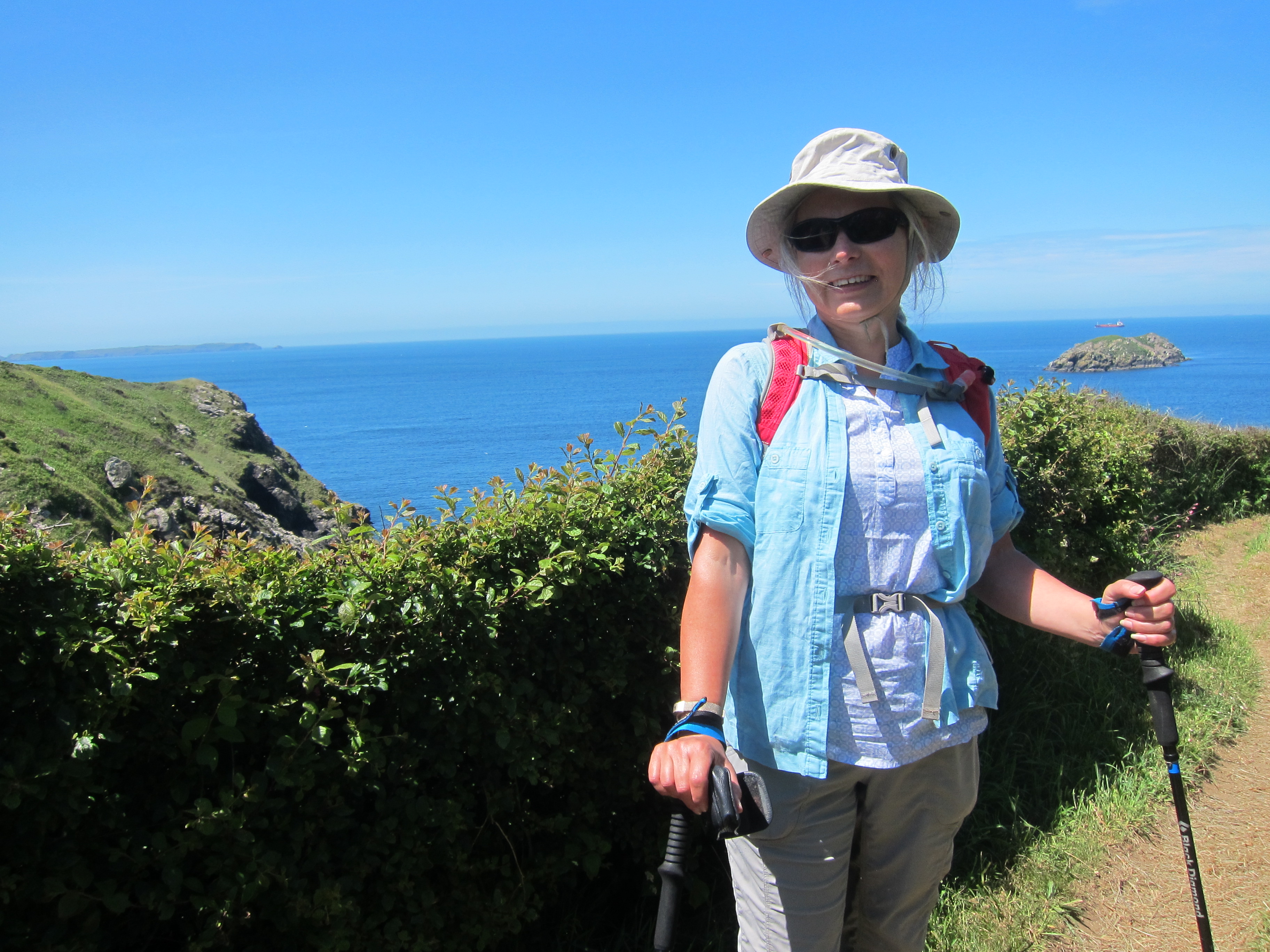
A particularly flattering image….
The day was glorious. Hot, bright sunshine, with enough breeze to prevent me overheating. Compared with the weather when we finished at St Brides in January 2020, it could not have been more different. It was wonderful to be on the path again.
The path from St Bride’s Chapel back to the shore.
The coast here is superb, and I could see across St Bride’s Bay to my destination, which I always like. The going was fairly easy, the path is well tended and there were not many ups and downs, the path mainly sticking to the cliff top. Frequent signs and closed off remnants of paths suggest regular landslides. The place was thick with wildflowers foxgloves, thrift, rock roses, vetch, and some sort of scabious.
Rock roses
At one place on the cliff top there was a curious rock, with what looked like a man-made hole through it. I’ve absolutely no idea why anyone would perch it there, but it framed the tanker in the bay very nicely when I peered through.
Rock with man-made hole
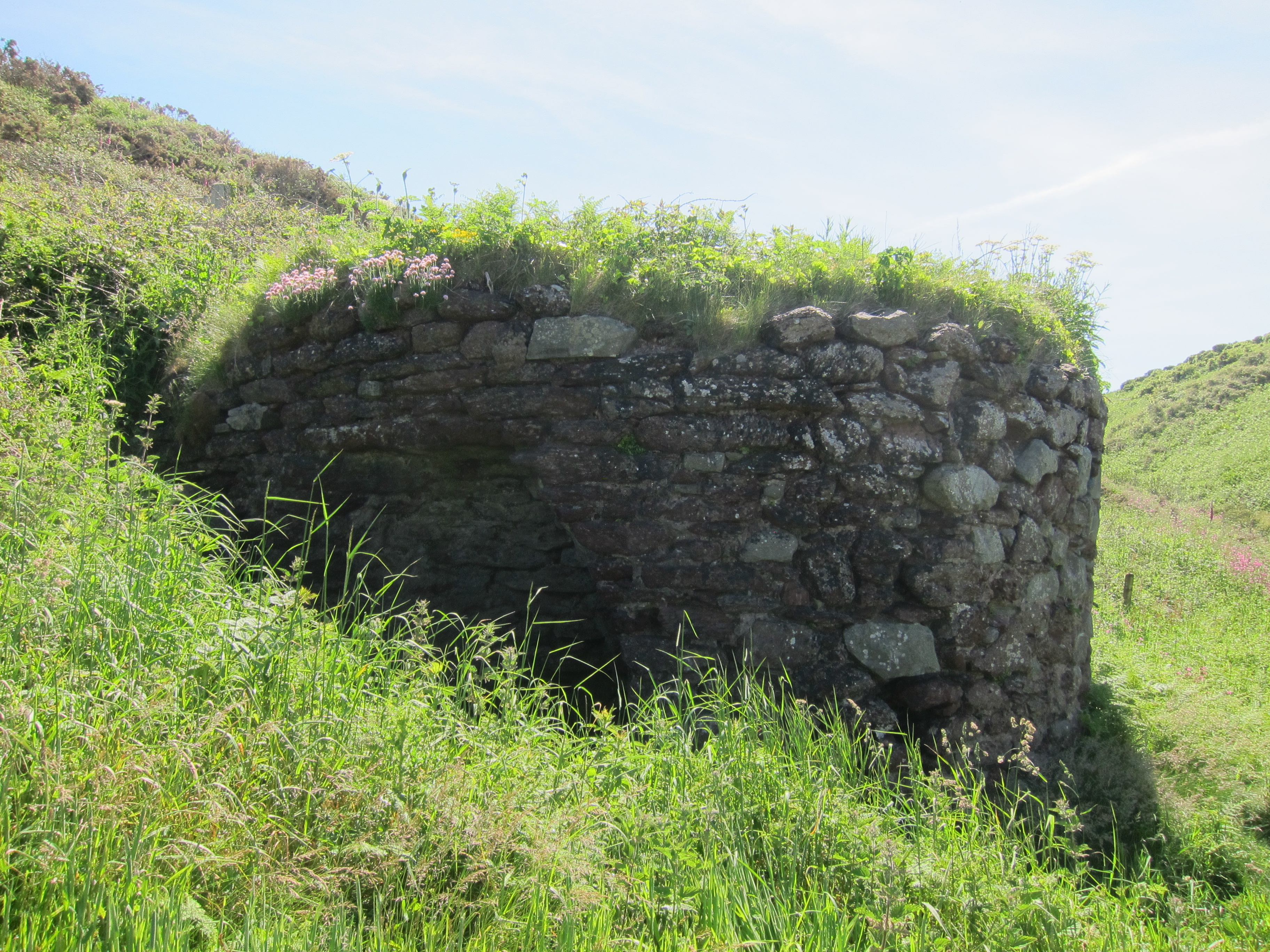
The day was uneventful and I made good progress. The most interesting relic I saw was a derelict circular stone building, close to the shore. I was puzzled as to what it might have been, it didn’t seem an obvious place for a fortress, but as I climbed out of the valley, the clue appeared in the valley’s name – Mill Haven.
Remains of the mill at Mill Haven
For much of the day, I could see the long beach at Newgale. The first path down to it was closed off, as was the second, which was steepish and scrambly. Not taking it meant a stiff climb back to the top of the cliff, along a bit, and then down again. I contemplated the path. I could probably have made it, and had I not been on my own, or if it had been at the start of the day, I might have done it, but it seemed too risky after a full day’s walk, when I was tiring. So I crawled up the steep cliff. Eventually there was a route to the beach, the last 15 feet needed a bit of sitting down and scrabbling, and a couple of ladies sitting underneath the cliff offered to help. I felt a bit embarrassed – they both looked rather less fit than me, but clearly, I was not impressive. It was fabulous to be on the sand, I took off my boots and walked the whole length of the beach, paddling, which I think is the first time I’ve actually had my feet in the water since Rhossili beach. The downside of Newgale, is that a sea wall has been constructed of large cobbles that it is necessary to scrabble over, which also means that you cannot see the water once you are on the street side. My accommodation is over the pub, but not related to it. It’s a bit noisy…
The misery of covid has meant that I have not been able to walk the coast since January 2020, but I have now booked my next leg for 22 – 25 June – St Bride’s to Abereiddy. During lockdown, I have done some walking – the highlight being completing the wonderful St Cuthbert’s Way which goes from Melrose to Lindisfarne in the brief freedom we had last autumn. The autumn colours were spectacular and the weather excellent. For covid safety, it involved a campervan. An interesting experience! They are very small for sharing….
Looking west from the track towards Town Yetholm
Lately, I’ve been exploring my new surroundings, as I have moved to Monmouthshire – what a delight! I am on the Gwent Levels, about 20 mins walk from the Severn Estuary (the stretch that I walked on Day 99, back in December 2017) and about the same time by car to the Wye Valley and the Brecon Beacons. So far, the highlight is the ancient woodland at Coed Gwent, where the cowslips have been blossoming.
I’m so glad we made time to go to Evensong yesterday. It was Candlemas, and the service was an absolute delight. All the electric lights were switched off, and we processed through the stunning cathedral, each member of the congregation holding a candle. There was a real sense of tradition and community in the service, which was conducted in both Welsh and English, with a bit of Latin thrown in from the choir. If you are interested in the cathedral, I’ve written a bit about it over at my history website – link here. https://bit.ly/3bZcAZZ
Another short walking day, as most of us needed to leave to get home at a reasonable hour for work the next day. We drove up to Martin Haven, and began walking around 11.30. We were finished and had eaten our sandwiches by 2.30.
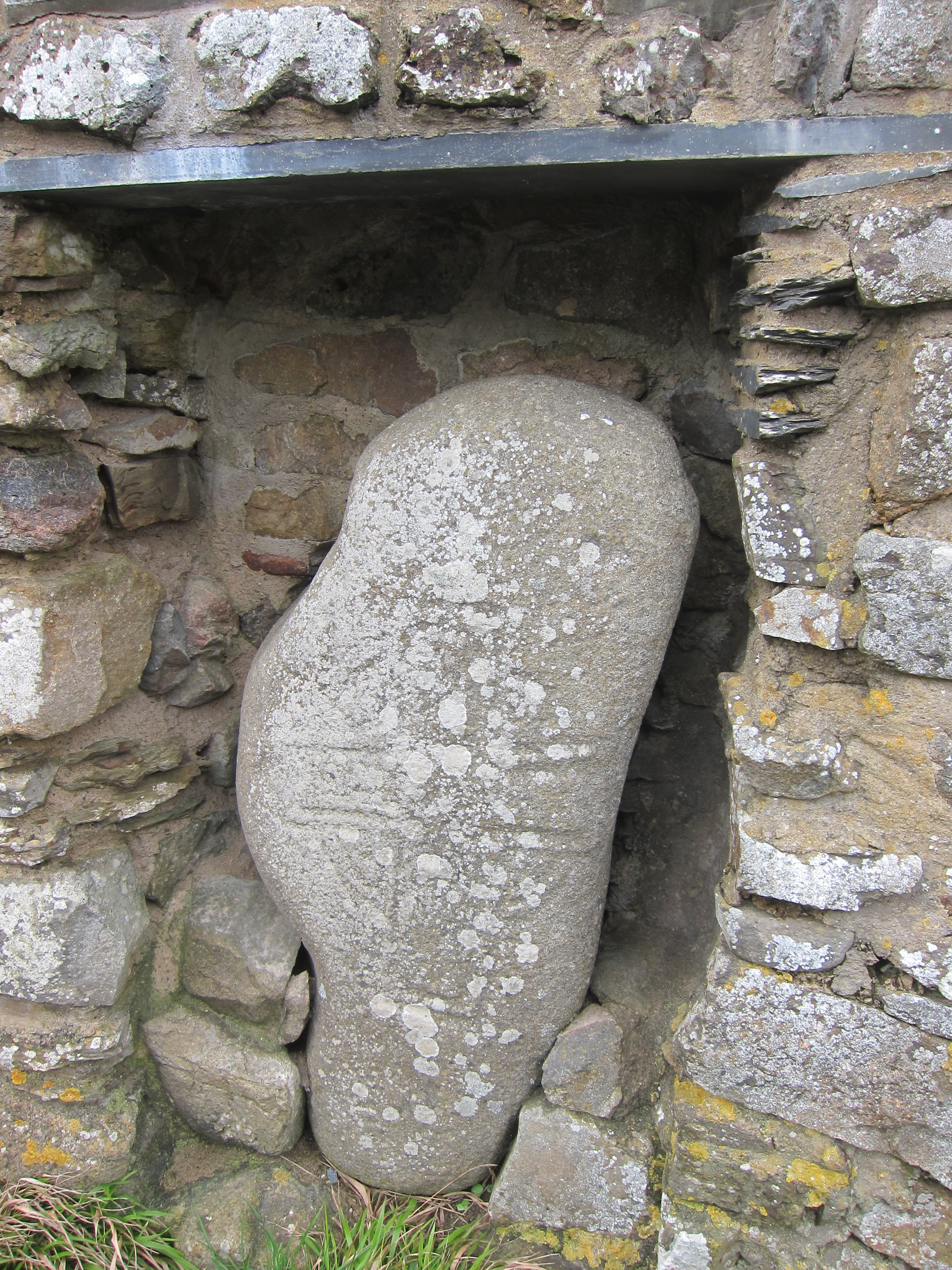
It was almost as windy as yesterday, but once we had came in east from the headland at Martin Haven, we were more sheltered. In the carpark, an ancient stone has been set into the wall. It is one of some thirty ring-stones found in Pembrokeshire.
7 – 9th c roundstone with Celtic cross, at St Martin Haven
The carving, a Celtic cross, dates from 7-9th centuries AD – the period when the Celtic church flourished along the Irish seaboard as monks travelled to and fro between Wales, Ireland, Cornwall and Brittany.
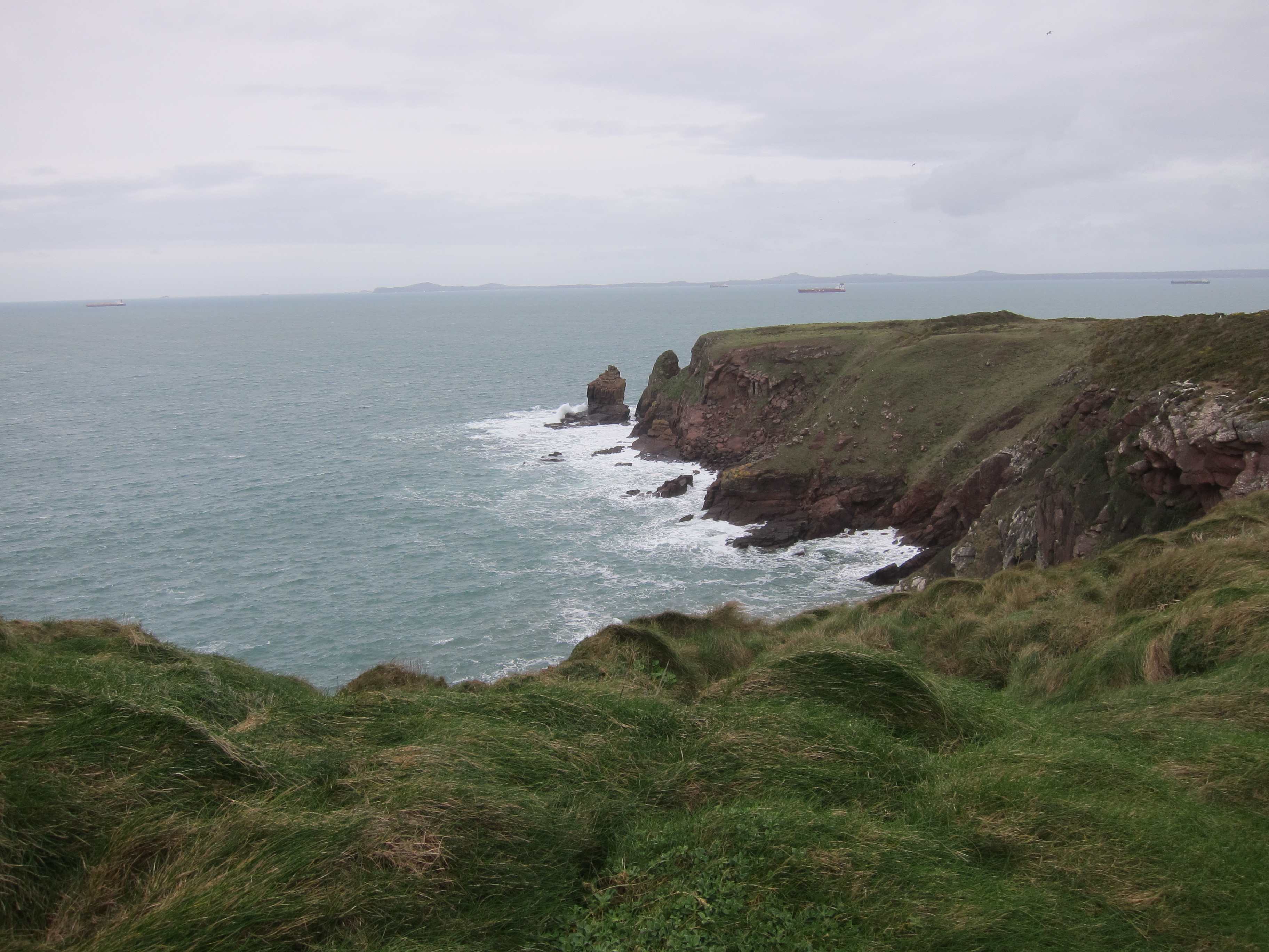
A different type of shipping surrounds the headland today – we could see several tankers, waiting to take their turns loading and unloading at Milford Haven – this stretch of St Brid’s Bay, being, presumably, calmer water than the open sea.
Shipping in St Bride’s Bay, waiting to go into port.
It was easy walking along a flat cliff-path. Once again, there was thick lichen on the stones, denoting clean air. Tom and Trevor were busy with their binoculars, but I did not recognise anything beyond gulls. As we came toward St Bride’s the silhouette of St Bride’s Castle was visible on the right. Now a luxury time-share, it was built in 1833, in gothic revival style, on the site of an earlier property. The estate is surrounded by a long dry-stone wall, buttressed against the wild wind.
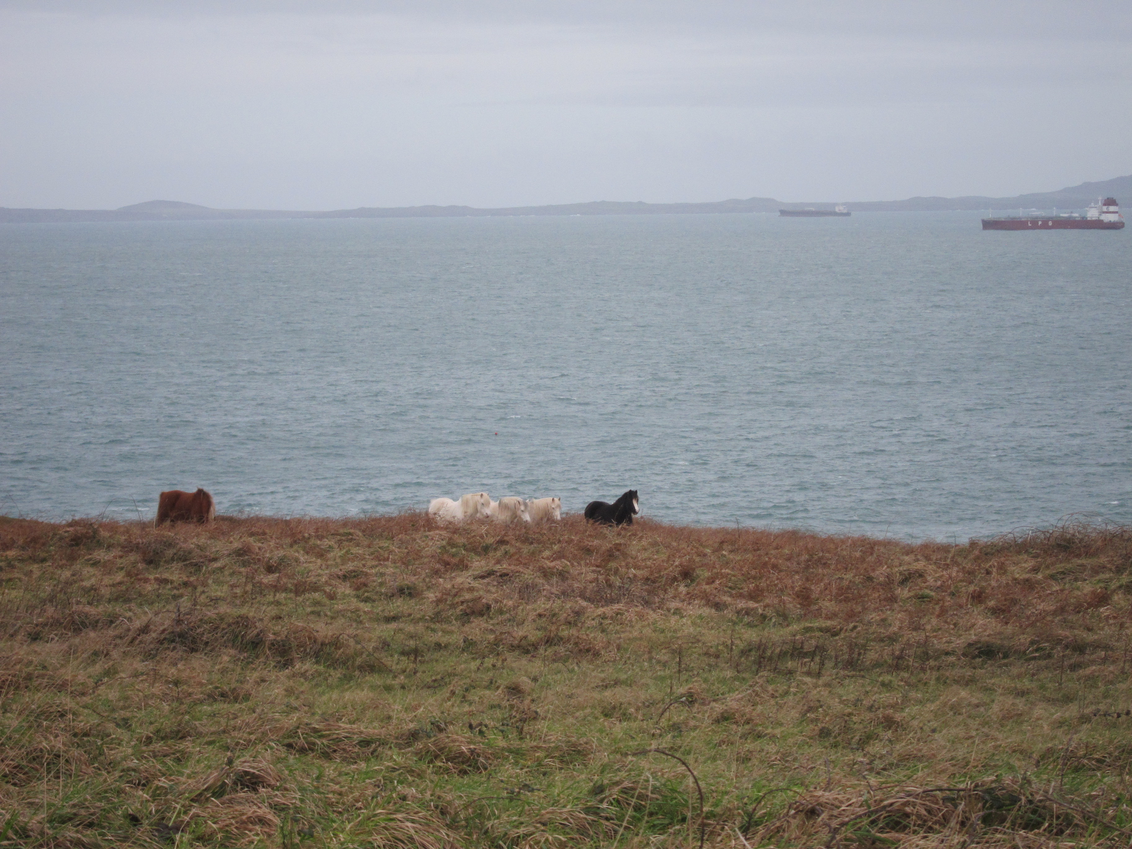
Wandering unfettered on the cliffs nearby were little Welsh ponies – standing braced with their rears into the wind.
Overlooking St Bride’s Bay
4 miles and a silver day to round the weekend off with.