Day 116 Castellmartin to Angle – 13 June 2019

Day 116 Castellmartin to Angle – 13 June 2019

I am glad I rested yesterday, as when I woke this morning, the sun was shining, I was full of energy and my knees had nothing to say.

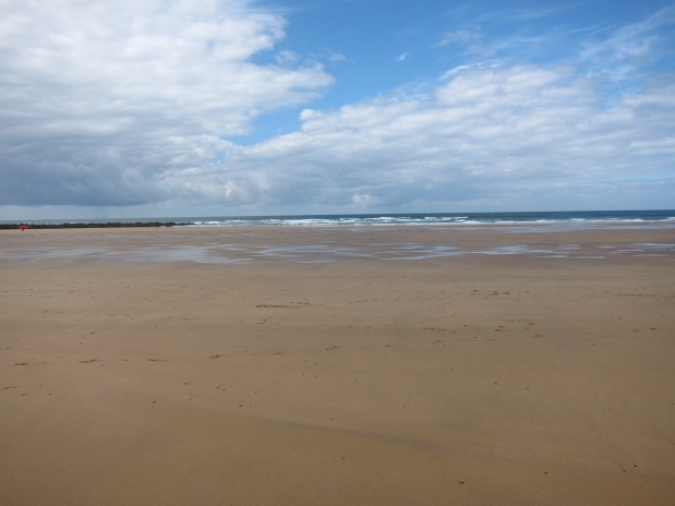
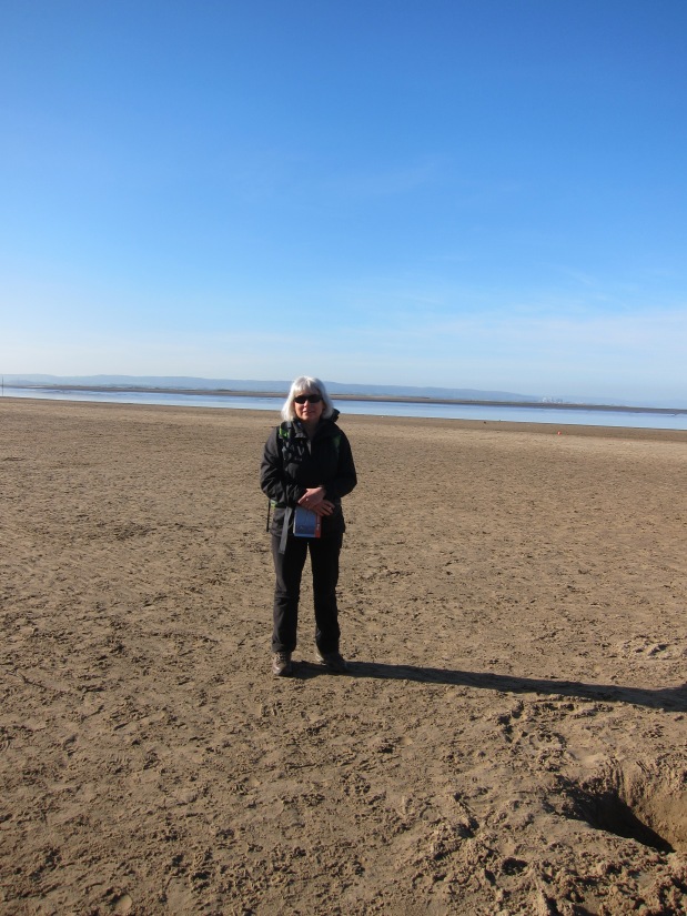
I drove up to Pembroke and waited for the bus – as always, I was ridiculously early, but I sat on a bench and watched the town begin to wake up. The ubiquitous strimmers were out in force.  The bus driver recognised me, of course, as he clearly makes it his business to give excellent service. When I got on, I was the only passenger, but we picked up others en route. I jumped off at the roundabout I had finished at on Thursday, with directions to go down a different route to avoid the main route along the road – unfortunately, it led to a field with copious cows, all morning-fresh and clustered around the exit stile, so I back-tracked – it was only a couple of hundred yards. I walked briskly along the tarmac, and soon came to another of the parallel paths that the MoD has arranged to keep walkers off the roads.  After about 45 minutes, I could see Freshwater West beach – I am happy to say that my suspicion that Barafundle is not the best beach in Wales was quickly confirmed – Freshwater West is superb – only marred by several camper vans blocking the views. IMG_4841Everywhere I looked, surfers were shimmying into their gear, and there was a mobile café serving bacon or plaice rolls. I resisted temptation, and just had coffee.  The beach was lovely to walk over, smooth reddish-gold sands, then the pathed climbed up.  Several people had informed me that the walk from Freshwater West to West Angle Bay was one of the toughest sections, and there were quite a few steep ups and downs, however, nothing like the horrors around Tintagel. Or perhaps my poles are entirely revolutionising my ability to go up and down. I met a twitcher seeking choughs. Apparently, this stretch is well-known for them. So far, I had not seen any, and thought that I might be reduced to touching up the photographs with red, but, about ten minutes later, I did see some.

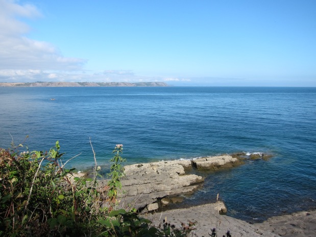
It was a glorious day – the sea was turquoise, and the rocks are the most amazing colours – orange, red, purple, and folded and twisted into shapes. IMG_4948One inlet looked like nothing so much as a stick of Toblerone – a row of triangular shaped rocks. The wildflowers continued to delight – no pyramid orchids today, but lots of thrift, and my personal favourite, the foxglove, as well as something that looked like gaura, or possibly a type of white salvia.IMG_4865

I reached West Angle at about 12.45, and bought another coffee to have with my sandwiches, overlooking the beach. To the north, is St Ann’s lighthouse, the other side of Milford Haven.

The village of Angle runs east-west, but the path goes north, and then runs parallel to it, facing into the sound.  It is a delightful stretch – hedgerow on one and sea on the other, with a well-trodden path. Lots of people were going back and forth along it, so I don’t know how I came to miss a small turn off and end in a potato field. Since there was a broad path alongside the crop, I assumed I was in the right place. It swung south and I supposed it would take me out by the church at Angle as marked on the map. In fact, it brought me into an overgrown field, which, luckily, had a gate I could clamber over, before sneaking through a couple of back gardens to reach the lane.  I had arrived in the middle of the village, rather than the east end. I went into the little church, another one with the vernacular style stone-tower, and a fourteenth century chapel behind, dedicated to sea-farers.  I still had 2 hours to kill before the bus, so I found the track and walked back towards where I had gone wrong. I did not quite get there, deciding to turn back when I reached the lifeboat station. I then walked all the way back along the street to the beach, for my only ice-cream of the trip.

The bus came more-or-less on time, and dropped me at Pembroke. Rather than coming straight back, I diverted to see the chapel at St Govan’s, which I could not reach on Tuesday as it is behind the closed section of the artillery range. It is quite extraordinary – a tiny chapel squeezed half-way down an inlet in the cliffs, with the sea pounding below. The legend is that a sixth-century Celtic missionary Govan, going about his business by sea, as the missionaries did in that time, was chased by pirates. He prayed, and an inlet in the rocks was opened that he slipped into, evading pursuit. The current chapel dates at least from the fourteenth century and may be as old as sixth century.IMG_4979

The evening was bright and fine, so I walked toward Bosherton, where I had been obliged to come inland on Thursday, to see more of the marvellous coast.  I am sorry to be going home tomorrow – although I think I need to accept that five days in one block needs to be followed by a rest day.  In total I have done 85 miles on this leg – about 20 less than I hoped.

A Silver day.

Day 108 – Porth Einon to Cheriton 24th July 2018

Day 108 – Porth Einon to Cheriton 24th July 2018

We promised ourselves that we would start earlier today, and we did a bit better than yesterday, finding somewhere to leave one car and wriggling all the way through the lanes to cross Gower from north to south for 9am.  The morning was somewhat overcast, but it was not raining, and the forecast was good. We set out along the east side of the headland at Porth Einon, climbing up past a campsite, and looking back across to the headland we were on yesterday.  There is a

IMG_4259

View east from Porth Einon

monument stone at the top, dedicated to Gwent Jones (1910 – 1962) and Stephen Lee (1889 – 1962), described as ‘Dau gyfaill gwyr’ – two faithful men, who, as members of the Gower Society, helped preserve the cliffs.

Their work was well done – the cliff top walk is fine walking. We were pleased to see some ponies enjoying the view, too.Ponies above Porth Eynon 24.7.18 The tide was out, showing how the cliffs have developed over millennia, rock thrusting up from the earth’s core, and being worn away by the constant pressure of the waves.  There are no trees on this stretch of path, nothing but gorse.  Although we have had rain the last couple of days, the grass is yellow and worn.

Around 10.15, the clouds began to clear. We were in hopes of finding a cliff-top café for coffee, but, once again, were disappointed.  The path winds in and out of the deep fissures in the cliff face – running inland for a few hundred yards, down and up a steep slope then out again towards the sea. We were looking out for the famous Worm’s Head, but were not quite sure we had found it, until we passed it and looked back, then the shape of it is easy to sea. Nothing to do with worms, of course – ‘worm’ is a mediaeval term for a dragon.

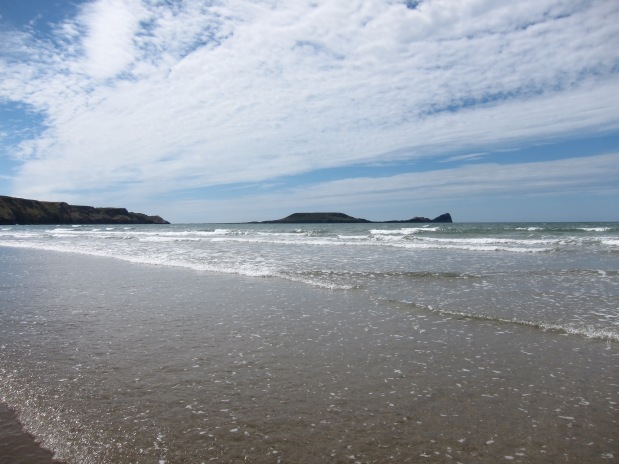
The cliff tops were easy walking, and we soon began to see lots of other people with children and dogs.  Passing the Worm’s Head, we could see the curve of bay that is the delightful Rhossili beach – voted Wales’ best beach this year (2018) by Trip Advisor, and apparently in their top ten for the last six years.  And it is, indeed, spectacular – probably the best beach I have encountered so far in the whole walk.  Some of the Norfolk beaches might run it close for length and beauty of sands, but with the cliffs and the scenery round Rhossili also being magnificent, it is in a class of its own.

Rhossili Beach 24.7.18

Me overlooking Rhossili Beach.

On a more prosaic note, there is also a fine café, where we had a super lunch, overlooking the sea. To reach the beach, you need to go down a winding path and then steps.  The sun was getting stronger, and the sky bluer – ideal conditions.

The beach itself is completely flat – the sands are soft and pale gold, and the water was warm- we took off our boots and walked through it – very welcome to the feet after several days walking. The size and quantity of jellyfish was less pleasing.  As we walked north (the bay is at the end of the peninsula, and turns north), we could see lots of para-skateboarders. Not sure that is the right name – they have skateboard type things, with sails, racing along the sands.  Some of them went so fast they took off and it looked great fun – shame I am too much of a wimp to give it a go.

The path climbs up the cliffs, to a hillier section. On this stretch, there is no beach – the rounded green hills just drop straight into the sea,  and you can see across the estuary of the Llwchwr into the county of Carmarthen.  Llanmadoc beach and the Llwchwr estuary 24.7.18We then curved round and down into some sand dunes, and the path meandered down to the beach at Llanmadoc   The beach went for miles, extending into an area called Whiteford Sands along a spit, and, for me, was quite as impressive as Rhossili. We kept thinking we must have reached the end, but the beach curved on and on for nearly four miles.  At the northern-most tip, it swung back on itself and the path went inland. To our left was a vast expanse of wetlands and marsh.  To our right,  a strip of woodland, Whitford Barrows, only a few hundred yards wide, but completely different scenery from the beach on the other side.Whitford Barrows 24.7.18

It used to be possible to cross the wetlands on a mediaeval sea wall at Cwm Ivy, but the wall was breached earlier this year, and has not been repaired. We therefore had to join the road and walk a mile or so along it, back to the pub, where I also picked up some good news about another project.

Unsurprisingly, with the views, the company and the weather, this was a diamond day – only my second. 18 miles.

Day 107 – Caswell Bay to Port Eynon

Day 107 – Caswell Bay to Port Eynon

What a difference from yesterday in the weather!  When we started out, it was grey and mizzling and continued overcast until well on into the afternoon. We drovIMG_4131e down into Gower, and left one car at Port Eynon, before coming back to Caswell Bay.  We dropped down on to Pwll du beach – being very critical of the rather ugly 1960s block of flats that over shadows it. Walking to the end of the beach, it was not clear where the path went – either over a heap of rocks at the end or else up onto the road in front of the block.

Whilst we were deliberating, we saw a couple of brave swimmers – it was still wet and quite chilly, and we were thinking that swimming was the last thing we fancied – suddenly, the man called out – Nick! Astonishingly, the couple had been my sister and brother-in-law’s neighbours in Surrey back in the early 2000s. Talk about a coincidence.  Just proves you cannot go anywhere without running into someone you know.

We chatted for a moment, and asked about any cafes in the vicinity – coffee was feeling like a good plan. Unfortunately, the nearest was an hour away at West Cliff.  We arrived at the excellent café in pouring rain, so spent a good 45 minutes having a delicious Welsh rarebit and coffee. It was still drizzling as we emerged but we were slightly comforted with the thought that the latest weather forecast was for sun in the afternoon.

Back on the path, we went round the headland, and found ourselves overlooking Three Cliffs Bay. The path then deviates into Pennard Burrows – as one might guess from the name, this is a series of sand-dunes – not brilliant for walking in, and easy to lose the path,  but, with the general lay of the land, not possible to get lost, even though you have to go slightly inland, towards a ruined church, as there is only one place to cross the little stream – a series of stepping stones. There were quite a few people about by this time, with dogs and children as the rain had stopped.

Over the stream, and up onto a low headland, than down through woodland with dunes under foot, onto Oxwich Bay.  We met a boy of around 12, who was holidaying with his IMG_4189family, who was eager to tell us about the giant blue jelly-fish he had found. It was the largest one he had ever seen – it was even the largest one his dad had ever seen!  And when we came onto Oxwich beach, we could agree that the jelly-fish are monsters!

We stopped for a drink at the hotel at the end of the bay, then went through the woods at the west end of Oxwich – there is a little church hidden in the woods, dedicated to St Illtyd. Legend has it that the first Christian church was built here in the sixth century – the current building is ancient enough – 13th & 14th century.  Unfortunately, it was locked.IMG_4206

There was a steep pull up to the top of the cliff, but the sun was beginning to shine quite brightly and the views were excellent as we did the last few miles along the beach edge before arriving at Port Eynon. There were lots of ponies wandering about – presumably they wander on the common land like Esmmoor ponies. IMG_4233

We found a pub, and had a welcome gin and tonic. The pub was crowded, and lots of people were eating. However, the presence of a (used) nappy in its sack on the table next to us argued in favour of a home-cooked meal.  A silver day, with 13 miles covered.

Day 104 Ogmore to Cynffig Country Park 16 April 2018

Day 104 Ogmore to Cynffig Country Park 16 April 2018

Today, I was out for 12 hours. Unfortunately, only five of them were spent actually walking – the rest was waiting for public transport to arrive, sitting on public transport whilst it went nowhere, and getting to and from public transport. It has been great staying with a friend as a base, but, practically speaking, it gets very hard as you get further away, even though, in theory, there is plenty of public transport in this area of South Wales.

Things began well enough – local train to Bristol Temple Meads, mainline train to Newport, change to Bridgend and a walk to the bus stop. En route, I stopped in a local café to buy a coffee – I try to avoid chains and patronise local businesses. As I queued, the man ahead of me turned around and said:

‘I don’t know why two of them have to come to the counter. They’re only gossiping – why can’t one sit down and the other get the order?’

I made a murmuring noise.

‘And why do they have the kitchen upstairs here?  There’s plenty of room for it down by here (or by yur as it is pronounced in the Valleys) – it would be much better.’

I murmured again.

‘It’s a wonder how ignorant some people are. A few years ago, I had to have an operation to cut a cancer off my ear’. He turned his head to show me his right ear.

Murmuring didn’t seem enough, so I graduated to ‘Goodness’.

‘The doctor I saw, he’s my neighbour. I told him he needed to mend the fence.  He said it wasn’t his fence. Of course it is, I told him. The posts are on your side. An educated man and he didn’t know whose fence it was. It wasn’t as though he’d only been there a minute. Five years he’d been there, and didn’t know that.’

Lost for words, I repeated ‘Goodness’.

‘There’s a shop down by here, got a massive glass window it has, and they’ve gone and put a great big sign in it. Why do they want to spend all that money on the glass, and then cover it up?  Two fish and chips, and I’m sitting upstairs,’ he said to the woman at the till, plonked down his money and walked away.

After this entertaining slice of local life, I got on the bus and hopped off near the pub we ate at yesterday. The other passengers had a discussion about the best place for me to alight, to find the footbridge over the Ogwr river. There are stepping stones as well, but seeing it has been so wet, the bridge seemed the better option.

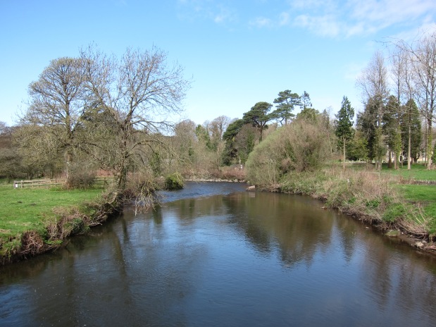
I found it easily and walked over the water meadows – heavily pocked with horse hooves. The ruins of Castell Ogwr are impressive. Built in the early 1100s, possibly by the de Longmore family, it came into the Chaworth family and thence to the duchy of Lancaster, and then the crown after Henry Bolingbroke took the throne in 1399. It was still in use in the nineteenth century. On the other side of the Ogwr is the delightful village surrounding the ruins of the de Cantilupe manor of Candlestone.  I did not divert to see the ruins, but enjoyed the pIMG_3277retty houses, the church and the spring flowers in the bright sunshine.

The track moves through a woodland to the high dunes of Merthyr Mawr – the path was fairly clear, although difficult to walk on, because trotting horses had created deep pockets in the narrow path.  After a mile or so, the path comes to the beach. The tide was way out, so I could walk across the sands all the way to Porth Cawl – there is one headland where it is necessary to climb up onto the prom, but otherwise, if the tide is low, you can walk across both bays at Porth Cawl – I really enjoyed this huge expanse of firm sand even thoug the sky lowered somewhat. IMG_3286

At the old dockyard, the warehouses have been turned into a row of eateries, and I had an excellent lunch – the staff did no more than glance expressionlessly at my muddy trousers before seating me.

After Porth Cawl, the chimneys of Porth Talbot steel works become visible – puffing the steam that I could see last summer from the Devon shore. Devon itself was very visible – the peaks of Great Hangman and Little Hangman, where Rachel and I were in July, and even the tip of Ilfracombe.

The walk continued at the edge of the beach, and partially on the shore itself – wide sands, with some rocks, and a golf course to the inland. This eventually turned to sand dunes at the Cynffig Nature Reserve, which apparently is one of the most diverse habitats in Wales, although I saw little other than grass and gorse. I navigated successfully across (previous coast walkers have complained of getting lost, so I think the authorities must have increased the number of marker posts).IMG_3346

I landed at Mawdlam at around 3.45. I would like to have gone further, but had to stop in a place where I could get a bus back to Bridgend. I didn’t get back to Bristol until 7.45 – very frustrating. I can’t face similar complications tomorrow, as I would only be able to walk for a short while anyway before heading home, so will leave the next section until I have a plan to walk from place to place again.  10.6 miles and a bronze day.


Day 96 Burnham-on-Sea to Weston-super-Mare 30 Oct 2017

Day 96 Burnham-on-Sea to Weston-super-Mare 30 Oct 2017

When I looked at the weather forecast last week, it suggested heavy rain for today, but it could not have been more wrong. It has been a glorious day – bright, sunny, warm and not a breath of wind.

I left my hotel (excellent dinner, dreIMG_2703adful service) to meet Jane at the Pavilion on the waterfront at 9.30. We had a dismal breakfast there – grease on toast – but that was the lowest point of the day.

The tide was far out and we walked across the firm, dark gold sands all the way to Brean Down. I knew that to cross the river Ax we would have to go a long way inland and we debated not climbing the headland because we would have to retrace our steps for a couple of miles, but the weather was so good, we were making such good time and the views promised to be so spectacular, that we decided to climb the steep staircase up to the long hogs back.

It was certainly worth it. The views were superb. IMG_2729All the way back to West Quantoxhead,  hazy in the distance, and the long flat expanse of Brean sands to the south, then the delightful villas of Weston to the north. The Down is the last outcrop of the Mendip Hills which we could see rolling away east. We descended and had a quick cream tea in the NT café at the bottom.IMG_2749

We walked back along the beach, planning to emerge onto the road towards Wick Farm where the path joins the road to cross the river. We undershot a bit and had to walk along the lane, which was astonishingly busy. Since my map was printed, the Sustrans route has been built, saving us from a long road bash as it is a firm track, a few yards away from the road. I was delighted to discover that the previously impassable crossing at the old sluice has now been modified to carry the path across the Ax. We strolled along, enjoying the sunshine, talking to the various dog walkers, and eventually emerged at the village of Uphill, with its ruined, church high above the road and the remains of quarrying underneath exposing the limestone rock, almost vertical, but dotted with Welsh (according to the sign) sheep, well adapted to steep rocky hillsides.

Then it was back to the bIMG_2771each and a long walk up to the middle of Weston-super-Mare, admiring the Holm islands (Steep and Flat) and Brean Down behind us.

Less pleasurable was trying to find my aunt’s house where I am staying, when the satnav refused to recognise the street name, although it has been there long before Google was ever born or thought of. After some fraught backwards and forwards along the same lane and a few dead ends, we made it.

14.4 miles. Legs are getting very achey – disappointing as only day 5.

All in all, a golden day.